
Ins and Outs Surf Guide
Ins and Outs in Tahiti is an exposed break.. Summer offers the favoured conditions for surfing. The best wind direction is from the southwest. Groundswells more frequent than windswells and the best swell direction is from the north.. Unlikely to be too crowded, even when the surf is up. Beware of sharks, rocks and urchins.
Ins and Outs Spot Info
| Type: | Rating: | Reliability: | Todays Sea Temp*: |
|---|---|---|---|
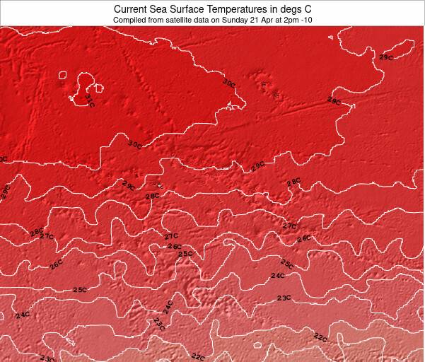
| rarely breaks | 27.5°C*ocean temperature recorded from satellite |
Surfing Ins and Outs:
The best conditions reported for surf at Ins and Outs occur when a North swell combines with an offshore wind direction from the Southwest.
What's the best time of year to surf Ins and Outs (for consistent clean waves)?
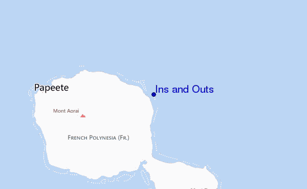
Explore Ins and Outs Location Map
Interactive Ins and Outs surf break location map. View information about nearby surf breaks, their wave consistency and rating compared to other spots in the region. Current swell conditions from local buoys are shown along with live wind speed and direction from nearby weather stations. Click icons on the map for more detail. The nearest passenger airport to Ins and Outs is Temae (Moorea) Airport (MOZ) in French Polynesia, which is 49 km (30 miles) away (directly). The second closest airport to Ins and Outs is Huahine Airport (HUH), also in French Polynesia, 207 km (129 miles) away.
- Map Icons:
 Break
Break Live Wave Height (m)
 Live Wind Speed (km/h)
 Surf Rating (10 Max)
 Ocean Swells (m)
- Wind Speed (km/h)
Wednesday, 10 June 2026, 04:56 Local Time
| Wednesday 10 | ||||
| 5AM | 8AM | 11AM | 2PM | |
| Wave (m) | ||||
| Period (s) | 13 | 13 | 12 | 12 |
| Wind (km/h) | ||||
| Wind State | on | on | on | on |
Tides at Ins and Outs
| NEXT | IS AT (local time) | remaining |
|---|---|---|
| high tide | ||
| low tide |
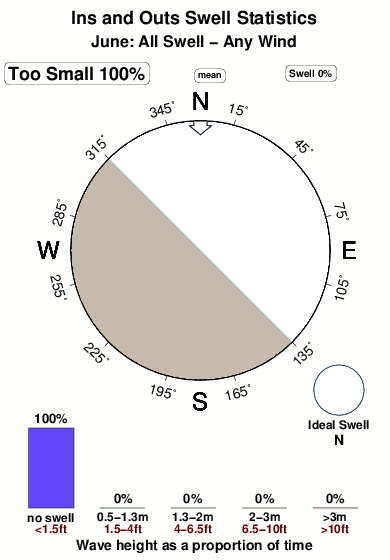
Swell History at Ins and Outs
Surf stats for Ins and Outs, see the swell variation by month or season on the history page here.

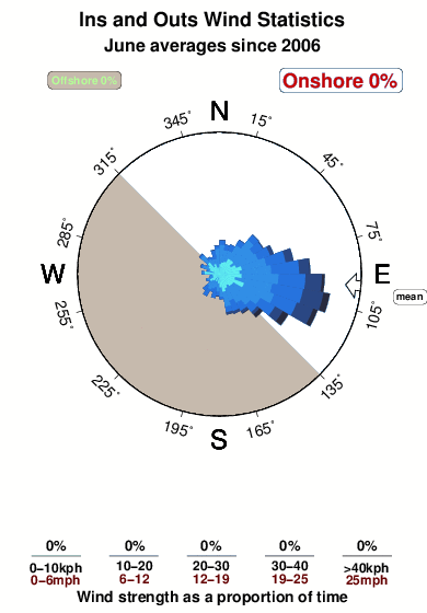
Wind History at Ins and Outs
Wind stats for Ins and Outs, see the variation in direction and stength by month or season on the history page here.
Other Nearby Breaks Closest To:
Discover surf breaks near Ins and Outs. Click below to view there surf guides.
- Papenoo Rivermouth (L'Embouchure)
 River
River 4.0
4.0
Reliability: fairly consistent11km away - Papenoo Beach (Chinaman's Bay)
 Beach and point
- 4.0
Reliability: fairly consistent12km away - Faaone
- Beach
Reliability: inconsistent13km away - Rocky Point
 Reef and point
- 4.0
Reliability: fairly consistent14km away - Orofara Beach
 Point
Point 3.0
3.0
Reliability: fairly consistent15km away
 Nearest