

- Forecast
- Maps
- Live
- Weather State
- Spot Information
Dreamland Surf Forecast
/ Bali – The Bukit (16 surf breaks) /

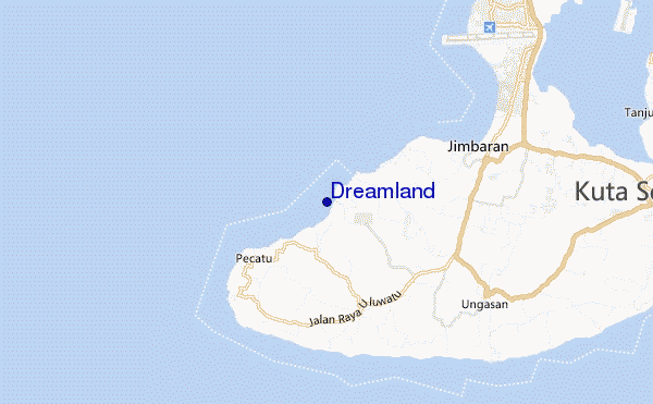
Dreamland surf Forecast / Bali – The Bukit / Indonesia
- Map Icons:
 Break
Break Live Wave Height (m)
 Live Wind Speed (km/h)
 Surf Rating (10 Max)
 Ocean Swells (m)
- Wind Speed (km/h)
How big are the waves at Dreamland today?
The current surf forecast for Dreamland at 1PM is: 1.1m 14s primary swell from a Southwest direction and 0.4m 8s secondary swell from a South-southwest direction (forecast issued at 07:00am May 10). An open ocean swell of 0.8m 6s is not directed at the surf break. The wind direction is predicted to be cross-offshore and the swell rating is 2.
| Time (WITA) & Date | Wave Height | Wave Period |
|---|---|---|
| Morning (10 May) | 3.5ft (1.1m) | 14s |
| Afternoon (10 May) | 3.5ft (1.1m) | 14s |
| Evening (10 May) | 3.5ft (1.1m) | 14s |
Table - waves today at Dreamland. (Swell directed towards the surf break)
Friday 10 | Saturday 11 | Sunday 12 | Monday 13 | Tuesday 14 | Wednesday 15 | Thursday 16 | Friday 17 | |||||||||||||||||||||||||||||||||||||||||||||||||||||
| 5 AM | 8 AM | 11 AM | 2 PM | 5 PM | 8 PM | 11 PM | 2 AM | 5 AM | 8 AM | 11 AM | 2 PM | 5 PM | 8 PM | 11 PM | 2 AM | 5 AM | 8 AM | 11 AM | 2 PM | 5 PM | 8 PM | 11 PM | 2 AM | 5 AM | 8 AM | 11 AM | 2 PM | 5 PM | 8 PM | 11 PM | 2 AM | 5 AM | 8 AM | 11 AM | 2 PM | 5 PM | 8 PM | 11 PM | 2 AM | 5 AM | 8 AM | 11 AM | 2 PM | 5 PM | 8 PM | 11 PM | 2 AM | 5 AM | 8 AM | 11 AM | 2 PM | 5 PM | 8 PM | 11 PM | 2 AM | 5 AM | 8 AM | 11 AM | 2 PM | |
Rating (10 max) | ||||||||||||||||||||||||||||||||||||||||||||||||||||||||||||
Swell Height Map |    |    |    |    |  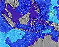 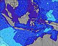 | 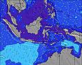 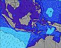 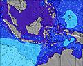 | 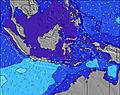 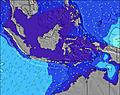 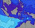 | 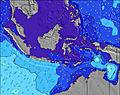 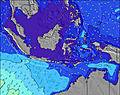 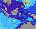 | ||||||||||||||||||||||||||||||||||||||||||||||||||||
| Wave Height (m) & direction (?) | ||||||||||||||||||||||||||||||||||||||||||||||||||||||||||||
| Period(s) (?) | 15 | 15 | 14 | 14 | 14 | 14 | 14 | 14 | 13 | 13 | 13 | 13 | 13 | 13 | 13 | 13 | 13 | 13 | 12 | 12 | 12 | 12 | 12 | 12 | 12 | 12 | 18 | 18 | 18 | 17 | 16 | 16 | 16 | 16 | 15 | 15 | 15 | 15 | 15 | 14 | 14 | 14 | 13 | 13 | 13 | 13 | 13 | 13 | 12 | 12 | 16 | 16 | 16 | 15 | 15 | 16 | 16 | 16 | 16 | 15 |
Wave (?)Graph | ||||||||||||||||||||||||||||||||||||||||||||||||||||||||||||
| Energy (?) | 558 | 543 | 529 | 514 | 514 | 507 | 434 | 363 | 347 | 342 | 342 | 342 | 342 | 286 | 282 | 286 | 286 | 245 | 187 | 178 | 178 | 178 | 178 | 175 | 175 | 172 | 211 | 276 | 276 | 258 | 334 | 407 | 407 | 402 | 487 | 632 | 702 | 1102 | 869 | 857 | 934 | 883 | 820 | 721 | 721 | 721 | 632 | 486 | 442 | 379 | 412 | 499 | 545 | 418 | 863 | 921 | 933 | 933 | 1112 | 1132 |
Wind (km/h) | ||||||||||||||||||||||||||||||||||||||||||||||||||||||||||||
| Wind State (?) onshore cross-onshore cross-shore cross-offshore offshore glassy | off | off | off | cross- off | off | cross- off | off | off | off | cross- off | cross- off | cross- off | cross- off | cross- off | off | off | off | off | cross- off | cross- off | cross- off | cross- off | cross- off | cross- off | off | off | off | cross- off | cross- off | cross- off | cross- off | off | off | off | cross- off | cross- off | cross- off | cross- off | cross- off | cross- off | off | off | off | cross- off | cross- off | cross- off | cross- off | cross- off | cross- off | off | off | cross- off | cross- off | cross- off | cross- off | cross- off | cross- off | off | cross- off | cross- off |
High Tide / height (m) | 10:53AM 2.89 | 11:44PM 2.13 | 11:29AM 2.80 | 12:21AM 2.02 | 12:05PM 2.64 | 12:59AM 1.89 | 12:41PM 2.43 | 1:41AM 1.76 | 1:19PM 2.19 | 2:35AM 1.66 | 2:04PM 1.95 | 3:56AM 1.61 | 3:12PM 1.73 | 5:42AM 1.67 | ||||||||||||||||||||||||||||||||||||||||||||||
Low Tide / height (m) | 4:39AM 0.50 | 5:34PM -0.10 | 5:15AM 0.55 | 6:12PM 0.02 | 5:50AM 0.64 | 6:50PM 0.20 | 6:25AM 0.77 | 7:30PM 0.40 | 7:04AM 0.94 | 8:15PM 0.62 | 7:51AM 1.12 | 9:11PM 0.80 | 9:11AM 1.27 | 10:27PM 0.93 | 11:34AM 1.28 | |||||||||||||||||||||||||||||||||||||||||||||
Friday 10 | Saturday 11 | Sunday 12 | Monday 13 | Tuesday 14 | Wednesday 15 | Thursday 16 | Friday 17 | |||||||||||||||||||||||||||||||||||||||||||||||||||||
| Sunrise | - | 6:22 | - | - | - | - | - | - | - | 6:22 | - | - | - | - | - | - | - | 6:22 | - | - | - | - | - | - | - | 6:24 | - | - | - | - | - | - | - | 6:24 | - | - | - | - | - | - | - | 6:24 | - | - | - | - | - | - | - | 6:24 | - | - | - | - | - | - | - | 6:24 | - | - |
| Sunset | - | - | - | - | 6:07 | - | - | - | - | - | - | - | 6:07 | - | - | - | - | - | - | - | 6:07 | - | - | - | - | - | - | - | 6:07 | - | - | - | - | - | - | - | 6:07 | - | - | - | - | - | - | - | 6:07 | - | - | - | - | - | - | - | 6:07 | - | - | - | - | - | - | - |
Rain (mm) | - | - | - | - | - | - | 1 | 1 | 1 | 1 | 2 | 1 | - | - | - | 1 | 1 | - | - | - | - | - | 1 | - | - | - | 1 | - | - | - | - | 1 | - | - | - | - | - | - | - | - | - | - | - | - | - | - | - | 1 | 1 | 1 | - | - | - | 1 | 1 | 1 | 1 | 2 | - | - |
| Temp. °C | 27 | 27 | 27 | 27 | 27 | 27 | 27 | 27 | 27 | 27 | 27 | 27 | 27 | 27 | 27 | 27 | 27 | 27 | 27 | 27 | 27 | 27 | 27 | 27 | 27 | 27 | 27 | 27 | 27 | 27 | 27 | 27 | 27 | 27 | 27 | 27 | 27 | 27 | 27 | 27 | 27 | 27 | 27 | 27 | 27 | 27 | 27 | 27 | 27 | 27 | 27 | 27 | 27 | 27 | 27 | 27 | 27 | 27 | 27 | 27 |
| Feels °C (?) | 28 | 28 | 28 | 28 | 28 | 28 | 28 | 29 | 29 | 28 | 28 | 27 | 28 | 29 | 29 | 28 | 28 | 30 | 29 | 29 | 29 | 29 | 29 | 29 | 28 | 28 | 28 | 28 | 29 | 29 | 29 | 28 | 28 | 29 | 29 | 28 | 28 | 28 | 28 | 28 | 28 | 28 | 28 | 28 | 28 | 28 | 28 | 27 | 27 | 27 | 27 | 27 | 27 | 27 | 28 | 27 | 27 | 27 | 28 | 27 |
FREE! Surf-Forecast.com widget for your website
The surf report / weather widget below is available to embed on third party websites free of charge and provides a summary of our Dreamland surf forecast. Simply grab the html code snippet that we provide and paste it into your own site. You can choose your preferred language and metric/imperial units for the surf forecast feed to suit users of your site. Click here to get the code.


 Nearest