

- Forecast
- Maps
- Live
- Weather State
- Spot Information
Dominical Surf Forecast
/ Golfo de Nicoya (40 surf breaks) /
Surf Forecasts
Beach
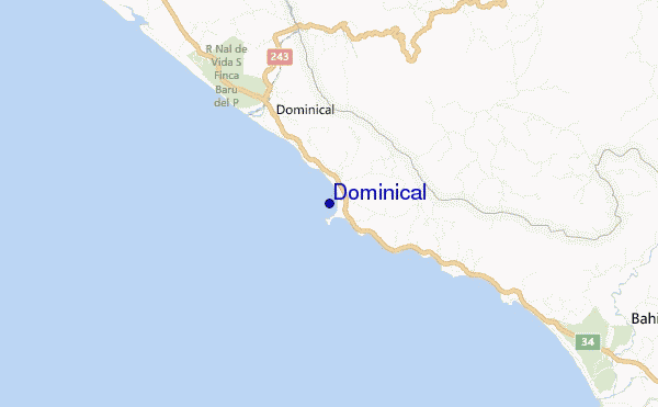
Dominical surf Forecast / Golfo de Nicoya / Costa Rica
48hr Weather and Surf, issued 5 am Saturday 27 Apr 2024 CST
Forecast update in hr min s Update imminent
Dominical surf forecast is for near shore open water. Breaking waves will often be smaller at less exposed spots.
Today's Dominical sea temperature is 30.4°C (Statistics for 27 Apr 1981-2005 - mean: 29.3 °C max: 30.5 °C min: 28.2 °C)
- Map Icons:
 Break
Break Live Wave Height (m)
 Live Wind Speed (km/h)
 Surf Rating (10 Max)
 Ocean Swells (m)
- Wind Speed (km/h)
Dominical surf forecast is for near shore open water. Breaking waves will often be smaller at less exposed spots.
Today's Dominical sea temperature is 30.4°C (Statistics for 27 Apr 1981-2005 - mean: 29.3 °C max: 30.5 °C min: 28.2 °C)
How big are the waves at Dominical today?
The current surf forecast for Dominical at 11AM is: 0.9m 16s primary swell from a Southwest direction and 0.7m 11s secondary swell from a South-southwest direction (forecast issued at 05:00am April 27). The wind direction is predicted to be cross-onshore and the swell rating is 2.
| Time (CST) & Date | Wave Height | Wave Period |
|---|---|---|
| Morning (27 Apr) | 3.5ft (1.1m) | 16s |
| Afternoon (27 Apr) | 3ft (0.9m) | 17s |
| Evening (27 Apr) | 2ft (0.6m) | 18s |
Table - waves today at Dominical. (Swell directed towards the surf break)
Updates in hr min s Update imminent
Saturday 27 | Sunday 28 | Monday 29 | Tuesday 30 | Wednesday 01 | Thursday 02 | Friday 03 | Saturday 04 | |||||||||||||||||||||||||||||||||||||||||||||||||||||
| 3 AM | 6 AM | 9 AM | 12 PM | 3 PM | 6 PM | 9 PM | 0 AM | 3 AM | 6 AM | 9 AM | 12 PM | 3 PM | 6 PM | 9 PM | 0 AM | 3 AM | 6 AM | 9 AM | 12 PM | 3 PM | 6 PM | 9 PM | 0 AM | 3 AM | 6 AM | 9 AM | 12 PM | 3 PM | 6 PM | 9 PM | 0 AM | 3 AM | 6 AM | 9 AM | 12 PM | 3 PM | 6 PM | 9 PM | 0 AM | 3 AM | 6 AM | 9 AM | 12 PM | 3 PM | 6 PM | 9 PM | 0 AM | 3 AM | 6 AM | 9 AM | 12 PM | 3 PM | 6 PM | 9 PM | 0 AM | 3 AM | 6 AM | 9 AM | 12 PM | |
Rating (10 max) | ||||||||||||||||||||||||||||||||||||||||||||||||||||||||||||
Swell Height Map |    |    |    |    |    |  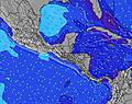 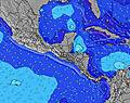 | 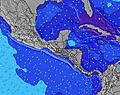 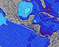 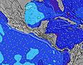 | 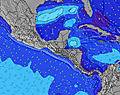 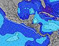 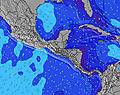 | ||||||||||||||||||||||||||||||||||||||||||||||||||||
| Wave Height (m) & direction (?) | ||||||||||||||||||||||||||||||||||||||||||||||||||||||||||||
| Period(s) (?) | 16 | 16 | 16 | 16 | 17 | 18 | 18 | 15 | 15 | 16 | 16 | 16 | 16 | 16 | 15 | 15 | 15 | 15 | 14 | 14 | 14 | 14 | 14 | 14 | 14 | 14 | 18 | 18 | 18 | 17 | 16 | 16 | 16 | 16 | 16 | 15 | 15 | 15 | 14 | 14 | 14 | 14 | 14 | 14 | 13 | 13 | 13 | 13 | 18 | 18 | 18 | 17 | 16 | 16 | 16 | 16 | 15 | 15 | 15 | 15 |
Wave (?)Graph | ||||||||||||||||||||||||||||||||||||||||||||||||||||||||||||
| Energy (?) | 254 | 587 | 595 | 371 | 493 | 300 | 192 | 262 | 269 | 400 | 411 | 416 | 416 | 348 | 280 | 258 | 255 | 309 | 305 | 305 | 248 | 248 | 297 | 337 | 236 | 232 | 319 | 276 | 312 | 487 | 595 | 452 | 447 | 441 | 649 | 592 | 576 | 568 | 437 | 437 | 431 | 425 | 407 | 323 | 313 | 309 | 222 | 222 | 222 | 316 | 316 | 302 | 343 | 334 | 334 | 334 | 409 | 398 | 398 | 474 |
Wind (km/h) | ||||||||||||||||||||||||||||||||||||||||||||||||||||||||||||
| Wind State (?) onshore cross-onshore cross-shore cross-offshore offshore glassy | glass | glass | cross- on | cross- on | glass | glass | glass | cross- off | cross- on | glass | glass | on | glass | glass | glass | glass | glass | glass | cross- on | cross- on | on | glass | glass | glass | glass | glass | glass | on | on | glass | glass | glass | glass | glass | glass | on | on | glass | glass | glass | glass | glass | glass | on | cross- on | glass | glass | glass | glass | glass | cross- on | on | on | glass | glass | glass | off | off | cross- on | on |
High Tide / height (m) | 4:48AM 2.46 | 4:54PM 2.64 | 5:26AM 2.40 | 5:33PM 2.57 | 6:07AM 2.33 | 6:16PM 2.48 | 6:56AM 2.28 | 7:07PM 2.39 | 7:53AM 2.26 | 8:10PM 2.31 | 9:00AM 2.29 | 9:22PM 2.27 | 10:10AM 2.40 | 10:37PM 2.31 | 11:16AM 2.57 | |||||||||||||||||||||||||||||||||||||||||||||
Low Tide / height (m) | 10:44AM 0.53 | 11:15PM 0.34 | 11:22AM 0.59 | 11:55PM 0.41 | 12:04PM 0.67 | 12:40AM 0.50 | 12:56PM 0.75 | 1:33AM 0.58 | 1:59PM 0.81 | 2:36AM 0.63 | 3:13PM 0.81 | 3:44AM 0.63 | 4:29PM 0.71 | 4:51AM 0.57 | ||||||||||||||||||||||||||||||||||||||||||||||
Saturday 27 | Sunday 28 | Monday 29 | Tuesday 30 | Wednesday 01 | Thursday 02 | Friday 03 | Saturday 04 | |||||||||||||||||||||||||||||||||||||||||||||||||||||
| Sunrise | - | 5:20 | - | - | - | - | - | - | - | 5:18 | - | - | - | - | - | - | - | 5:18 | - | - | - | - | - | - | - | 5:18 | - | - | - | - | - | - | - | 5:18 | - | - | - | - | - | - | - | 5:18 | - | - | - | - | - | - | - | 5:18 | - | - | - | - | - | - | - | 5:16 | - | - |
| Sunset | - | - | - | - | 5:45 | - | - | - | - | - | - | - | 5:45 | - | - | - | - | - | - | - | 5:45 | - | - | - | - | - | - | - | 5:45 | - | - | - | - | - | - | - | 5:45 | - | - | - | - | - | - | - | 5:45 | - | - | - | - | - | - | - | 5:45 | - | - | - | - | - | - | - |
Rain (mm) | 1 | 1 | 1 | 2 | 5 | 8 | 8 | 7 | 5 | 5 | 7 | 2 | 1 | 1 | - | 1 | 1 | - | - | 1 | 1 | 2 | 1 | - | - | - | - | - | 1 | - | - | - | 1 | 1 | - | - | 1 | 1 | 1 | - | - | 1 | 1 | 1 | 1 | 1 | 4 | 3 | 1 | 1 | - | - | 1 | 1 | - | - | 2 | 1 | - | 1 |
| Temp. °C | 27 | 27 | 29 | 29 | 27 | 26 | 25 | 25 | 25 | 25 | 25 | 26 | 27 | 26 | 26 | 26 | 26 | 26 | 28 | 29 | 28 | 27 | 26 | 26 | 26 | 26 | 28 | 29 | 29 | 28 | 27 | 27 | 27 | 26 | 29 | 29 | 29 | 28 | 27 | 27 | 27 | 27 | 29 | 29 | 29 | 28 | 27 | 27 | 26 | 26 | 29 | 29 | 29 | 28 | 27 | 27 | 26 | 26 | 29 | 29 |
| Feels °C (?) | 32 | 32 | 34 | 34 | 32 | 32 | 30 | 30 | 29 | 30 | 30 | 31 | 32 | 32 | 31 | 31 | 31 | 31 | 32 | 33 | 32 | 32 | 31 | 30 | 30 | 30 | 32 | 33 | 33 | 34 | 32 | 32 | 32 | 30 | 33 | 33 | 33 | 33 | 32 | 32 | 32 | 32 | 34 | 33 | 34 | 33 | 32 | 32 | 31 | 30 | 34 | 33 | 34 | 34 | 32 | 32 | 30 | 29 | 33 | 33 |
FREE! Surf-Forecast.com widget for your website
The surf report / weather widget below is available to embed on third party websites free of charge and provides a summary of our Dominical surf forecast. Simply grab the html code snippet that we provide and paste it into your own site. You can choose your preferred language and metric/imperial units for the surf forecast feed to suit users of your site. Click here to get the code.


 Nearest