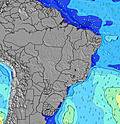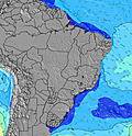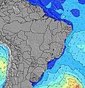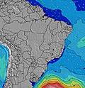
- Forecast
- Maps
- Live
- Weather State
- Spot Information
Surf Forecasts:
Balneario Novo Quintao surfForecast / Rio Grande Do Sul / Brazil
Forecast update in hr min s Forecast update imminent
Balneario Novo Quintao surf forecast is for near shore open water. Breaking waves will often be smaller at less exposed spots.
Today's Balneario Novo Quintao sea temperature is
24.9° C
(Which is slightly warmer than usual)How big are the waves at Balneario Novo Quintao today?
The current surf forecast for Balneario Novo Quintao at 8AM is: 0.7m 9s primary swell from a East-southeast direction and 0.7m 6s secondary swell from a East-northeast direction (forecast issued at 02:00am March 22). The wind direction is predicted to be cross-offshore.
| Time (-03) & Date | Wave Height | Wave Period |
|---|---|---|
| Morning (22 Mar) | 2.5ft (0.7m) | 9s |
| Afternoon (22 Mar) | 2.5ft (0.7m) | 9s |
| Evening (22 Mar) | 2.5ft (0.7m) | 10s |
Table - waves today at Balneario Novo Quintao. (Swell directed towards the surf break)
Updates in hr min s Forecast update imminent
Sunday 22 | Monday 23 | Tuesday 24 | ||||||||||||||||||||||
| 0 AM | 3 AM | 6 AM | 9 AM | 12 PM | 3 PM | 6 PM | 9 PM | 0 AM | 3 AM | 6 AM | 9 AM | 12 PM | 3 PM | 6 PM | 9 PM | 0 AM | 3 AM | 6 AM | 9 AM | 12 PM | 3 PM | 6 PM | 9 PM | |
Rating (10 max) | ||||||||||||||||||||||||
Swell Height Map | ||||||||||||||||||||||||
| Wave Height (m) & direction (?) | ||||||||||||||||||||||||
| Period(s) (?) | 6 | 6 | 9 | 9 | 9 | 9 | 9 | 10 | 10 | 10 | 9 | 9 | 5 | 6 | 7 | 7 | 7 | 8 | 8 | 7 | 7 | 8 | 8 | 7 |
Wave (?)Graph | ||||||||||||||||||||||||
| 104 | 93 | 68 | 67 | 84 | 65 | 73 | 80 | 81 | 103 | 78 | 78 | 87 | 207 | 297 | 243 | 208 | 176 | 120 | 97 | 69 | 113 | 110 | 88 | |
Wind (km/h) | ||||||||||||||||||||||||
| Wind State (?) onshore cross-onshore cross-shore cross-offshore offshore glassy | cross | cross- off | cross- off | cross- off | cross- off | cross- off | cross | cross- on | on | cross- on | cross- on | cross- on | cross- on | cross- on | cross- on | cross | cross- off | cross- off | off | cross- off | cross- off | cross- off | cross | cross- on |
High Tide / height (m) | 1:43AM 0.29 | 8:22AM 0.20 | 2:23PM 0.42 | 8:27PM 0.37 | 2:00AM 0.32 | 9:28AM 0.17 | 3:02PM 0.38 | 9:36PM 0.44 | 2:15AM 0.36 | 10:27AM 0.16 | 3:43PM 0.33 | |||||||||||||
Low Tide / height (m) | 5:19AM 0.09 | 10:23AM 0.16 | 5:33PM 0.27 | 11:34PM 0.25 | 6:06AM 0.02 | 11:02AM 0.15 | 6:02PM 0.24 | 12:37AM 0.34 | 6:52AM -0.02 | 11:52AM 0.14 | 6:32PM 0.21 | |||||||||||||
Sunday 22 | Monday 23 | Tuesday 24 | ||||||||||||||||||||||
| Sunrise | - | - | - | 6:24 | - | - | - | - | - | - | - | 6:26 | - | - | - | - | - | - | - | 6:26 | - | - | - | - |
| Sunset | - | - | - | - | - | - | 6:30 | - | - | - | - | - | - | - | 6:29 | - | - | - | - | - | - | - | 6:27 | - |
Rain (mm) | - | - | - | - | - | - | - | - | - | - | - | - | - | 1 | 2 | 1 | 5 | - | - | 1 | 1 | - | - | - |
| Temp. °C | 24 | 23 | 23 | 24 | 25 | 25 | 24 | 24 | 24 | 23 | 23 | 24 | 25 | 25 | 24 | 24 | 23 | 23 | 23 | 21 | 21 | 21 | 21 | 21 |
| Feels °C (?) | 26 | 25 | 24 | 25 | 26 | 26 | 25 | 26 | 27 | 25 | 24 | 23 | 23 | 23 | 20 | 25 | 26 | 25 | 25 | 20 | 21 | 20 | 18 | 19 |
- Map Icons:
Break
Live Wave Height (m)
Live Wind Speed (km/h)
Surf Rating (10 Max)
Ocean Swells (m)
Wind Speed (km/h)


