
Ano Nuevo Surf Guide
Ano Nuevo in San Mateo is a sheltered beach and reef break that has unreliable waves. Spring and Summer provide the best conditions. Ideal winds are from the northeast with some shelter here from north northwest winds. Tends to receive distant groundswells and the optimum swell angle is from the southwest. The beach breaks consists of rights. Good surf at all stages of the tide. Sometimes crowded. Take care of sharks,.
Ano Nuevo Spot Info
| Type: | Rating: | Reliability: | Todays Sea Temp*: |
|---|---|---|---|
| inconsistent | 11.8°C*ocean temperature recorded from satellite |
Surfing Ano Nuevo:
The best conditions reported for surf at Ano Nuevo occur when a Southwest swell combines with an offshore wind direction from the Northeast.
What's the best time of year to surf Ano Nuevo (for consistent clean waves)?
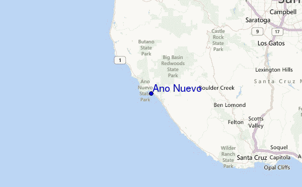
Explore Ano Nuevo Location Map
Interactive Ano Nuevo surf break location map. View information about nearby surf breaks, their wave consistency and rating compared to other spots in the region. Current swell conditions from local buoys are shown along with live wind speed and direction from nearby weather stations. Click icons on the map for more detail. The closest passenger airport to Ano Nuevo is Moffett Federal Afld (Mountain View) Airport (NUQ) in USA, 41 km (25 miles) away (directly). The second nearest airport to Ano Nuevo is Norman Y Mineta San Jose International Airport (SJC), also in USA, 43 km (27 miles) away.
- Map Icons:
 Break
Break Live Wave Height (m)
 Live Wind Speed (km/h)
 Surf Rating (10 Max)
 Ocean Swells (m)
- Wind Speed (km/h)
Tuesday, 9 June 2026, 22:02 Local Time
| Tue | Wed | |||
| 8PM | 11PM | 2AM | 5AM | |
| Wave (m) | ||||
| Period (s) | 19 | 18 | 18 | 18 |
| Wind (km/h) | ||||
| Wind State | cross | cross- off |
cross- off |
cross- off |
Tides at Ano Nuevo
| NEXT | IS AT (local time) | remaining |
|---|---|---|
| high tide | ||
| low tide |

Swell History at Ano Nuevo
Surf stats for Ano Nuevo, see the swell variation by month or season on the history page here.


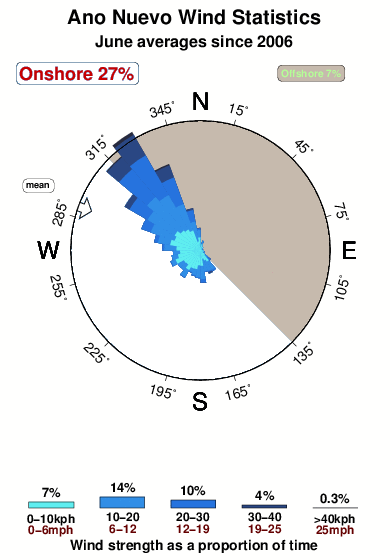
Wind History at Ano Nuevo
Wind stats for Ano Nuevo, see the variation in direction and stength by month or season on the history page here.
Other Nearby Breaks Closest To:
Discover surf breaks near Ano Nuevo. Click below to view there surf guides.
- Waddell Creek
 Beach and reef
 2.0
2.0
Reliability: inconsistent1km away - Scott Creek-Beach
- Beach and reef
- 2.0
Reliability: fairly consistent5km away - Scott Creek-Reef
- Beach and reef
- 2.0
Reliability: consistent5km away - Davenport Landing
 Reef and point
- 2.0
Reliability: fairly consistent6km away - Gazos Creek
- Beach
- 2.0
Reliability: inconsistent7km away
 Nearest