

Surf Forecasts:

How big are the waves at Sunrise today (29 Jul):
- Morning surf: Morning surf (29 Jul, local time) - 10ft (3.0m), 9s period with SSE swell.
- Afternoon surf: Afternoon surf (29 Jul, local time) - 8ft (2.4m), 9s period with SSE swell.
- Evening surf: Evening surf (29 Jul, local time) - 7ft (2.1m), 9s period with SSE swell.
The current surf forecast for Sunrise at 9AM is: 3.0m 9s primary swell from a South-southeast direction and 2.5m 9s secondary swell from a South-southeast direction, 0.7m 9s secondary swell from a East direction (forecast issued at 01:00am July 29). The wind direction is predicted to be cross-offshore.
| Time (SAST) & Date | Wave Height | Wave Period |
|---|---|---|
| Morning (29 Jul) | 10ft (3.0m) | 9s |
| Afternoon (29 Jul) | 8ft (2.4m) | 9s |
| Evening (29 Jul) | 7ft (2.1m) | 9s |
Table - waves today at Sunrise. (Swell directed towards the surf break)
Short Range ForecastHeavy rain (total 21mm), heaviest during Wed night. Very mild (max 19°C on Fri afternoon, min 14°C on Wed night). Winds decreasing (fresh winds from the SSW on Thu afternoon, light winds from the WSW by Fri night). | ||||||||||||||||||||||||
Wednesday 29 | Thursday 30 | Friday 31 | ||||||||||||||||||||||
2 AM | 5 AM | 8 AM | 11 AM | 2 PM | 5 PM | 8 PM | 11 PM | 2 AM | 5 AM | 8 AM | 11 AM | 2 PM | 5 PM | 8 PM | 11 PM | 2 AM | 5 AM | 8 AM | 11 AM | 2 PM | 5 PM | 8 PM | 11 PM | |
Swell Height Map |  |  |  |  | 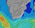 |  |  | 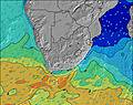 |  | |||||||||||||||
Wave Height (m) Direction Period (s) | S 9 | S 9 | SSE 9 | SSE 9 | SSE 9 | SSE 9 | SSE 9 | SSE 9 | S 9 | S 9 | S 9 | S 9 | S 9 | S 9 | S 9 | SSE 9 | SSE 9 | S 9 | SSE 9 | SSE 9 | SSE 9 | SSE 9 | SSE 8 | S 8 |
Wave Graph | ||||||||||||||||||||||||
1225 | 1553 | 1315 | 1021 | 897 | 802 | 697 | 617 | 676 | 977 | 676 | 876 | 1108 | 973 | 1131 | 1274 | 933 | 1089 | 907 | 1070 | 947 | 821 | 471 | 367 | |
Wind (km/h) | ||||||||||||||||||||||||
Wind State on-shore cross-onshore cross-shore cross-offshore off-shore glassy | cross-off | cross-off | cross-off | cross-off | cross-off | cross-off | cross-off | cross-off | cross-off | cross-off | cross-off | cross-off | cross-off | cross-off | cross-off | cross-off | cross-off | cross-off | cross-off | cross-off | cross | cross-off | cross-off | off |
High Tide | 3:44AM1.67m | 4:07PM1.69m | 4:13AM1.74m | 4:35PM1.78m | 4:41AM1.78m | 5:03PM1.83m | ||||||||||||||||||
Low Tide | 9:54AM0.19m | 10:07PM0.25m | 10:22AM0.11m | 10:36PM0.20m | 10:49AM0.07m | |||||||||||||||||||
— | 6:41 | — | — | — | — | — | — | — | 6:41 | — | — | — | — | — | — | — | 6:41 | — | — | — | — | — | — | |
— | — | — | — | — | 5:21 | — | — | — | — | — | — | — | 5:21 | — | — | — | — | — | — | — | 5:22 | — | — | |
mm | 1 | 1 | 2 | 1 | 1 | 2 | 6 | 6 | 1 | — | — | — | — | 1 | 1 | — | — | — | — | — | — | — | — | — |
Temp °C | 16 | 16 | 17 | 17 | 16 | 16 | 14 | 15 | 15 | 15 | 15 | 18 | 18 | 18 | 17 | 16 | 16 | 16 | 16 | 18 | 19 | 17 | 17 | 16 |
Feels °C | 12 | 13 | 15 | 14 | 13 | 12 | 11 | 12 | 12 | 12 | 11 | 11 | 11 | 11 | 10 | 10 | 10 | 10 | 11 | 12 | 13 | 12 | 15 | 13 |
Swell 1 Height (m) Direction Period (s) | SSW 15 | SSE 9 | SSE 9 | SSE 9 | SSE 9 | E 9 | SSE 9 | SSE 9 | SSE 9 | SSE 9 | SSW 15 | SSW 15 | E 9 | SSW 14 | E 9 | SSW 14 | SSW 14 | E 10 | SSE 9 | SSW 14 | SSW 14 | SSW 13 | ESE 10 | S 8 |
174 | 1182 | 1039 | 1021 | 897 | 136 | 697 | 617 | 547 | 572 | 234 | 231 | 61 | 207 | 61 | 480 | 156 | 74 | 907 | 145 | 104 | 66 | 205 | 367 | |
Swell 2 Height (m) Direction Period (s) | E 10 | SSW 15 | E 9 | E 9 | E 9 | SSW 14 | E 9 | E 9 | E 9 | E 9 | E 9 | E 9 | — | E 9 | — | E 9 | E 10 | E 10 | — | SSW 14 | SSW 17 | SSW 16 | SSW 13 | ESE 9 |
67 | 172 | 83 | 87 | 136 | 158 | 130 | 103 | 79 | 79 | 81 | 61 | — | 63 | — | 41 | 49 | 18 | — | 347 | 59 | 89 | 66 | 280 | |
Swell 3 Height (m) Direction Period (s) | — | E 9 | SSW 15 | SSW 14 | SSW 14 | — | SSW 14 | SSW 13 | SSW 15 | SSW 15 | — | — | — | — | — | — | — | — | — | — | — | — | SSW 16 | SSW 15 |
— | 64 | 167 | 165 | 158 | — | 165 | 66 | 181 | 176 | — | — | — | — | — | — | — | — | — | — | — | — | 52 | 126 | |
Wind waves Height (m) Direction Period (s) | S 9 | S 9 | SSE 9 | — | — | SSE 9 | — | — | S 9 | S 9 | S 9 | S 9 | S 9 | S 9 | S 9 | SSE 9 | SSE 9 | S 9 | SW 14 | SSE 9 | SSE 9 | SSE 9 | SSE 8 | — |
1225 | 1553 | 1315 | — | — | 802 | — | — | 676 | 977 | 676 | 876 | 1108 | 973 | 1131 | 1274 | 933 | 1089 | 595 | 1070 | 947 | 821 | 471 | — | |
Nearest Offshore or Glassy | ||||||||||||||||||||||||
Distance (km) | 34 | 34 | 8 | 31 | 87 | 34 | 34 | 34 | 0 | 34 | 34 | 363 | 1241 | 437 | 271 | 81 | 34 | 34 | 34 | 916 | 925 | 935 | 0 | 0 |
Best forecast wave conditions in KwaZulu-Natal North Coast | ||||||||||||||||||||||||
Best forecast wave conditions in South Africa | ||||||||||||||||||||||||
Header Global | ||||||||||||||||||||||||
- Map Icons:
 Break
Break Live Wave Height (m)
 Live Wind Speed (km/h)
 Surf Rating (10 Max)
 Ocean Swells (m)
- Wind Speed (km/h)


FREE! Surf-Forecast.com widget for your website
The surf report / weather widget below is available to embed on third party websites free of charge and provides a summary of our Sunrise surf forecast. Simply grab the html code snippet that we provide and paste it into your own site. You can choose your preferred language and metric/imperial units for the surf forecast feed to suit users of your site. Click here to get the code.
 Nearest