

The World’s Most Inconsistent Waves
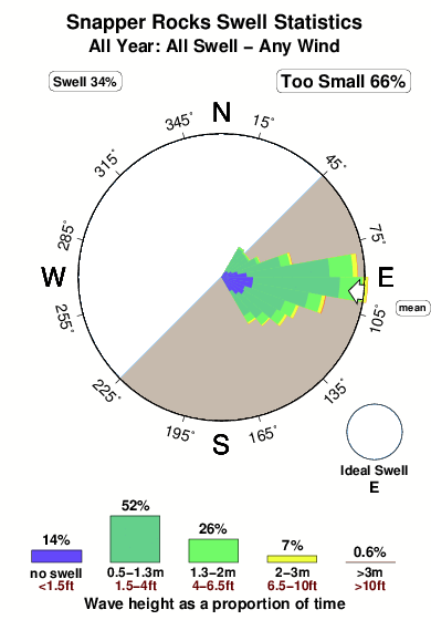
Huntington, Dribbleton, Virginia, Holland and the Superbank! We recently had a look at the world’s most consistent waves. This was based on the combination of swells and wind directed at 7,000 surf spots, as compiled from our data since 2006. Those stats, represented in easy-to-read graphics, are located under each wave’s spot guides, with historical swell and wind breakdowns available by month, season, and year. There is also an offshore filter, which shows how often the swells come with clean

 Nearest