

30th Street/Ship Bottom Surf Guide
30th Street/Ship Bottom in New Jersey is an exposed beach break that has fairly consistent surf and can work at any time of the year. Offshore winds are from the west. Most of the surf here comes from groundswells and the best swell direction is from the southeast. Waves at the beach break both left and right. When it's working here, it can get crowded.
30th Street/Ship Bottom Spot Info
| Type: | Rating: | Reliability: | Todays Sea Temp*: |
|---|---|---|---|
| fairly consistent | 19.2°C*ocean temperature recorded from satellite |
Surfing 30th Street/Ship Bottom:
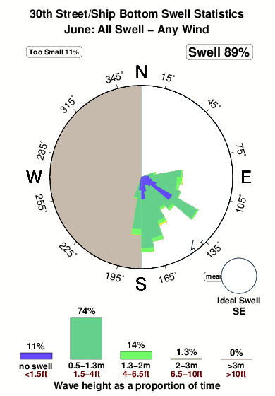
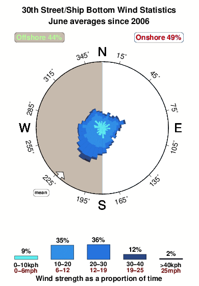
The best conditions reported for surf at 30th Street/Ship Bottom occur when a Southeast swell combines with an offshore wind direction from the West.
What's the best time of year to surf 30th Street/Ship Bottom (for consistent clean waves)?
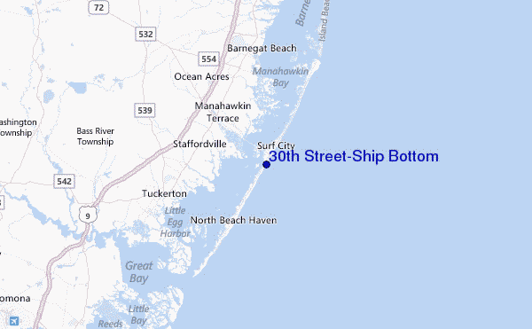
Explore 30th Street/Ship Bottom Location Map
Interactive 30th Street/Ship Bottom surf break location map. View information about nearby surf breaks, their wave consistency and rating compared to other spots in the region. Current swell conditions from local buoys are shown along with live wind speed and direction from nearby weather stations. Click icons on the map for more detail. The closest passenger airport to 30th Street/Ship Bottom is Atlantic City International Airport (ACY) in USA, 39 km (24 miles) away (directly). The second nearest airport to 30th Street/Ship Bottom is Lakehurst Naes Airport (NEL), also in USA, 46 km (29 miles) away.
- Map Icons:
 Break
Break Live Wave Height (m)
 Live Wind Speed (km/h)
 Surf Rating (10 Max)
 Ocean Swells (m)
- Wind Speed (km/h)
Wednesday, 10 June 2026, 10:45 Local Time
| Wednesday 10 | ||||
| 11AM | 2PM | 5PM | 8PM | |
| Wave (m) | ||||
| Period (s) | 9 | 8 | 5 | 6 |
| Wind (km/h) | ||||
| Wind State | cross- off |
cross- off |
cross- off |
cross- off |
Tides at 30th Street/Ship Bottom
| NEXT | IS AT (local time) | remaining |
|---|---|---|
| high tide | ||
| low tide |
Swell History at 30th Street/Ship Bottom
Surf stats for 30th Street/Ship Bottom, see the swell variation by month or season on the history page here.

Wind History at 30th Street/Ship Bottom
Wind stats for 30th Street/Ship Bottom, see the variation in direction and stength by month or season on the history page here.
Other Nearby Breaks Closest To:
Discover surf breaks near 30th Street/Ship Bottom. Click below to view there surf guides.
 Nearest