
Tanjung Batu Surf Guide
Tanjung Batu in Brunei is an exposed river break that has unreliable waves. The best conditions for surfing are during the cyclone season. The best wind direction is from the south southeast with some shelter here from west winds. Waves just as likely from local windswells as from distant groundswells and the best swell direction is from the north. The river break offers both left and right hand waves. Good surf at all stages of the tide. Unlikely to be too crowded, even when the surf is up. Beware of - Rips / undertow - Pollution.
Tanjung Batu Spot Info
| Type: | Rating: | Reliability: | Todays Sea Temp*: |
|---|---|---|---|
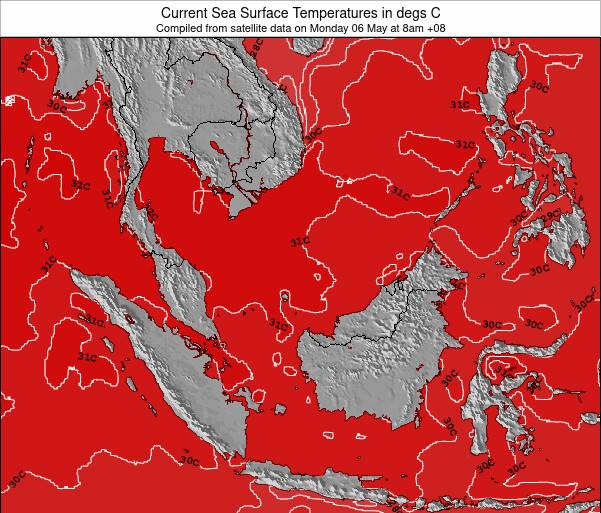
| inconsistent | 30.8°C*ocean temperature recorded from satellite |
Surfing Tanjung Batu:
The best conditions reported for surf at Tanjung Batu occur when a North swell combines with an offshore wind direction from the South-southeast.
What's the best time of year to surf Tanjung Batu (for consistent clean waves)?
Explore Tanjung Batu Location Map
Interactive Tanjung Batu surf break location map. View information about nearby surf breaks, their wave consistency and rating compared to other spots in the region. Current swell conditions from local buoys are shown along with live wind speed and direction from nearby weather stations. Click icons on the map for more detail. The closest passenger airport to Tanjung Batu is Brunei International Airport (BWN) in Brunei, 18 km (11 miles) away (directly). The second nearest airport to Tanjung Batu is Labuan Airport (LBU) in Malaysia, 35 km (22 miles) away.
- Map Icons:
 Break
Break Live Wave Height (m)
 Live Wind Speed (km/h)
 Surf Rating (10 Max)
 Ocean Swells (m)
- Wind Speed (km/h)
Thursday, 11 June 2026, 10:00 Local Time
| Thursday 11 | ||||
| 11AM | 2PM | 5PM | 8PM | |
| Wave (m) | ||||
| Period (s) | 5 | 6 | 6 | 5 |
| Wind (km/h) | ||||
| Wind State | cross | cross- on |
cross- on |
cross- on |
Tides at Tanjung Batu
| NEXT | IS AT (local time) | remaining |
|---|---|---|
| high tide | ||
| low tide |
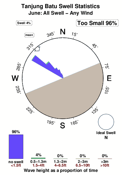
Swell History at Tanjung Batu
Surf stats for Tanjung Batu, see the swell variation by month or season on the history page here.


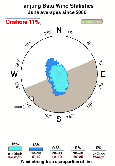
Wind History at Tanjung Batu
Wind stats for Tanjung Batu, see the variation in direction and stength by month or season on the history page here.
Other Nearby Breaks Closest To:
Discover surf breaks near Tanjung Batu. Click below to view there surf guides.
 Nearest