
Punta Canoas Surf Guide
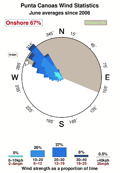
Punta Canoas in Baja Norte is an exposed reef and point break that usually has waves and can work at any time of the year. The best wind direction is from the north northeast with some shelter here from northwest winds. Groundswells more frequent than windswells and the best swell direction is from the southwest. It's sometimes crowded here. Beware of rips and sharks.
Punta Canoas Spot Info
| Type: | Rating: | Reliability: | Todays Sea Temp*: |
|---|---|---|---|
| consistent | 16.6°C*ocean temperature recorded from satellite |
Surfing Punta Canoas:
The best conditions reported for surf at Punta Canoas occur when a Southwest swell combines with an offshore wind direction from the North-northeast.
What's the best time of year to surf Punta Canoas (for consistent clean waves)?
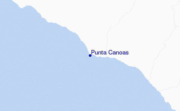
Explore Punta Canoas Location Map
Interactive Punta Canoas surf break location map. View information about nearby surf breaks, their wave consistency and rating compared to other spots in the region. Current swell conditions from local buoys are shown along with live wind speed and direction from nearby weather stations. Click icons on the map for more detail. The nearest passenger airport to Punta Canoas is Punta Penasco Airport (PPE) in Mexico, which is 267 km (166 miles) away (directly). The second closest airport to Punta Canoas is General Alberto L Salinas C International (Ensenada) Airport (ESE), also in Mexico, 296 km (184 miles) away.
- Map Icons:
 Break
Break Live Wave Height (m)
 Live Wind Speed (km/h)
 Surf Rating (10 Max)
 Ocean Swells (m)
- Wind Speed (km/h)
Wednesday, 10 June 2026, 11:06 Local Time
| Wednesday 10 | ||||
| 8AM | 11AM | 2PM | 5PM | |
| Wave (m) | ||||
| Period (s) | 16 | 16 | 16 | 16 |
| Wind (km/h) | ||||
| Wind State | glass | cross- on |
cross | cross |
Tides at Punta Canoas
| NEXT | IS AT (local time) | remaining |
|---|---|---|
| high tide | ||
| low tide |
Swell History at Punta Canoas
Surf stats for Punta Canoas, see the swell variation by month or season on the history page here.


Wind History at Punta Canoas
Wind stats for Punta Canoas, see the variation in direction and stength by month or season on the history page here.
Other Nearby Breaks Closest To:
Discover surf breaks near Punta Canoas. Click below to view there surf guides.
- Punta San Carlos
 Reef and point
 2.0
2.0
Reliability: fairly consistent39km away - Punta Blanca (Seven Sisters)
- Reef and point
 1.0
1.0
Reliability: consistent59km away - Punta San Antonio
- Reef and point
- 2.0
Reliability: fairly consistent62km away - Punta Cono
- Reef and point
- 1.0
Reliability: consistent78km away - Punta Baja
 Beach and reef
- 2.0
Reliability: inconsistent84km away
 Nearest