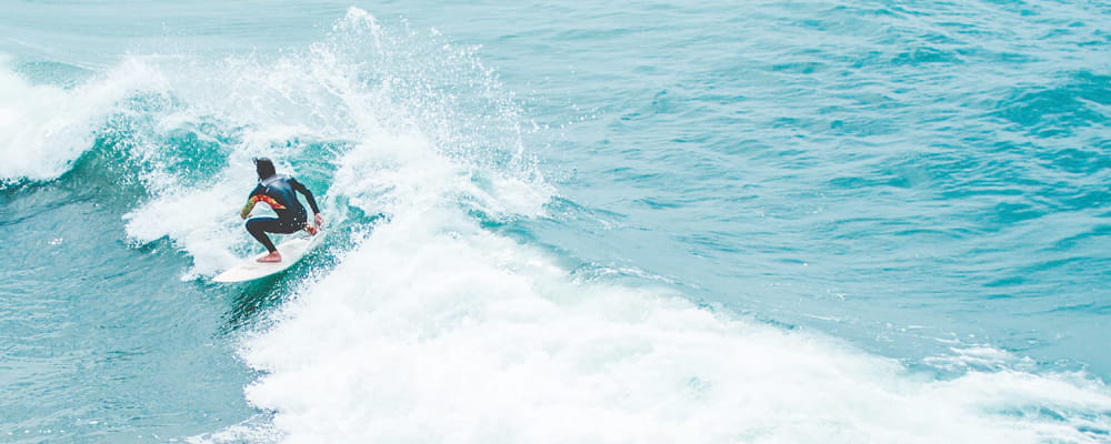
Oyster Bar Beachbreak Surf Guide
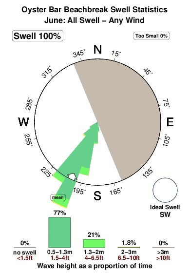
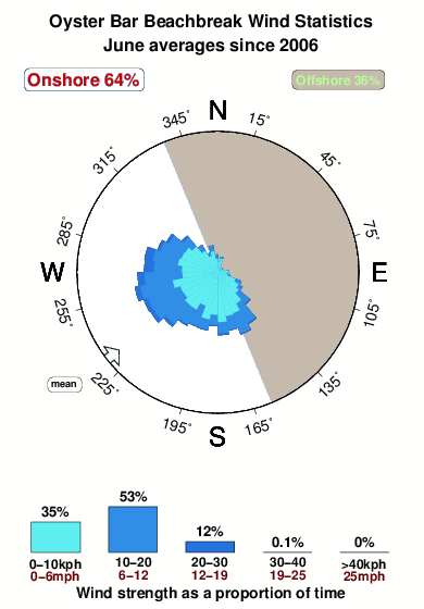
Oyster Bar Beachbreak in Sinaloa is an exposed beach break. Summer offers the favoured conditions for surfing. The best wind direction is from the east northeast. Clean groundswells prevail and the ideal swell direction is from the southwest. The beach breaks favour lefts. Good surf at all stages of the tide. When the surf is up, it can get quite busy in the water. Beware of .
Oyster Bar Beachbreak Spot Info
| Type: | Rating: | Reliability: | Todays Sea Temp*: |
|---|---|---|---|
| rarely breaks | 29.2°C*ocean temperature recorded from satellite |
Surfing Oyster Bar Beachbreak:
The best conditions reported for surf at Oyster Bar Beachbreak occur when a Southwest swell combines with an offshore wind direction from the East-northeast.
What's the best time of year to surf Oyster Bar Beachbreak (for consistent clean waves)?
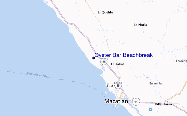
Explore Oyster Bar Beachbreak Location Map
Interactive Oyster Bar Beachbreak surf break location map. View information about nearby surf breaks, their wave consistency and rating compared to other spots in the region. Current swell conditions from local buoys are shown along with live wind speed and direction from nearby weather stations. Click icons on the map for more detail. The nearest passenger airport to Oyster Bar Beachbreak is General Rafael Buelna International (Mazatlan) Airport (MZT) in Mexico, which is 35 km (22 miles) away (directly). The second closest airport to Oyster Bar Beachbreak is Culiacan International Airport (CUL), also in Mexico, 182 km (113 miles) away.
- Map Icons:
 Break
Break Live Wave Height (m)
 Live Wind Speed (km/h)
 Surf Rating (10 Max)
 Ocean Swells (m)
- Wind Speed (km/h)
Wednesday, 10 June 2026, 08:59 Local Time
| Wednesday 10 | ||||
| 8AM | 11AM | 2PM | 5PM | |
| Wave (m) | ||||
| Period (s) | 16 | 16 | 16 | 16 |
| Wind (km/h) | ||||
| Wind State | cross- on |
on | on | on |
Tides at Oyster Bar Beachbreak
| NEXT | IS AT (local time) | remaining |
|---|---|---|
| high tide | ||
| low tide |
Oyster Bar Beachbreak Sea Temperature
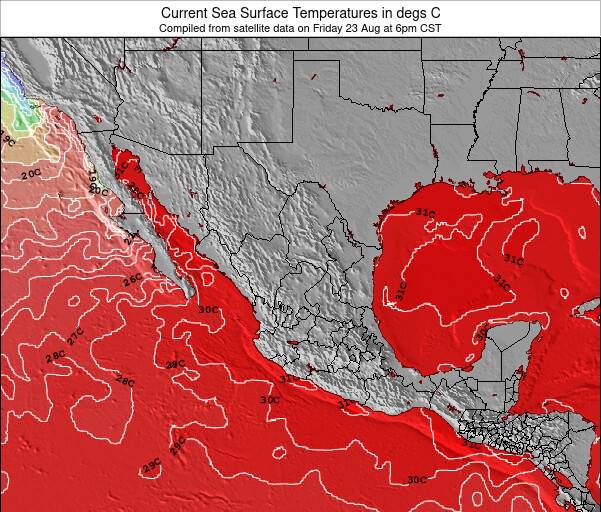
Very warm air temperatures and very warm water(29.2 °C) too at Oyster Bar Beachbreak, warm enough for wearing board shorts and a rash vest in the surf. Cloudy, but feeling very pleasant in and out of the water.
Swell History at Oyster Bar Beachbreak
Surf stats for Oyster Bar Beachbreak, see the swell variation by month or season on the history page here.

Wind History at Oyster Bar Beachbreak
Wind stats for Oyster Bar Beachbreak, see the variation in direction and stength by month or season on the history page here.
Other Nearby Breaks Closest To:
Discover surf breaks near Oyster Bar Beachbreak. Click below to view there surf guides.
 Nearest