- Forecast
- Maps
- Live
- Weather State
- Spot Information
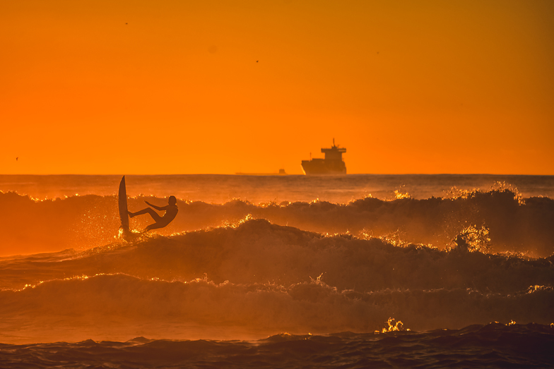
Matosinhos Surf Forecast
/ Douro & Minho (25 surf breaks) /Surf Forecasts:

Matosinhos surfForecast / Douro & Minho / Portugal
Forecast update in hr min s Forecast update imminent
Matosinhos surf forecast is for near shore open water. Breaking waves will often be smaller at less exposed spots.
Today's Matosinhos sea temperature is
16.9° C
(Which is normal for this time of year)How big are the waves at Matosinhos today?
The current surf forecast for Matosinhos at 12PM is: 2.4m 17s primary swell from a West direction (forecast issued at 05:00am November 04). The wind direction is predicted to be cross-offshore and the swell rating is 11.
| Time (WET) & Date | Wave Height | Wave Period |
|---|---|---|
| Morning (04 Nov) | 6ft (1.8m) | 13s |
| Afternoon (04 Nov) | 7ft (2.1m) | 15s |
| Evening (04 Nov) | 8ft (2.5m) | 16s |
Table - waves today at Matosinhos. (Swell directed towards the surf break)
Updates in hr min s Forecast update imminent
Tuesday 04 | Wednesday 05 | Thursday 06 | Fri 07 | |||||||||||||||||||||
| 3 AM | 6 AM | 9 AM | 12 PM | 3 PM | 6 PM | 9 PM | 0 AM | 3 AM | 6 AM | 9 AM | 12 PM | 3 PM | 6 PM | 9 PM | 0 AM | 3 AM | 6 AM | 9 AM | 12 PM | 3 PM | 6 PM | 9 PM | 0 AM | |
Rating (10 max) | ||||||||||||||||||||||||
Swell Height Map |    |  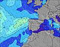 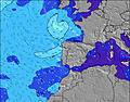 |  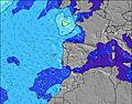 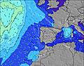 |  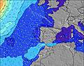 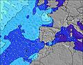 | ||||||||||||||||||||
| Wave Height (m) & direction (?) | ||||||||||||||||||||||||
| Period(s) (?) | 12 | 12 | 13 | 17 | 15 | 16 | 16 | 15 | 15 | 10 | 14 | 14 | 9 | 9 | 10 | 13 | 13 | 13 | 13 | 13 | 12 | 12 | 12 | 12 |
Wave (?)Graph | ||||||||||||||||||||||||
| 598 | 447 | 1028 | 3347 | 2043 | 2252 | 3543 | 3666 | 1312 | 1522 | 1139 | 1139 | 1199 | 1759 | 3172 | 5927 | 7753 | 8258 | 6935 | 4965 | 3459 | 2815 | 2094 | 1756 | |
Wind (km/h) | ||||||||||||||||||||||||
| Wind State (?) onshore cross-onshore cross-shore cross-offshore offshore glassy | cross- off | cross- off | cross | cross- off | cross- off | cross- off | cross- off | cross | cross- off | cross- off | cross | cross- on | cross- on | cross- on | cross- on | cross- on | on | on | on | cross- on | cross- on | on | on | cross |
High Tide / height (m) | 12:17AM 3.24 | 12:38PM 3.28 | 1:09AM 3.12 | 1:36PM 3.08 | 2:11AM 2.99 | 2:48PM 2.89 | ||||||||||||||||||
Low Tide / height (m) | 6:24AM 0.71 | 6:53PM 0.73 | 7:18AM 0.86 | 7:49PM 0.92 | 8:24AM 1.00 | 8:57PM 1.09 | ||||||||||||||||||
Tuesday 04 | Wednesday 05 | Thursday 06 | Fri 07 | |||||||||||||||||||||
| Sunrise | - | - | 7:07 | - | - | - | - | - | - | - | 7:09 | - | - | - | - | - | - | - | 7:11 | - | - | - | - | - |
| Sunset | - | - | - | - | 5:27 | - | - | - | - | - | - | - | 5:25 | - | - | - | - | - | - | - | 5:24 | - | - | - |
Rain (mm) | - | - | - | - | - | - | - | - | 14 | 7 | 6 | 11 | 3 | 3 | 5 | 2 | 2 | 3 | 3 | 2 | 2 | 1 | - | - |
| Temp. °C | 15 | 15 | 16 | 19 | 20 | 20 | 22 | 21 | 16 | 17 | 17 | 16 | 15 | 15 | 15 | 15 | 15 | 15 | 15 | 15 | 16 | 16 | 16 | 15 |
| Feels °C (?) | 12 | 11 | 11 | 13 | 15 | 15 | 15 | 13 | 12 | 13 | 11 | 10 | 7 | 7 | 6 | 6 | 7 | 8 | 8 | 9 | 11 | 12 | 13 | 12 |
- Map Icons:
 Break
Break Live Wave Height (m)
 Live Wind Speed (km/h)
 Surf Rating (10 Max)
 Ocean Swells (m)
- Wind Speed (km/h)
FREE! Surf-Forecast.com widget for your website
The surf report / weather widget below is available to embed on third party websites free of charge and provides a summary of our Matosinhos surf forecast. Simply grab the html code snippet that we provide and paste it into your own site. You can choose your preferred language and metric/imperial units for the surf forecast feed to suit users of your site. Click here to get the code.
 Nearest