
K.O.A Surf Guide
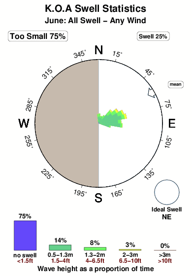
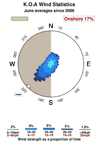
K.O.A in North Carolina is an exposed beach break that has dependable surf and can work at any time of the year. The best wind direction is from the west. Windswells and groundswells in equal measure and the ideal swell direction is from the northeast. The beach break provides left and right handers. Good surf at all stages of the tide. When the surf is up, it can get quite busy in the water. Watch out for rips, man-made danger (buoys etc...) and sharks.
K.O.A Spot Info
| Type: | Rating: | Reliability: | Todays Sea Temp*: |
|---|---|---|---|
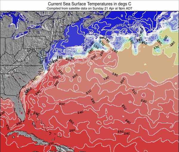
| consistent | 22.0°C*ocean temperature recorded from satellite |
Surfing K.O.A:
The best conditions reported for surf at K.O.A occur when a Northeast swell combines with an offshore wind direction from the West.
What's the best time of year to surf K.O.A (for consistent clean waves)?
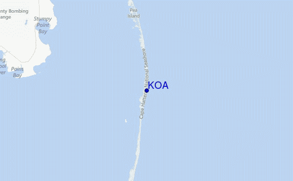
Explore K.O.A Location Map
Interactive K.O.A surf break location map. View information about nearby surf breaks, their wave consistency and rating compared to other spots in the region. Current swell conditions from local buoys are shown along with live wind speed and direction from nearby weather stations. Click icons on the map for more detail. The closest passenger airport to K.O.A is Elizabeth City Cgas Rgnl Airport (ECG) in USA, 102 km (63 miles) away (directly). The second nearest airport to K.O.A is Cherry Point Mcas Airport (NKT), also in USA, 147 km (91 miles) away.
- Map Icons:
 Break
Break Live Wave Height (m)
 Live Wind Speed (km/h)
 Surf Rating (10 Max)
 Ocean Swells (m)
- Wind Speed (km/h)
Wednesday, 10 June 2026, 09:56 Local Time
| Wednesday 10 | ||||
| 11AM | 2PM | 5PM | 8PM | |
| Wave (m) | ||||
| Period (s) | 7 | 6 | 6 | 8 |
| Wind (km/h) | ||||
| Wind State | cross- off |
cross- off |
cross- off |
cross- off |
Tides at K.O.A
| NEXT | IS AT (local time) | remaining |
|---|---|---|
| high tide | ||
| low tide |
Swell History at K.O.A
Surf stats for K.O.A, see the swell variation by month or season on the history page here.

Wind History at K.O.A
Wind stats for K.O.A, see the variation in direction and stength by month or season on the history page here.
Other Nearby Breaks Closest To:
Discover surf breaks near K.O.A. Click below to view there surf guides.
 Nearest