

D'Estrees Bay Surf Guide
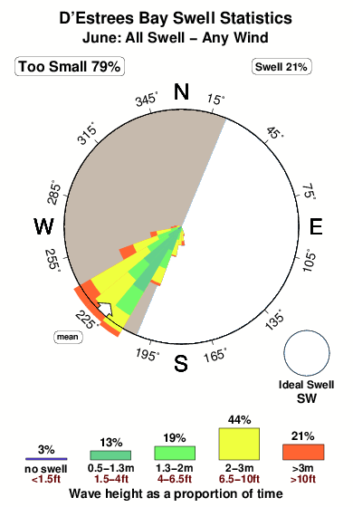
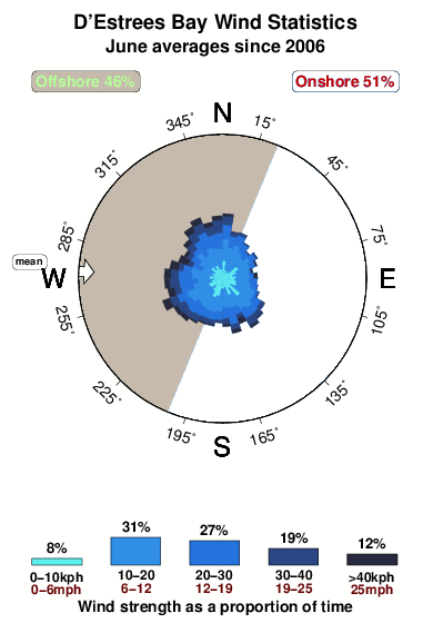
D'Estrees Bay in Kangaroo Island is a very sheltered reef break that has quite reliable surf. Winter is the favoured time of year for surfing here. The best wind direction is from the west northwest. Clean groundswells prevail and the optimum swell angle is from the southwest. Both left and right reef breaks. It very rarely gets crowded here. Beware of rips, rocks and sharks.
D'Estrees Bay Spot Info
| Type: | Rating: | Reliability: | Todays Sea Temp*: |
|---|---|---|---|
| fairly consistent | 17.0°C*ocean temperature recorded from satellite |
Surfing D'Estrees Bay:
The best conditions reported for surf at D'Estrees Bay occur when a Southwest swell combines with an offshore wind direction from the West-northwest.
What's the best time of year to surf D'Estrees Bay (for consistent clean waves)?
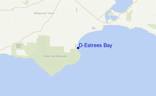
Explore D'Estrees Bay Location Map
Interactive D'Estrees Bay surf break location map. View information about nearby surf breaks, their wave consistency and rating compared to other spots in the region. Current swell conditions from local buoys are shown along with live wind speed and direction from nearby weather stations. Click icons on the map for more detail. The nearest passenger airport to D'Estrees Bay is Adelaide International Airport (ADL) in Australia, which is 140 km (87 miles) away (directly). The second closest airport to D'Estrees Bay is Woomera Airport (UMR), also in Australia, 539 km (335 miles) away.
- Map Icons:
 Break
Break Live Wave Height (m)
 Live Wind Speed (km/h)
 Surf Rating (10 Max)
 Ocean Swells (m)
- Wind Speed (km/h)
Wednesday, 10 June 2026, 16:21 Local Time
| Wednesday 10 | ||||
| 12:30PM | 3:30PM | 6:30PM | 9:30PM | |
| Wave (m) | ||||
| Period (s) | 14 | 17 | 17 | 16 |
| Wind (km/h) | ||||
| Wind State | cross- off |
cross- off |
off | cross- off |
Tides at D'Estrees Bay
| NEXT | IS AT (local time) | remaining |
|---|---|---|
| high tide | ||
| low tide |
Swell History at D'Estrees Bay
Surf stats for D'Estrees Bay, see the swell variation by month or season on the history page here.

Wind History at D'Estrees Bay
Wind stats for D'Estrees Bay, see the variation in direction and stength by month or season on the history page here.
Other Nearby Breaks Closest To:
Discover surf breaks near D'Estrees Bay. Click below to view there surf guides.
- Pennington Bay
 Sandbar
 1.0
1.0
Reliability: fairly consistent16km away - Vivonne Bay
 Beach and sandbar
- 1.0
Reliability: fairly consistent38km away - Cape Young Husband
 Point
Point 3.0
3.0
Reliability: fairly consistent39km away - Cape Kersaint
- Point
- 1.0
Reliability: fairly consistent44km away - Stokes Bay
 Reef
Reef- 3.0
Reliability: fairly consistent53km away
 Nearest