San Mateo Surf
Detailed San Mateo surf forecast maps and the latest eyeball surf report from local surfers in the region. Near-shore swell is shown on the map together with the surf forecast rating for spots in San Mateo. Find the best places to surf in offshore conditions by selecting the wind option on the forecast map. Windsurfers and kite surfers can also use this option to find more favorable cross-shore conditions in San Mateo. Our local Wavefinder indicates where some of the best conditions are likely to be found in San Mateo over the next 7 days. Surf photos from San Mateo and reviews of the best spots and surfing conditions have been provided by local surfers.
San Mateo Surf Forecast map for predicting the best wave and wind conditions across the region. For surfers, the map shows the most powerful swell tracking across near-shore open water and not the peak waves experienced by boats out at sea. Move your mouse over the ocean swell symbols or the surf breaks on the coastline to see a more detailed surf forecast including wave period and wind conditions. The forecast updates every 6 hours and most live weather reports update every hour. You can animate the San Mateo Surf map or show live wind and wave conditions as reported from wavebuoys and local weather stations. Surf breaks shown along the San Mateo coastline are also listed below.
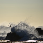
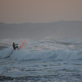
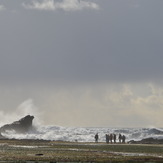
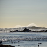
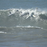
San Mateo Photos
San Mateo Wavefinder
Saturday 1 | Sunday 2 | Monday 3 | Tuesday 4 | Wednesday 5 | Thursday 6 | Friday 7 | |||||||||||||||
AM | PM | Night | AM | PM | Night | AM | PM | Night | AM | PM | Night | AM | PM | Night | AM | PM | Night | AM | PM | Night | |
Best forecast wave conditions in San Mateo | |||||||||||||||||||||
Wave Height (m) Direction Period (s) | WNW 8 | WNW 8 | WNW 9 | WNW 9 | WNW 10 | WNW 10 | WNW 10 | WNW 10 | NW 9 | NW 9 | WNW 9 | WNW 8 | WNW 8 | SW 14 | WNW 9 | SW 13 | SW 13 | SW 13 | SW 13 | SSW 19 | SSW 17 |
197 | 294 | 675 | 866 | 506 | 746 | 970 | 373 | 502 | 406 | 147 | 188 | 96 | 58 | 138 | 85 | 84 | 85 | 139 | 210 | 157 | |
Wind (km/h) | |||||||||||||||||||||
Wind State on-shore cross-onshore cross-shore cross-offshore off-shore glassy | cross | cross | on | on | cross | cross-on | cross-off | cross-off | cross-off | cross-off | cross-on | cross-off | on | cross-on | glassy | cross-on | cross-on | cross | cross | cross | cross |
High Tide | 1:21PM1.37m | 1:15AM2.12m | 2:07AM1.96m | 2:44PM1.63m | 3:09AM1.80m | 2:55PM1.58m | 4:11AM1.46m | 3:38PM1.63m | 5:38AM0.92m | 4:30PM1.69m | 7:19AM0.98m | 5:31PM1.75m | |||||||||
Low Tide | 6:57PM0.66m | 7:36AM0.56m | 7:46PM0.57m | 8:24PM1.03m | 8:19AM0.77m | 9:22PM0.93m | 8:54AM0.96m | 10:18PM0.79m | 9:04AM0.64m | 10:58PM0.23m | 10:00AM0.83m | 00:11AM0.09m | 11:15AM0.96m | 1:18AM-0.07m | |||||||
mm | — | — | — | — | — | — | — | — | — | — | — | — | — | — | — | — | — | — | — | — | — |
Max °C | 19 | 20 | 14 | 18 | 20 | 14 | 16 | 16 | 14 | 17 | 20 | 15 | 18 | 20 | 15 | 20 | 21 | 15 | 19 | 19 | 15 |
Min °C | 13 | 19 | 12 | 13 | 19 | 13 | 13 | 16 | 13 | 14 | 19 | 14 | 15 | 19 | 14 | 17 | 19 | 14 | 15 | 17 | 13 |
Chill °C | 19 | 20 | 13 | 18 | 20 | 13 | 15 | 15 | 13 | 17 | 20 | 15 | 18 | 20 | 15 | 20 | 21 | 15 | 19 | 19 | 15 |
6:13 | — | — | 6:13 | — | — | 6:15 | — | — | 6:16 | — | — | 6:16 | — | — | 6:18 | — | — | 6:18 | — | — | |
— | 8:15 | — | — | 8:15 | — | — | 8:15 | — | — | 8:13 | — | — | 8:12 | — | — | 8:10 | — | — | 8:09 | — | |
Swell 1 Height (m) Direction Period (s) | WNW 8 | S 13 | WNW 9 | WNW 9 | WNW 10 | WNW 10 | WNW 10 | WNW 10 | NW 9 | NW 9 | WNW 9 | WNW 8 | WNW 8 | WNW 8 | WNW 9 | WNW 9 | WNW 8 | WNW 9 | WNW 8 | SSW 19 | WNW 8 |
197 | 90 | 675 | 866 | 506 | 746 | 970 | 373 | 502 | 406 | 147 | 188 | 96 | 58 | 138 | 67 | 48 | 49 | 39 | 210 | 74 | |
Swell 2 Height (m) Direction Period (s) | S 13 | SW 14 | SSW 14 | SSW 13 | SW 13 | SW 13 | SSW 13 | SW 13 | SSW 12 | SW 15 | SW 12 | SSW 13 | SW 14 | SW 14 | SSW 13 | SW 13 | SW 13 | SW 13 | SW 13 | SW 13 | SSW 17 |
89 | 48 | 78 | 102 | 46 | 44 | 66 | 42 | 57 | 60 | 36 | 66 | 52 | 52 | 63 | 85 | 84 | 85 | 84 | 82 | 157 | |
Wind waves Height (m) Direction Period (s) | — | WNW 8 | — | — | — | — | — | — | — | — | — | — | — | — | — | — | — | — | NW 8 | WNW 8 | — |
— | 294 | — | — | — | — | — | — | — | — | — | — | — | — | — | — | — | — | 82 | 52 | — | |
Sea °C | 16 | 16 | 16 | 16 | 16 | 16 | 16 | 16 | 16 | 16 | 16 | 16 | 16 | 16 | 16 | 16 | 16 | 16 | 16 | 16 | 16 |
Diff °C | |||||||||||||||||||||
San Mateo Surf Breaks
San Mateo County sports a number of different surf spots, mostly beach breaks, but with a few semi-secret reef spots. The best time of year to surf is the Fall/Winter, from October through January. To access the surf spots you will use Highway 1, leaving either Pacifica or Santa Cruz and driving along the cliffs looking for the turnouts that lead to the beaches and coves. There's a variety of breaks that allow you to surf different locations depending on conditions. Ocean Beach is a 2 mile stretch of heavy beach break. Very exposed to swell and unfortunately wind. Glorious days to be had in fall when the winds go off shore and the fog is nowhere to be found. As for the rest of the coast in SMC, there are spots that face different directions that are best for catching swell or hiding from it when it is big. The topography is dynamic here as to SoCal in that way.
 Nearest