
Sprat Bay Surf Guide
Sprat Bay in Saint Thomas is a sheltered point break that has unreliable waves. Offshore winds blow from the north northwest with some shelter here from west winds. Windswells are much more typical than groudswells and the ideal wave direction is from the south. There is no point break. It very rarely gets crowded here. Hazards include Urchins - Rocks - Sharks.
Sprat Bay Spot Info
| Type: | Rating: | Reliability: | Todays Sea Temp*: |
|---|---|---|---|
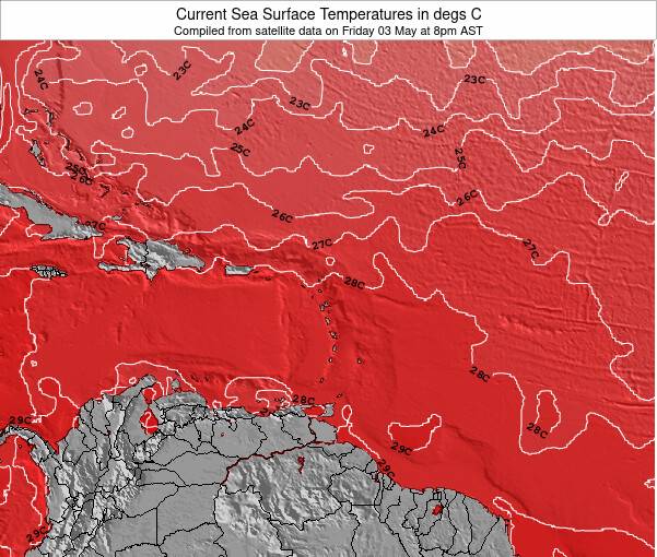
| inconsistent | 28.9°C*ocean temperature recorded from satellite |
Surfing Sprat Bay:
The best conditions reported for surf at Sprat Bay occur when a South swell combines with an offshore wind direction from the North-northwest.
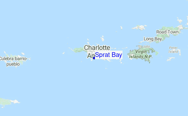
Explore Sprat Bay Location Map
Interactive Sprat Bay surf break location map. View information about nearby surf breaks, their wave consistency and rating compared to other spots in the region. Current swell conditions from local buoys are shown along with live wind speed and direction from nearby weather stations. Click icons on the map for more detail.
- Map Icons:
 Break
Break Live Wave Height (m)
 Live Wind Speed (km/h)
 Surf Rating (10 Max)
 Ocean Swells (m)
- Wind Speed (km/h)
Monday, 3 August 2026, 14:24 Local Time
| Monday 03 | ||||
| 11AM | 2PM | 5PM | 8PM | |
| Wave (m) | ||||
| Period (s) | - | - | 6 | 6 |
| Wind (km/h) | ||||
| Wind State | cross- on |
cross | cross | cross |
Tides at Sprat Bay
| NEXT | IS AT (local time) | remaining |
|---|---|---|
| high tide | ||
| low tide |
Swell History at Sprat Bay
Surf stats for Sprat Bay, see the swell variation by month or season on the history page here.


Wind History at Sprat Bay
Wind stats for Sprat Bay, see the variation in direction and stength by month or season on the history page here.

Other Nearby Breaks Closest To:
Discover surf breaks near Sprat Bay. Click below to view there surf guides.
 Nearest