

Surf Forecasts:

Praia do Norte surf forecast from 3 Aug 2026:
- Best quality surf: Tuesday 4 Aug, 4AM (local time) - 3.5ft (1.0m), 9s period, W swell with glassy winds.
- Most powerful swell: Thursday 6 Aug, 4AM (local time) - 5.5ft (1.7m), 10s period, NNW swell with 495 kJ wave energy.
- Next surfable swell (1★+): Tuesday 4 Aug, 4AM (local time) - 3.5ft (1.0m), 9s period with W swell.
Best Forecast Surf Conditions for Praia do Norte this week:
The surf forecast for Praia do Norte over the next 16 days: The first swell (rated 1 star or higher) is forecast to arrive on Tuesday (Aug 04) at 4AM. The primary swell is predicted to be 1.0m and 9s period with a secondary swell of 0.2m and 8s. The wind is predicted to be glassy as the swell arrives.
The most powerful waves expected at Praia do Norte in the next 16 days are 1.7m 10s and forecast to arrive on Thursday (Aug 06) at 4AM. Winds are predicted to be cross-shore at the time the swell arrives. The largest open ocean swell (not directed at the beach) is 0.1m 12s period and expected on Thursday (Aug 06) at 1PM.
| Wave Type | Time (WEST) & Date | Wave Height & Period |
|---|---|---|
| Next good surf (1 star+) | 4AM (Tue 4th Aug) | 3.5ft (1.0m) 9s |
| Best Surf | 4AM (Tue 4th Aug) | 3.5ft (1.0m) 9s |
| Most Powerful | 4AM (Thu 6th Aug) | 5.5ft (1.7m) 10s |
Table - best surf conditions forecast for Praia do Norte over the next 16 days.
The Lowdown
Alright folks, Rusty here. Gotta be straight with you – it’s a tough stretch ahead for Praia do Norte. The whole 16-day window is looking pretty grim, with no real standouts to get excited about. The wind is just not playing ball, and it's either cross or cross-onshore for most of the run, which is gonna leave things choppy and messy.
Right from the start on Sunday, August 2nd, we’ve got a weak 2ft W swell wrapping in with a 10-second period. The combined energy is only 120, which is weak, and with a cross-on NW breeze at 9 mph, it’s just not worth paddling out. The water’s sitting at 68°, which is about average for this time of year, but that’s the only thing that’s normal.
We slide through Monday and Tuesday with tiny, poor-quality 2ft to 3ft swells, and the wind stays on it or cross-shore. The energy picks up a bit by Thursday the 6th, with a 5ft NNW swell and a moderate 469 energy reading, but it’s straight up ruined by a fresh N cross-breeze at 19 mph. Friday the 7th and Saturday the 8th are the same story – chest-high lumps but with that nasty cross-chop.
The pattern doesn’t let up. We go through the whole first week and into the second with the same story: moderate-sized swell (5ft to 6ft) but always with that cross or cross-on wind. The period stays short, mostly 7 to 9 seconds, so there’s no real power or shape to the waves. It’s just wind-affected junk.
The only thing that might make you look twice is the morning of Saturday the 15th. We’ve got a 7ft NNW swell with an 8-second period, and a solid 547 energy reading. The wind finally swings onshore from the WSW at 9 mph, but it’s still only a marginal call. It’s not proper, and it’s definitely not for beginners – that’s big, lumpy, and likely closing out.
Then Monday the 17th morning, the pulse gets bigger: 10ft to 12ft NNW swell with a 9-second period, and the energy goes through the roof at 1337 to 1648. That’s a serious amount of water moving. But the wind is still a factor, going from cross to cross-on. That’s expert-only territory, and even then, with the short period and onshore wind, it’s going to be a messy, dangerous beast. This is more of a kite-surfing show than a paddle-surfing session.
Sorry, crew. This is one of those blank runs where the forecast just isn’t giving us anything clean. Don’t hold your breath.
Rusty.
Short Range ForecastMostly dry. Warm (max 23°C on Tue morning, min 19°C on Sun night). Winds increasing (calm on Mon night, fresh winds from the NNW by Wed afternoon). | Days 4-6 Weather SummaryMostly dry. Warm (max 22°C on Sat afternoon, min 18°C on Wed night). Mainly fresh winds. | ||||||||||||||||||||
Monday 3 | Tuesday 4 | Wednesday 5 | Thursday 6 | Friday 7 | Saturday 8 | Sunday 9 | |||||||||||||||
AM | PM | Night | AM | PM | Night | AM | PM | Night | AM | PM | Night | AM | PM | Night | AM | PM | Night | AM | PM | Night | |
Swell Height Map |  |  | 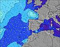 | 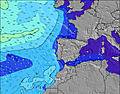 | 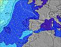 | 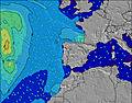 | 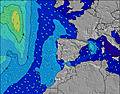 | ||||||||||||||
Wave Height (m) Direction Period (s) | W 9 | W 9 | W 9 | WNW 9 | WNW 8 | WNW 8 | NNW 9 | NNW 11 | NNW 10 | NNW 9 | NNW 9 | NNW 7 | NNW 8 | NNW 10 | NNW 10 | NNW 9 | NNW 9 | N 8 | W 7 | W 7 | W 7 |
Wave Graph | |||||||||||||||||||||
60 | 162 | 158 | 129 | 118 | 90 | 75 | 143 | 482 | 464 | 405 | 249 | 310 | 407 | 295 | 132 | 79 | 32 | 47 | 35 | 35 | |
Wind (km/h) | |||||||||||||||||||||
Wind State on-shore cross-onshore cross-shore cross-offshore off-shore glassy | cross-on | on | cross-on | cross-on | cross-on | cross-on | cross | cross | cross | cross | cross | cross | cross | cross-on | cross | cross | cross-on | cross | cross | cross-on | cross |
High Tide | 6:15AM2.58m | 6:29PM2.74m | 6:54AM2.52m | 7:11PM2.61m | 7:40AM2.43m | 8:02PM2.45m | 8:38AM2.33m | 9:08PM2.30m | 9:51AM2.28m | 10:33PM2.23m | 11:16AM2.33m | 00:00AM2.29m | 12:33PM2.50m | 1:13AM2.45m | |||||||
Low Tide | 12:13PM0.42m | 00:43AM0.38m | 12:54PM0.52m | 1:25AM0.50m | 1:43PM0.64m | 2:17AM0.64m | 2:47PM0.76m | 3:24AM0.77m | 4:09PM0.82m | 4:48AM0.82m | 5:40PM0.74m | 6:12AM0.73m | 6:58PM0.54m | ||||||||
6:39 | — | — | 6:39 | — | — | 6:41 | — | — | 6:41 | — | — | 6:43 | — | — | 6:43 | — | — | 6:45 | — | — | |
— | 8:46 | — | — | 8:45 | — | — | 8:45 | — | — | 8:44 | — | — | 8:43 | — | — | 8:42 | — | — | 8:39 | — | |
mm | — | — | — | — | — | — | — | — | — | — | — | — | — | — | — | — | — | — | — | — | — |
Temp °C | 22 | 22 | 21 | 23 | 23 | 21 | 20 | 20 | 18 | 21 | 21 | 18 | 21 | 21 | 19 | 21 | 22 | 19 | 21 | 21 | 19 |
Feels °C | 22 | 22 | 23 | 23 | 23 | 22 | 19 | 17 | 14 | 18 | 18 | 14 | 19 | 18 | 17 | 19 | 20 | 18 | 20 | 19 | 18 |
Swell 1 Height (m) Direction Period (s) | W 9 | W 9 | W 9 | WNW 9 | WNW 8 | WNW 8 | WNW 8 | NNW 11 | W 10 | W 10 | W 10 | WNW 10 | WNW 9 | WNW 9 | NNW 10 | NNW 9 | NNW 9 | N 8 | W 7 | W 7 | W 7 |
60 | 162 | 158 | 129 | 118 | 90 | 63 | 143 | 52 | 49 | 48 | 30 | 28 | 28 | 295 | 132 | 79 | 32 | 47 | 35 | 35 | |
Swell 2 Height (m) Direction Period (s) | NNW 7 | NNW 7 | N 8 | NNW 8 | NNW 11 | NNW 11 | NNW 9 | W 7 | W 7 | W 7 | S 12 | S 13 | S 13 | S 12 | WNW 9 | WNW 9 | WNW 9 | WNW 8 | NW 10 | NW 10 | NW 9 |
11 | 5 | 5 | 6 | 13 | 64 | 75 | 39 | 23 | 8 | 3 | 3 | 3 | 3 | 26 | 26 | 26 | 22 | 25 | 24 | 19 | |
Swell 3 Height (m) Direction Period (s) | NNW 5 | — | SW 13 | S 13 | N 10 | SW 12 | WNW 10 | WNW 10 | SW 14 | SW 12 | — | — | — | — | S 12 | S 12 | S 12 | NNW 10 | N 7 | N 7 | N 6 |
2 | — | 7 | 3 | 2 | 6 | 34 | 35 | 8 | 5 | — | — | — | — | 3 | 3 | 3 | 11 | 9 | 4 | 1 | |
Wind waves Height (m) Direction Period (s) | — | — | — | — | — | — | — | NNW 4 | NNW 10 | NNW 9 | NNW 9 | NNW 7 | NNW 8 | NNW 10 | — | — | — | — | — | WNW 2 | — |
— | — | — | — | — | — | — | 7 | 482 | 464 | 405 | 249 | 310 | 407 | — | — | — | — | — | 1 | — | |
Nearest Offshore or Glassy | |||||||||||||||||||||
Distance (km) | 30 | 145 | 406 | 30 | 40 | 219 | 30 | 30 | 402 | 128 | 235 | 470 | 266 | 266 | 495 | 141 | 141 | 497 | 141 | 141 | 550 |
Best forecast wave conditions in Ericeira | |||||||||||||||||||||
Best forecast wave conditions in Portugal | |||||||||||||||||||||
Header Global | |||||||||||||||||||||
- Map Icons:
 Break
Break Live Wave Height (m)
 Live Wind Speed (km/h)
 Surf Rating (10 Max)
 Ocean Swells (m)
- Wind Speed (km/h)
Latest Updates


FREE! Surf-Forecast.com widget for your website
The surf report / weather widget below is available to embed on third party websites free of charge and provides a summary of our Praia do Norte surf forecast. Simply grab the html code snippet that we provide and paste it into your own site. You can choose your preferred language and metric/imperial units for the surf forecast feed to suit users of your site. Click here to get the code.
Information about the Praia do Norte Surf forecast
The above surf forecast table for Praia do Norte provides essential information for determining whether the surfing conditions will be good over the next 16 days. A general guide to surfing at Praia do Norte can be found by selecting the local surf guide option on the grey menu. Our Praia do Norte surf forecast is unique since it includes wave energy (power) that defines the real feel of the surf rather than just the height or the period. If you surf the same spot (Praia do Norte) regularly then make a mental note of the wave energy from the surf forecast table each time you go. Very soon you may start to choose your surf days based on the wave energy alone combined with our forecast of favourable offshore wind conditions. Our star ratings will help here and of course you will also find the usual wave height and period predictions on our surf forecasts as well as a full break down of the swell components under our advanced users option (to reveal that, click the little Einstein character under the tide times).
Further information to help with frequently asked questions about our surf forecast for Praia do Norte may be found under the help tab on the top menu and also by moving your mouse over the question marks on the surf forecast table itself. Please always bear in mind that the forecast is for near-shore open water and local factors at each surf break influence the actual breaking wave height, such as the beach / reef profile, water depths offshore and shelter.
Praia do Norte is 19 km (12 miles) from Sintra. If you plan a holiday in Ericeira, look for hotels and other accommodation in Sintra. Sintra has rooms for a wide range of budgets as well as car hire and transport links.
 Nearest