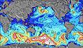
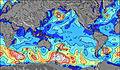
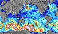
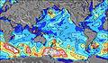
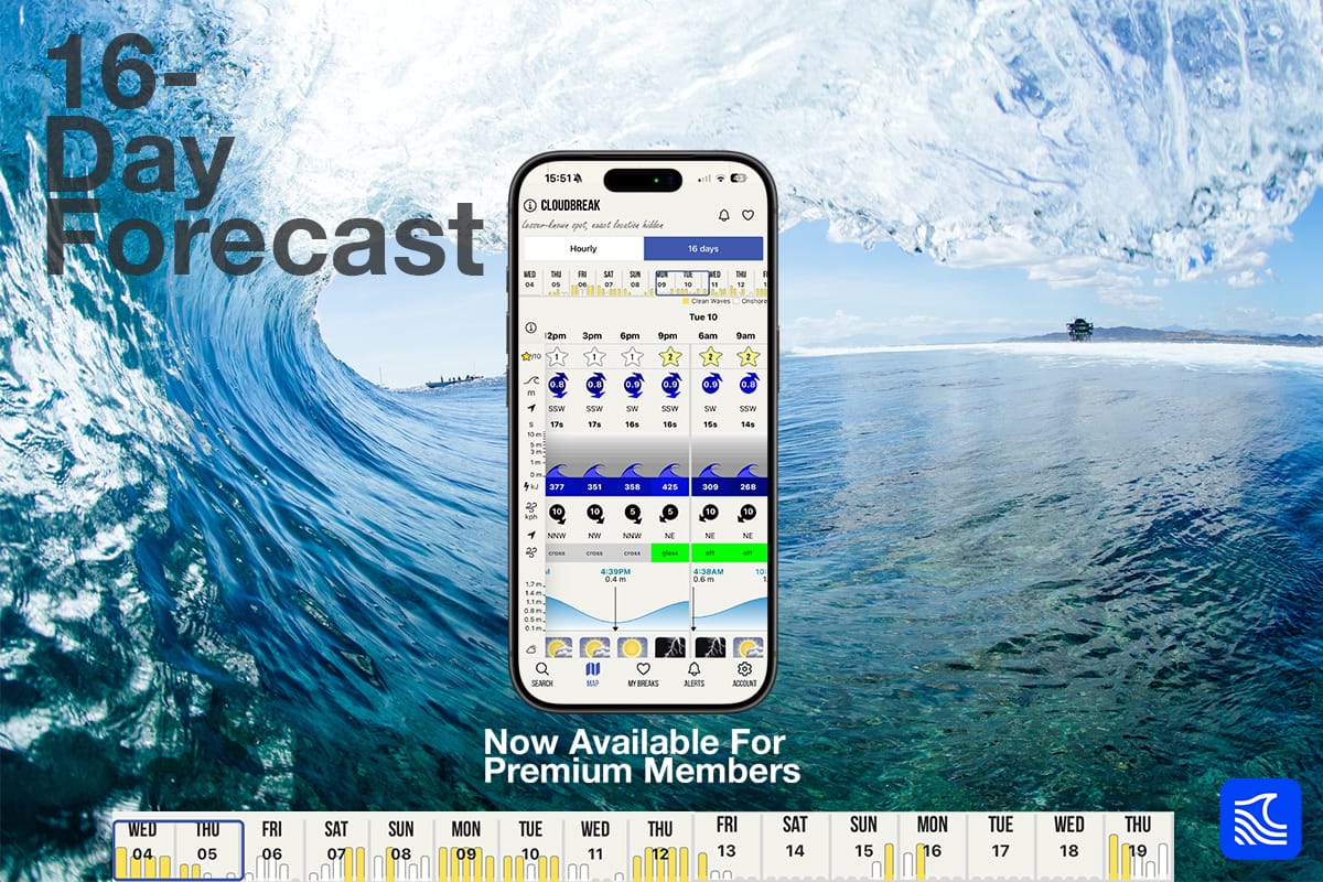
Surf Forecast Surf Report
  • Country flag icon
  • Country flag icon
  • Country flag icon
  • Country flag icon
  • Country flag icon
  • Country flag icon
app storeplay store
Tahai surf break
Reef
Tahai location map

Tahai surf Forecast / Easter Island / Chile

48hr Weather and Surf, issued 11 am Thursday 25 Apr 2024 -06
Forecast update in  hr  min  s Update imminent
Tahai surf forecast is for near shore open water. Breaking waves will often be smaller at less exposed spots.
Today's Tahai sea temperature is 23.5°C (Statistics for 25 Apr 1981-2005 - mean: 23.7 °C max: 24.7 °C min: 22.2 °C)
  • Map Icons:
  • Break
  • Live Wave Height (m)
  • Live Wind Speed (km/h)
  • Surf Rating (10 Max)
  • Ocean Swells (m)
  • Wind Speed (km/h)
<span class="translation_missing" title="translation missing: en.leaflet.map_placeholder_alt">Map Placeholder Alt</span>
Tahai surf forecast is for near shore open water. Breaking waves will often be smaller at less exposed spots.
Today's Tahai sea temperature is 23.5°C (Statistics for 25 Apr 1981-2005 - mean: 23.7 °C max: 24.7 °C min: 22.2 °C)


How big are the waves at Tahai today?

The current surf forecast for Tahai at 2PM is: 0.3m 12s primary swell from a Northwest direction (forecast issued at 11:00am April 25). An open ocean swell of 1.3m 13s is not directed at the surf break, a second open ocean swell of 0.9m 11s is not directed at the surf break, a second open ocean swell of 0.9m 12s is not directed at the surf break. The wind direction is predicted to be offshore.

Time (-06) & DateWave HeightWave Period
Morning (25 Apr)1ft (0.3m)12s
Afternoon (25 Apr)4.5ft (1.3m)13s
Evening (25 Apr)4.5ft (1.3m)13s

Table - waves today at Tahai. (Swell directed towards the surf break)

Updates in  hr  min  s Update imminent
Thursday
25
Friday
26
Saturday
27
Sunday
28
Monday
29
Tuesday
30
Wednesday
01
Thursday
02
9AM12PM3PM6PM9PM0AM3AM6AM9AM12PM3PM6PM9PM0AM3AM6AM9AM12PM3PM6PM9PM0AM3AM6AM9AM12PM3PM6PM9PM0AM3AM6AM9AM12PM3PM6PM9PM0AM3AM6AM9AM12PM3PM6PM9PM0AM3AM6AM9AM12PM3PM6PM9PM0AM3AM6AM9AM12PM3PM6PM
Rating
(10 max)
0
0
0
0
0
0
0
0
0
0
0
0
0
0
0
0
0
0
0
0
0
0
0
0
0
0
0
0
0
0
0
0
0
Swell
Height Map
Wave Height (m) & direction (?)
0.3
NW
0.3
NW
1.3
SW
1.3
SW
1.3
SW
1.3
SW
1.3
SW
1.2
SW
1.2
SW
1.1
SW
1.1
SW
1.1
SW
1
SW
0.9
SW
0.1
SW
0.1
NW
0.3
SW
1.1
SW
0.4
SW
0.4
SW
0.1
NW
0.5
SW
0.5
SW
0.5
SW
0.5
SW
0.8
SW
0.6
SW
0.6
SW
0.6
SW
0.8
SW
0.8
SW
0.8
SW
0.9
SW
0.9
SW
0.8
SW
0.8
SW
0.9
SW
0.9
SW
1.1
SW
1.1
SW
1.1
SW
1
SW
1
SW
1
SW
1
SW
0.9
SW
0.9
SW
0.9
SW
0.9
SW
0.7
SW
0.9
SW
0.8
SW
0.8
SW
0.6
SW
0.6
SW
0.8
SW
0.6
SW
0.7
SW
0.7
SW
1.1
SW
Period(s) (?)121213131314141414141414131320111814181716161616161515151515151514141716161616151414141414131313131314141313131313131315
Wave
Graph
(?)Metric surfscale
Energy (?)232356056057759562156555749240440435228615551011110710127127127127262183188178262258255301272350314421416611565499387387382377295282277277158297241212140142215138168168572
Wind
(km/h)
20
SE
20
ESE
20
ESE
25
ESE
30
ESE
30
ESE
25
ESE
25
SE
30
SE
30
SE
35
ESE
45
ESE
40
ESE
35
ESE
35
SE
35
SE
35
SE
30
SE
35
ESE
40
ESE
45
ESE
40
ESE
40
ESE
50
ESE
50
ESE
50
ESE
45
SE
50
SE
45
ESE
40
ESE
35
ESE
40
ESE
40
ESE
45
ESE
40
ESE
45
ESE
45
E
40
ESE
40
ESE
40
ESE
40
E
35
E
35
E
40
ESE
40
E
35
E
35
E
30
E
35
E
35
E
30
E
30
E
35
E
35
ENE
35
E
30
ENE
35
ENE
40
ENE
40
ENE
35
ENE
Wind State (?)
onshore
cross-onshore
cross-shore
cross-offshore
offshore
glassy
offoffoffoffoffoffoffoffoffoffoffoffoffoffoffoffoffoffoffoffoffoffoffoffoffoffoffoffoffoffcross-
off
offcross-
off
cross-
off
cross-
off
cross-
off
cross-
off
cross-
off
cross-
off
cross-
off
cross-
off
cross-
off
cross-
off
cross-
off
cross-
off
cross-
off
cross-
off
cross-
off
cross-
off
cross-
off
cross-
off
cross-
off
cross-
off
cross-
off
cross-
off
cross-
off
cross-
off
cross-
off
cross-
off
cross-
off
High Tide
/ height (m)
6:10AM
0.72
6:37PM
0.58
6:54AM
0.70
7:25PM
0.54
7:43AM
0.69
8:21PM
0.52
8:41AM
0.67
9:24PM
0.51
9:45AM
0.66
10:32PM
0.53
10:52AM
0.67
11:38PM
0.58
11:58AM
0.70
12:38AM
0.64
12:59PM
0.74
Low Tide
/ height (m)
12:20PM
0.27
12:13AM
0.32
1:07PM
0.29
12:58AM
0.35
2:03PM
0.30
1:56AM
0.37
3:08PM
0.31
3:07AM
0.38
4:16PM
0.29
4:23AM
0.36
5:20PM
0.26
5:33AM
0.31
6:17PM
0.21
6:36AM
0.24
Thursday
25
Friday
26
Saturday
27
Sunday
28
Monday
29
Tuesday
30
Wednesday
01
Thursday
02
Sunrise7:39-------7:39-------7:41-------7:41-------7:41-------7:41-------7:43-------7:43---
Sunset---6:50-------6:49-------6:47-------6:47-------6:46-------6:45-------6:45-------6:44
part cloudrain showersclearclearpart cloudcloudcloudcloudcloudpart cloudcloudcloudcloudpart cloudclearpart cloudthunderstorm clearthunderstorm thunderstorm thunderstorm thunderstorm thunderstorm thunderstorm thunderstorm thunderstorm rain showersrain showersthunderstorm thunderstorm rain showersrain showerslight rainrain showersrain showersrain showersrain showersclearpart cloudpart cloudpart cloudcloudcloudpart cloudclearclearpart cloudpart cloudcloudpart cloudpart cloudpart cloudcloudcloudclearrain showersrain showersrain showerspart cloudpart cloud
Rain (mm)
-1--------------1-1221133211111111111------------------111--
Temp. °C192020202121202020202019191919201920202021212020202021212121212121212121212121212121212121212121212122222122212121212122
Feels °C (?)171717171717161616151512121313141316151414151412121215141516161515151615151516151516171616161616161618181618171817151617

FREE! Surf-Forecast.com widget for your website

The surf report / weather widget below is available to embed on third party websites free of charge and provides a summary of our Tahai surf forecast. Simply grab the html code snippet that we provide and paste it into your own site. You can choose your preferred language and metric/imperial units for the surf forecast feed to suit users of your site. Click here to get the code.


Nearest
Nearest