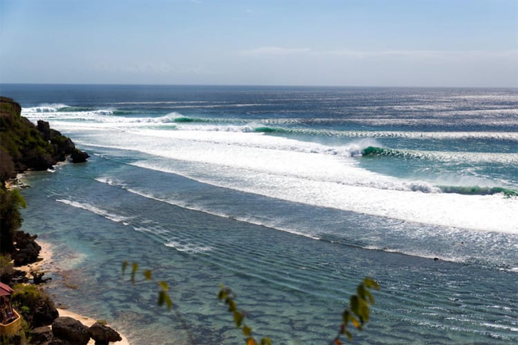
Using Surf-Forecast’s Historical Surf Data To Find The Most Consistent Waves On Earth
Using our statistical data for 7000 spots dating back to 2006, we can find those waves that break the most, with the best winds.
Surf Forecasts:

The surf forecast for Playa Bruja over the next 12 days: The first swell (rated 1 star or higher) is forecast to arrive on Sunday (Dec 28) at 5AM. The primary swell is predicted to be 0.3m and 15s period with a secondary swell of 0.3m and 5s. Another secondary swell of 0.3m and 12s is also forecast. The wind is predicted to be cross-offshore as the swell arrives.
The most powerful waves expected at Playa Bruja in the next 12 days are 1.1m 6s and forecast to arrive on Saturday (Jan 03) at 2AM. Winds are predicted to be cross-offshore at the time the swell arrives.
| Wave Type | Time (MST) & Date | Wave Height & Period |
|---|---|---|
| Next good surf (1 star+) | 5AM (Sun 28th Dec) | 1ft (0.3m) 15s |
| Best Surf | 5AM (Sun 28th Dec) | 1ft (0.3m) 15s |
| Most Powerful | 2AM (Sat 3rd Jan) | 3.5ft (1.1m) 6s |
Table - best surf conditions forecast for Playa Bruja over the next 12 days.
Short Range Forecast Mostly dry. Warm (max 26°C on Tue morning, min 21°C on Sat night). Wind will be generally light. | Days 3-6 Weather Summary Mostly dry. Warm (max 24°C on Wed morning, min 20°C on Wed night). Wind will be generally light. | |||||||||||||||||||||
Sunday 28 | Monday 29 | Tuesday 30 | Wednesday 31 | Thursday 01 | Friday 02 | Sat 03 | ||||||||||||||||
| Night | AM | PM | Night | AM | PM | Night | AM | PM | Night | AM | PM | Night | AM | PM | Night | AM | PM | Night | AM | PM | ||
Rating (10 max) | ||||||||||||||||||||||
Swell Height Map |  |  |  |  | 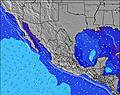 | 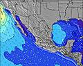 | 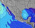 | 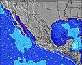 | ||||||||||||||
| Wave Height (m) & direction (?) | ||||||||||||||||||||||
| Period(s) (?) | 15 | 15 | 12 | 11 | 13 | 13 | 13 | 7 | 6 | 7 | 12 | 13 | 11 | 19 | 13 | 4 | 18 | 18 | 6 | 10 | 16 | |
Wave (?)Graph | ||||||||||||||||||||||
| 33 | 33 | 23 | 12 | 28 | 28 | 27 | 17 | 16 | 14 | 23 | 26 | 12 | 59 | 28 | 24 | 49 | 49 | 69 | 19 | 41 | ||
Wind (km/h) | ||||||||||||||||||||||
| Wind State (?) onshore cross-onshore cross-shore cross-offshore offshore glassy | cross- off | cross | cross- on | glass | glass | cross- on | off | glass | cross- on | glass | on | cross- on | cross | cross | cross- on | cross | on | cross- on | cross- off | cross- on | cross- on | |
High Tide / height (m) | 2:52AM 1.42 | 4:30PM 1.05 | 3:51AM 1.51 | 6:13PM 1.15 | 4:46AM 1.62 | 7:13PM 1.26 | 5:36AM 1.72 | 8:00PM 1.34 | 6:24AM 1.81 | 8:41PM 1.39 | 7:09AM 1.87 | 9:20PM 1.40 | 7:52AM 1.89 | |||||||||
Low Tide / height (m) | 10:25AM 0.68 | 8:57PM 0.90 | 11:29AM 0.44 | 10:29PM 0.96 | 12:19PM 0.22 | 11:38PM 0.98 | 1:05PM 0.04 | 12:32AM 0.96 | 1:48PM -0.08 | 1:17AM 0.93 | 2:29PM -0.13 | 1:59AM 0.90 | 3:09PM -0.11 | |||||||||
Sunday 28 | Monday 29 | Tuesday 30 | Wednesday 31 | Thursday 01 | Friday 02 | Sat 03 | ||||||||||||||||
| Sunrise | - | 6:46 | - | - | 6:46 | - | - | 6:47 | - | - | 6:47 | - | - | 6:48 | - | - | 6:48 | - | - | 6:48 | - | |
| Sunset | - | - | 5:28 | - | - | 5:29 | - | - | 5:30 | - | - | 5:30 | - | - | 5:30 | - | - | 5:31 | - | - | 5:31 | |
Rain (mm) | - | - | - | - | - | - | - | - | - | - | - | - | - | - | - | - | - | - | - | - | - | |
| Temp. °C | 22 | 24 | 24 | 22 | 23 | 24 | 22 | 26 | 24 | 23 | 24 | 24 | 22 | 24 | 24 | 22 | 24 | 24 | 22 | 23 | 23 | |
| Feels °C (?) | 25 | 26 | 26 | 25 | 25 | 26 | 24 | 29 | 26 | 25 | 26 | 25 | 22 | 23 | 22 | 21 | 24 | 23 | 22 | 23 | 21 | |
Using our statistical data for 7000 spots dating back to 2006, we can find those waves that break the most, with the best winds.
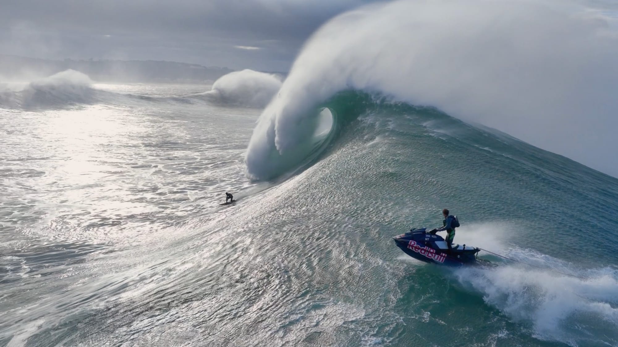
70-foot plus waves predicted for Portuguese big wave tow surfing competition.
Surf-forecast is providing a free, all-access pass to our premium features and 12-day forecasts all weekend.
Previously used in our snow jackets for mountain conditions, PrimaLoft® technology is making its debut in the surf industry. The aim is to bring mountain-grade warmth to the waves.
Discover more articles and updates in the Greenroom.
The surf report / weather widget below is available to embed on third party websites free of charge and provides a summary of our Playa Bruja surf forecast. Simply grab the html code snippet that we provide and paste it into your own site. You can choose your preferred language and metric/imperial units for the surf forecast feed to suit users of your site. Click here to get the code.
The above surf forecast table for Playa Bruja provides essential information for determining whether the surfing conditions will be good over the next 12 days. A general guide to surfing at Playa Bruja can be found by selecting the local surf guide option on the grey menu. Our Playa Bruja surf forecast is unique since it includes wave energy (power) that defines the real feel of the surf rather than just the height or the period. If you surf the same spot (Playa Bruja) regularly then make a mental note of the wave energy from the surf forecast table each time you go. Very soon you may start to choose your surf days based on the wave energy alone combined with our forecast of favourable offshore wind conditions. Our star ratings will help here and of course you will also find the usual wave height and period predictions on our surf forecasts as well as a full break down of the swell components under our advanced users option (to reveal that, click the little Einstein character under the tide times).
Further information to help with frequently asked questions about our surf forecast for Playa Bruja may be found under the help tab on the top menu and also by moving your mouse over the question marks on the surf forecast table itself. Please always bear in mind that the forecast is for near-shore open water and local factors at each surf break influence the actual breaking wave height, such as the beach / reef profile, water depths offshore and shelter.
Are you planning a holiday in Sinaloa? If you are looking for accommodation near Playa Bruja, camping, hotels and holiday cottages in Sinaloa, consider staying in Mazatlan which is 29 km (18 miles) away.
 Nearest