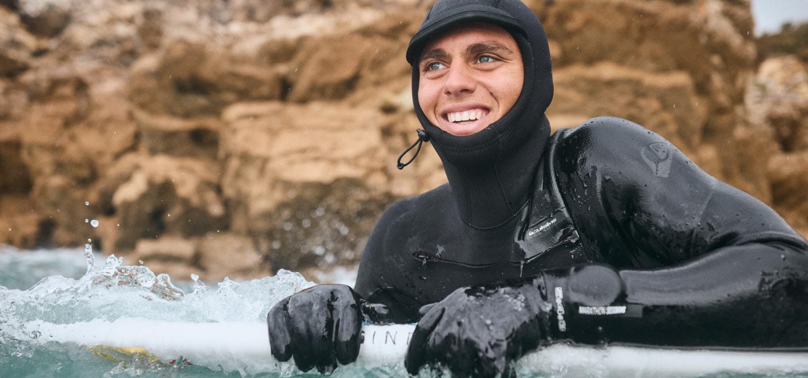
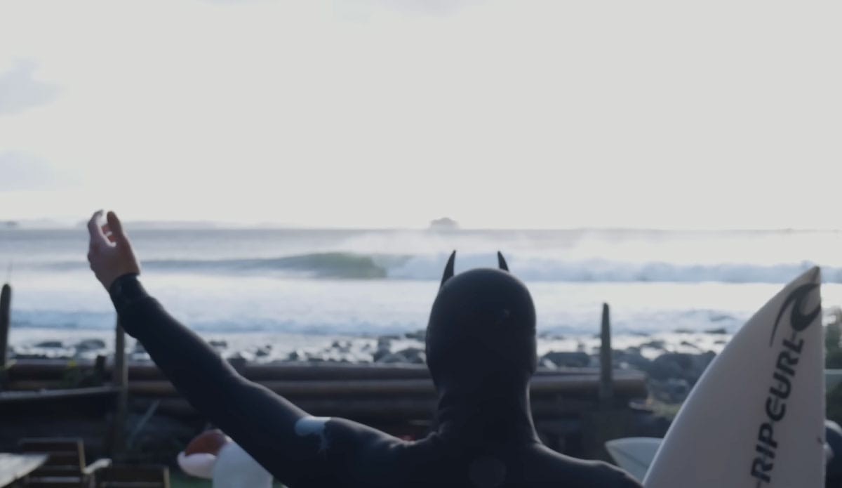
Surf Forecast Surf Report
  • Country flag icon
  • Country flag icon
  • Country flag icon
  • Country flag icon
  • Country flag icon
  • Country flag icon
app storeplay store
Reef
Maria Chiquita location map

Maria Chiquita surf Forecast / Colón / Panama

48hr Weather and Surf, issued 12 pm Wednesday 24 Apr 2024 EST
Forecast update in  hr  min  s Update imminent
Maria Chiquita surf forecast is for near shore open water. Breaking waves will often be smaller at less exposed spots.
Today's Maria Chiquita sea temperature is 29.2°C (Statistics for 24 Apr 1981-2005 - mean: 27.9 °C max: 28.9 °C min: 26.7 °C)
  • Map Icons:
  • Break
  • Live Wave Height (m)
  • Live Wind Speed (km/h)
  • Surf Rating (10 Max)
  • Ocean Swells (m)
  • Wind Speed (km/h)
<span class="translation_missing" title="translation missing: en.leaflet.map_placeholder_alt">Map Placeholder Alt</span>
Maria Chiquita surf forecast is for near shore open water. Breaking waves will often be smaller at less exposed spots.
Today's Maria Chiquita sea temperature is 29.2°C (Statistics for 24 Apr 1981-2005 - mean: 27.9 °C max: 28.9 °C min: 26.7 °C)


How big are the waves at Maria Chiquita today?

The current surf forecast for Maria Chiquita at 3PM is: 1.4m 7s primary swell from a Northeast direction (forecast issued at 12:00pm April 24). The wind direction is predicted to be onshore.

Time (EST) & DateWave HeightWave Period
Morning (24 Apr)4.5ft (1.4m)7s
Afternoon (24 Apr)4.5ft (1.4m)7s
Evening (24 Apr)4.5ft (1.4m)7s

Table - waves today at Maria Chiquita. (Swell directed towards the surf break)

Updates in  hr  min  s Update imminent
Wednesday
24
Thursday
25
Friday
26
Saturday
27
Sunday
28
Monday
29
Tuesday
30
Wednesday
01
10AM1PM4PM7PM10PM1AM4AM7AM10AM1PM4PM7PM10PM1AM4AM7AM10AM1PM4PM7PM10PM1AM4AM7AM10AM1PM4PM7PM10PM1AM4AM7AM10AM1PM4PM7PM10PM1AM4AM7AM10AM1PM4PM7PM10PM1AM4AM7AM10AM1PM4PM7PM10PM1AM4AM7AM10AM1PM4PM7PM
Rating
(10 max)
0
0
0
0
0
0
0
0
0
0
0
0
0
0
0
0
0
0
0
Swell
Height Map
Wave Height (m) & direction (?)
1.4
NE
1.4
NE
1.4
NNE
1.4
NNE
1.4
NNE
1.4
NE
1.4
NE
1.4
NNE
1.4
NNE
1.5
NNE
1.4
NE
1.4
NE
1.4
NE
1.3
NE
1.2
NE
1.2
NE
1.2
NNE
1.3
NNE
1.2
NE
1.2
NE
1.2
NNE
1.1
NE
0.9
NE
0.9
NE
1
NE
0.8
NE
0.8
NE
1
NNE
1
NNE
1.1
NE
1.1
NE
1.1
NE
1.1
NE
1.1
NE
1.1
NE
1
NE
1.1
NE
1
NE
1
NE
1
NE
1
NE
0.8
NE
0.9
NE
0.9
NE
0.9
NE
0.8
NE
0.7
NE
0.9
NE
0.9
NE
0.9
NE
0.8
NE
0.8
NE
0.8
NE
0.8
NE
0.9
NE
0.9
NE
1
NE
1
NE
1
NE
1
NE
Period(s) (?)777777777777888877777777777777777777777777777778877777777777
Wave
Graph
(?)Metric surfscale
Energy (?)1681681751912072232232072022302001882041911821691421731431431311169191104625993931191401221161061069110293991071077382697955509694916562627382841041029996
Wind
(km/h)
20
NNE
20
NNE
20
N
20
N
20
N
20
N
15
N
20
N
15
NNE
15
NNE
15
NNE
10
NE
5
NE
5
N
5
NNW
5
NW
5
WNW
10
NW
10
NE
15
NE
15
ENE
10
ENE
5
NE
10
NE
10
ENE
10
NE
15
NNE
10
NNE
5
NNE
5
WSW
5
W
5
W
5
W
10
NW
5
NW
5
NNE
5
ENE
5
ENE
10
NE
10
ENE
10
NNE
10
NNE
10
NNE
10
NE
5
ENE
5
ENE
5
NE
5
ESE
5
WSW
10
NW
10
NW
10
NNW
5
N
5
NNE
5
E
5
E
5
NNE
10
N
15
N
10
N
Wind State (?)
onshore
cross-onshore
cross-shore
cross-offshore
offshore
glassy
cross-
on
cross-
on
ononononononononcross-
on
cross-
on
glassonglassglasscross-
on
cross-
on
cross-
on
cross-
on
cross-
on
crosscross-
on
cross-
on
crosscross-
on
cross-
on
cross-
on
glassglasscrossglasscrosscross-
on
cross-
on
glassglassglasscross-
on
cross-
on
cross-
on
oncross-
on
cross-
on
crossglasscross-
on
glassglasscross-
on
cross-
on
ononglassglassglassonononon
High Tide
/ height (m)
1:16AM
0.38
1:50AM
0.39
2:25AM
0.40
3:02AM
0.41
3:41AM
0.42
4:21AM
0.43
9:02PM
0.21
5:04AM
0.42
Low Tide
/ height (m)
9:24AM
0.07
9:57AM
0.04
10:30AM
0.01
11:02AM
-0.00
11:35AM
-0.00
12:07PM
0.01
12:38PM
0.02
10:51PM
0.20
1:09PM
0.04
Wednesday
24
Thursday
25
Friday
26
Saturday
27
Sunday
28
Monday
29
Tuesday
30
Wednesday
01
Sunrise-------6:03-------6:03-------6:03-------6:03-------6:03-------6:01-------6:01----
Sunset--6:29-------6:29-------6:30-------6:30-------6:30-------6:30-------6:30-------6:30-
thunderstorm thunderstorm thunderstorm thunderstorm thunderstorm thunderstorm thunderstorm thunderstorm thunderstorm thunderstorm thunderstorm thunderstorm thunderstorm thunderstorm thunderstorm thunderstorm thunderstorm thunderstorm thunderstorm thunderstorm thunderstorm thunderstorm thunderstorm thunderstorm thunderstorm cloudthunderstorm thunderstorm thunderstorm thunderstorm part cloudpart cloudthunderstorm thunderstorm thunderstorm part cloudthunderstorm thunderstorm thunderstorm thunderstorm thunderstorm part cloudthunderstorm thunderstorm thunderstorm part cloudthunderstorm cloudthunderstorm thunderstorm thunderstorm clearclearthunderstorm thunderstorm thunderstorm thunderstorm thunderstorm thunderstorm thunderstorm
Rain (mm)
2111131361135153242224333421-2311--221-23211-121-1-211--1211111
Temp. °C282928272727272727252425252525262727262626252525272827262626262627282827262626262828282726262626282828272726262627282827
Feels °C (?)293029282829292929282629302930313131292929282929303129293030303031323231303030303231313130313031333131313131313131313130

FREE! Surf-Forecast.com widget for your website

The surf report / weather widget below is available to embed on third party websites free of charge and provides a summary of our Maria Chiquita surf forecast. Simply grab the html code snippet that we provide and paste it into your own site. You can choose your preferred language and metric/imperial units for the surf forecast feed to suit users of your site. Click here to get the code.


Nearest
Nearest