Warning: Potential Hurricane Karen Approaching in Atlantic
A rare coastal low in the North Atlantic could turn into Hurricane Karen… and she wants to speak to the manager.
A rare coastal low is expected to develop off the Carolinas on the East Coast of the USA and strengthen this weekend. If the storm develops into a tropical storm, as designated by the National Hurricane Center, it will be named Karen.
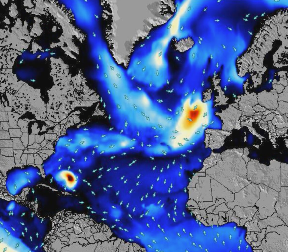
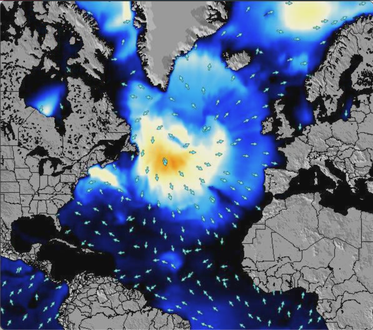
Now we all know that Karen’s can be seen as entitled or excessively demanding. And this coastal low has its own singular issues. The disturbance was formed several hundred miles west-northwest of the Azores, or level with New York, in a zone far outside the typical hurricane breeding grounds further south in the Atlantic, Gulf of Mexico, or Caribbean. Our Wave Energy map tracks it here.
Hurricanes are typically formed during cyclogenesis, when warm sea surface temperatures combine with hot, humid air. This storm, however, is forming in cooler northern waters and under increasing wind shear. This makes its tropical development rare, but not impossible.
In many ways, it resembles the more classic “Nor-easter” storms, the large, intense areas of low pressure that can produce heavy rain, heavy snow, severe coastal flooding or even blizzard conditions in winter along the East Coast of the USA.
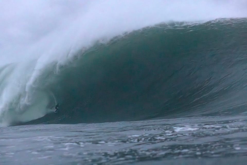
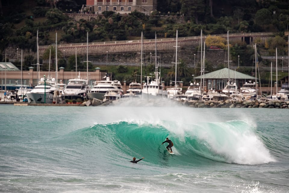
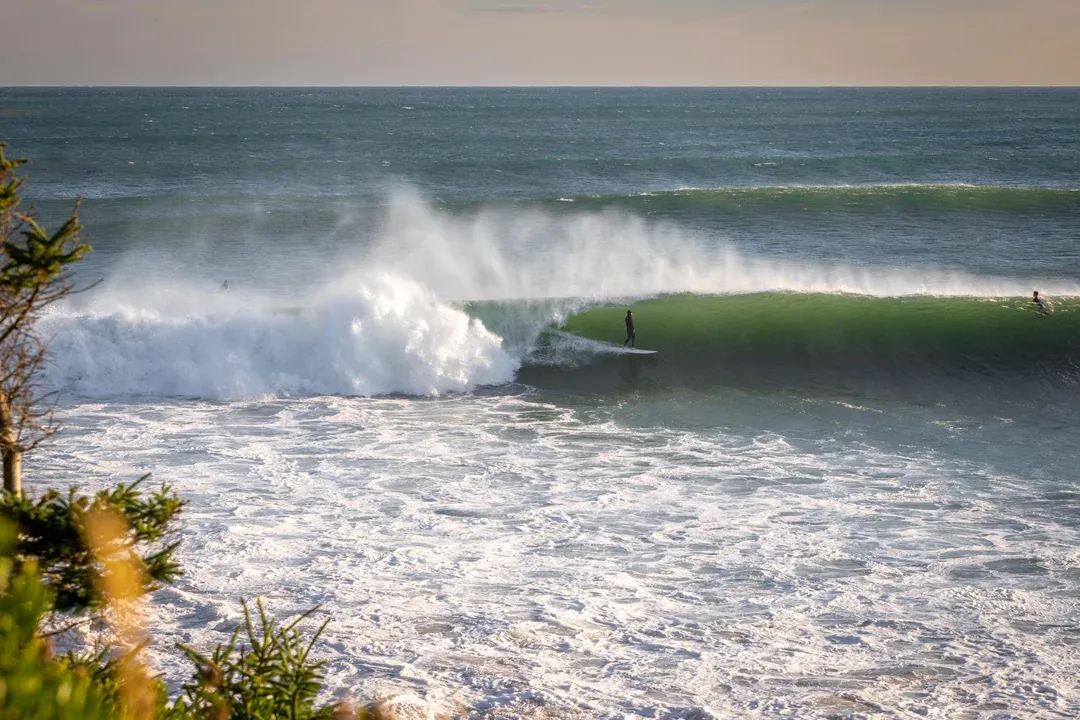
This storm could provide all these types of disruptive and damaging weather patterns, just without the snow, and with added ocean activity. At the moment, it is due to track north and will grow stronger each day, peaking on Monday or Tuesday. Not so good for beachside homeowners on the eastern seaboard, but loads of potential opportunity for surfers.
On the eastern Atlantic, North Carolina and New Jersey will be battered by swell, wind, and rain. Our Long Island, NY forecast has a swell peaking on Monday with a 4 metres, 12-second period, ESE swell, with a massive energy rating of almost 4000KJ, albeit accompanied by 50 km/h winds. Further south on the Outer Banks, Hatteras Lighthouse has a more manageable energy rating of around 1500 and lighter SW winds. The OB crew will be chasing their own sources of gold.
Up north, our friends in Nova Scotia should also cop a winter-like storm, just with tropical water temps of 16 degrees Celsius and a solid 12 hours of daylight to enjoy the swell. The last Hurricane, Erin, absolutely delivered for the hardcore Nova Scotians, and they’ll be licking their chops.
Now, Karen’s are notoriously unpredictable. You never know what will set them off. All this remains hypothetical, but you can follow the storm’s track on all our extensive animated wave, wind, and energy maps that are available for over 7000 surf spots. On the website, simply click on the map below the forecast, and zoom in or out. Over the weekend, we will find out if Karen goes ballistic, and let you know who scored. Let us know how you dealt with the barrage.