

Surf Forecasts:

How big are the waves at Yachats today (09 Jun):
- Morning surf: Morning surf (09 Jun, local time) - 8ft (2.4m), 10s period with W swell.
- Afternoon surf: Afternoon surf (09 Jun, local time) - 7ft (2.2m), 9s period with W swell.
- Evening surf: Evening surf (09 Jun, local time) - 6.5ft (2.0m), 9s period with W swell.
The current surf forecast for Yachats at 3AM is: 2.2m 9s primary swell from a West-southwest direction and 1.4m 9s secondary swell from a West-northwest direction, 0.6m 14s secondary swell from a Southwest direction (forecast issued at 10:00pm June 08). The wind direction is predicted to be onshore.
| Time (PDT) & Date | Wave Height | Wave Period |
|---|---|---|
| Morning (09 Jun) | 8ft (2.4m) | 10s |
| Afternoon (09 Jun) | 7ft (2.2m) | 9s |
| Evening (09 Jun) | 6.5ft (2.0m) | 9s |
Table - waves today at Yachats. (Swell directed towards the surf break)
Updates in hr min s Forecast update imminent
Short Range ForecastLight rain (total 4mm), mostly falling on Mon night. Very mild (max 16°C on Thu morning, min 9°C on Wed night). Winds decreasing (fresh winds from the SW on Mon night, calm by Tue night). | ||||||||||||||||||||||||
Mon 8 | Tuesday 9 | Wednesday 10 | Thursday 11 | |||||||||||||||||||||
8 PM | 11 PM | 2 AM | 5 AM | 8 AM | 11 AM | 2 PM | 5 PM | 8 PM | 11 PM | 2 AM | 5 AM | 8 AM | 11 AM | 2 PM | 5 PM | 8 PM | 11 PM | 2 AM | 5 AM | 8 AM | 11 AM | 2 PM | 5 PM | |
Swell Height Map |  |  | 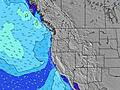 |  |  | 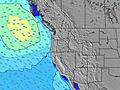 |  | 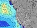 | 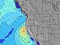 | |||||||||||||||
Wave Height (m) Direction Period (s) | SW 8 | WSW 8 | WSW 9 | WSW 9 | W 10 | W 9 | W 9 | W 9 | W 9 | W 9 | W 9 | W 9 | W 10 | W 10 | WNW 10 | WNW 9 | WNW 9 | WNW 10 | WNW 10 | WNW 10 | WNW 10 | WNW 10 | W 10 | W 10 |
Wave Graph | ||||||||||||||||||||||||
946 | 864 | 749 | 919 | 1057 | 1021 | 847 | 715 | 664 | 606 | 577 | 516 | 527 | 469 | 481 | 433 | 433 | 411 | 419 | 370 | 378 | 346 | 194 | 161 | |
Wind (km/h) | ||||||||||||||||||||||||
Wind State on-shore cross-onshore cross-shore cross-offshore off-shore glassy | cross-on | on | cross-on | cross-on | cross-on | cross-on | cross-on | on | on | cross-on | on | glassy | glassy | cross-on | cross-on | cross | cross | cross-off | cross-off | cross-off | cross-off | cross | cross | cross |
High Tide | 7:17AM2.30m | 7:54PM2.98m | 8:40AM2.31m | 8:36PM3.13m | 9:55AM2.39m | |||||||||||||||||||
Low Tide | 1:43AM1.39m | 1:10PM1.20m | 2:42AM1.08m | 2:04PM1.35m | 3:37AM0.74m | 3:01PM1.48m | ||||||||||||||||||
— | — | — | 5:31 | — | — | — | — | — | — | — | 5:31 | — | — | — | — | — | — | — | 5:31 | — | — | — | — | |
8:58 | — | — | — | — | — | — | — | 8:59 | — | — | — | — | — | — | — | 8:59 | — | — | — | — | — | — | 9:00 | |
mm | 1 | — | — | 1 | — | 1 | 1 | — | — | — | — | — | — | — | — | — | — | — | — | — | — | — | — | — |
Temp °C | 13 | 13 | 12 | 12 | 12 | 13 | 14 | 14 | 13 | 12 | 12 | 12 | 13 | 14 | 15 | 14 | 13 | 10 | 9 | 9 | 12 | 16 | 16 | 15 |
Feels °C | 8 | 9 | 8 | 8 | 9 | 10 | 10 | 11 | 10 | 10 | 11 | 11 | 12 | 12 | 11 | 10 | 9 | 7 | 6 | 6 | 10 | 12 | 11 | 10 |
Swell 1 Height (m) Direction Period (s) | SW 24 | SW 14 | WNW 9 | WSW 9 | W 10 | W 9 | W 9 | W 9 | W 9 | W 9 | W 9 | W 9 | W 10 | W 10 | WNW 10 | WNW 9 | WNW 9 | WNW 10 | WNW 10 | WNW 10 | WNW 10 | WNW 10 | W 10 | W 10 |
141 | 169 | 300 | 919 | 1057 | 1021 | 847 | 715 | 664 | 606 | 577 | 516 | 527 | 469 | 481 | 433 | 433 | 411 | 419 | 370 | 378 | 346 | 194 | 161 | |
Swell 2 Height (m) Direction Period (s) | WNW 16 | SW 24 | SW 14 | NW 9 | NW 9 | SW 14 | SW 14 | SW 14 | SW 14 | SSW 20 | SW 19 | SW 19 | SSW 19 | SSW 19 | SSW 18 | SSW 18 | SSW 18 | SW 18 | SSW 18 | SSW 18 | SW 17 | SSW 16 | SSW 16 | SW 16 |
25 | 87 | 167 | 396 | 287 | 127 | 127 | 125 | 123 | 253 | 303 | 303 | 251 | 243 | 214 | 209 | 207 | 249 | 207 | 207 | 148 | 181 | 173 | 125 | |
Swell 3 Height (m) Direction Period (s) | SW 20 | WNW 16 | SW 23 | SW 14 | SW 14 | SW 21 | SW 21 | SW 21 | SW 20 | SW 14 | SW 13 | SW 13 | SW 13 | SW 13 | SW 13 | SW 13 | SW 13 | SW 13 | SW 13 | SW 13 | SW 13 | WNW 13 | WNW 13 | WNW 13 |
15 | 25 | 85 | 167 | 164 | 224 | 224 | 220 | 188 | 91 | 88 | 87 | 85 | 61 | 61 | 61 | 61 | 43 | 44 | 44 | 27 | 34 | 34 | 34 | |
Wind waves Height (m) Direction Period (s) | SW 8 | WSW 8 | WSW 9 | — | — | — | — | — | — | — | — | — | — | — | — | — | — | — | — | — | — | — | NNW 5 | NNW 5 |
946 | 864 | 749 | — | — | — | — | — | — | — | — | — | — | — | — | — | — | — | — | — | — | — | 56 | 77 | |
Nearest Offshore or Glassy | ||||||||||||||||||||||||
Distance (km) | 289 | 333 | 266 | 223 | 223 | 223 | 836 | 836 | 433 | 106 | 106 | 106 | 106 | 722 | 735 | 836 | 735 | 48 | 48 | 48 | 48 | 292 | 757 | 477 |
Best forecast wave conditions in South Oregon | ||||||||||||||||||||||||
Best forecast wave conditions in United States | ||||||||||||||||||||||||
Header Global | ||||||||||||||||||||||||
- Map Icons:
 Break
Break Live Wave Height (m)
 Live Wind Speed (km/h)
 Surf Rating (10 Max)
 Ocean Swells (m)
- Wind Speed (km/h)


FREE! Surf-Forecast.com widget for your website
The surf report / weather widget below is available to embed on third party websites free of charge and provides a summary of our Yachats surf forecast. Simply grab the html code snippet that we provide and paste it into your own site. You can choose your preferred language and metric/imperial units for the surf forecast feed to suit users of your site. Click here to get the code.
 Nearest