

Whitecliff Bay Surf Guide
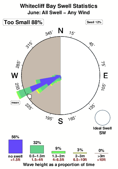
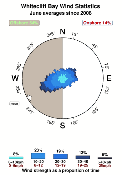
Whitecliff Bay in Isle of Wight is a reasonably exposed beach break that only works once in a while. Winter is the optimum time of year for surfing here. The best wind direction is from the west. Usually gets local windswells, but groundswells do happen and the best wave direction is from the southwest. Waves at the beach break both left and right. Best around low tide.
Whitecliff Bay Spot Info
| Type: | Rating: | Reliability: | Todays Sea Temp*: |
|---|---|---|---|
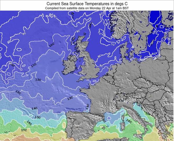
| inconsistent | 15.4°C*ocean temperature recorded from satellite |
Surfing Whitecliff Bay:
The best conditions reported for surf at Whitecliff Bay occur when a Southwest swell combines with an offshore wind direction from the West.
What's the best time of year to surf Whitecliff Bay (for consistent clean waves)?
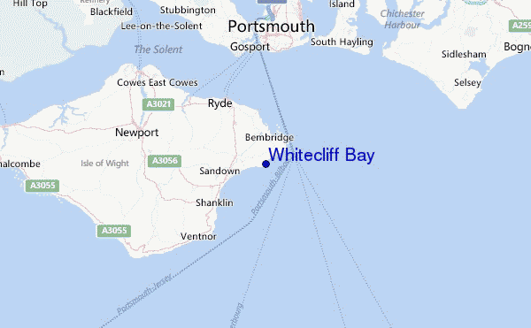
Explore Whitecliff Bay Location Map
Interactive Whitecliff Bay surf break location map. View information about nearby surf breaks, their wave consistency and rating compared to other spots in the region. Current swell conditions from local buoys are shown along with live wind speed and direction from nearby weather stations. Click icons on the map for more detail. The closest passenger airport to Whitecliff Bay is Southampton Airport (SOU) in England, 36 km (22 miles) away (directly). The second nearest airport to Whitecliff Bay is Bournemouth Airport (BOH), also in England, 54 km (34 miles) away.
- Map Icons:
 Break
Break Live Wave Height (m)
 Live Wind Speed (km/h)
 Surf Rating (10 Max)
 Ocean Swells (m)
- Wind Speed (km/h)
Tuesday, 9 June 2026, 12:16 Local Time
| Tuesday 09 | ||||
| 10AM | 1PM | 4PM | 7PM | |
| Wave (m) | ||||
| Period (s) | 6 | 6 | 6 | 7 |
| Wind (km/h) | ||||
| Wind State | off | off | cross- off |
off |
Tides at Whitecliff Bay
| NEXT | IS AT (local time) | remaining |
|---|---|---|
| high tide | ||
| low tide |
Swell History at Whitecliff Bay
Surf stats for Whitecliff Bay, see the swell variation by month or season on the history page here.

Wind History at Whitecliff Bay
Wind stats for Whitecliff Bay, see the variation in direction and stength by month or season on the history page here.
Other Nearby Breaks Closest To:
Discover surf breaks near Whitecliff Bay. Click below to view there surf guides.
 Nearest