

Surf Forecasts:

How big are the waves at Walkerville today (09 Jun):
- Morning surf: Morning surf (09 Jun, local time) - 0.5ft (0.1m), 9s period with E swell.
- Afternoon surf: Afternoon surf (09 Jun, local time) - 0.5ft (0.2m), 6s period with E swell.
- Evening surf: Evening surf (09 Jun, local time) - 1.5ft (0.4m), 3s period with ENE swell.
The current surf forecast for Walkerville at 3PM is: 0.2m 6s primary swell from a East direction (forecast issued at 09:00am June 09). An open ocean swell of 1.1m 14s is not directed at the surf break, a second open ocean swell of 0.4m 19s is not directed at the surf break. The wind direction is predicted to be cross-offshore.
| Time (AEST) & Date | Wave Height | Wave Period |
|---|---|---|
| Morning (09 Jun) | 0.5ft (0.1m) | 9s |
| Afternoon (09 Jun) | 0.5ft (0.2m) | 6s |
| Evening (09 Jun) | 1.5ft (0.4m) | 3s |
Table - waves today at Walkerville. (Swell directed towards the surf break)
Updates in hr min s Forecast update imminent
Short Range ForecastLight rain (total 3mm), mostly falling on Wed afternoon. Very mild (max 19°C on Tue afternoon, min 13°C on Wed night). Winds decreasing (fresh winds from the NNW on Wed morning, light winds from the WNW by Wed night). | ||||||||||||||||||||||||
Tuesday 9 | Wednesday 10 | Thursday 11 | Fri 12 | |||||||||||||||||||||
7 AM | 10 AM | 1 PM | 4 PM | 7 PM | 10 PM | 1 AM | 4 AM | 7 AM | 10 AM | 1 PM | 4 PM | 7 PM | 10 PM | 1 AM | 4 AM | 7 AM | 10 AM | 1 PM | 4 PM | 7 PM | 10 PM | 1 AM | 4 AM | |
Swell Height Map |  |  |  | 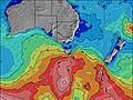 |  |  | 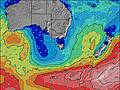 |  |  | |||||||||||||||
Wave Height (m) Direction Period (s) | E 9 | E 9 | E 6 | ENE 4 | E 4 | ENE 3 | ENE 3 | E 4 | E 5 | E 6 | ESE 6 | ESE 6 | ESE 6 | ESE 6 | E 6 | E 7 | E 7 | E 7 | ENE 7 | ENE 7 | ENE 3 | E 4 | E 4 | E 4 |
Wave Graph | ||||||||||||||||||||||||
2 | 1 | 2 | 5 | 4 | 3 | 3 | 3 | 4 | 11 | 8 | 8 | 4 | 4 | 7 | 4 | 9 | 9 | 9 | 9 | 5 | 2 | 3 | 3 | |
Wind (km/h) | ||||||||||||||||||||||||
Wind State on-shore cross-onshore cross-shore cross-offshore off-shore glassy | cross | cross-off | cross-off | cross | cross | cross-off | cross-off | cross-off | cross-off | off | off | off | cross-off | cross-off | cross-off | off | cross-off | cross-off | cross-on | cross-on | cross-on | cross | cross | cross-off |
High Tide | 5:23AM2.03m | 6:02PM2.36m | 6:09AM2.00m | 6:35PM2.31m | 7:00AM1.99m | 7:09PM2.28m | ||||||||||||||||||
Low Tide | 11:25AM0.51m | 00:18AM0.77m | 12:06PM0.66m | 1:01AM0.70m | 12:52PM0.83m | 1:47AM0.62m | ||||||||||||||||||
7:28 | — | — | — | — | — | — | — | 7:30 | — | — | — | — | — | — | — | 7:30 | — | — | — | — | — | — | 7:31 | |
— | — | — | 5:00 | — | — | — | — | — | — | — | 5:00 | — | — | — | — | — | — | — | 5:00 | — | — | — | 5:00 | |
mm | — | — | — | — | — | — | — | — | — | — | — | 1 | 1 | 1 | — | — | — | — | — | — | — | — | — | — |
Temp °C | 14 | 14 | 18 | 19 | 18 | 17 | 15 | 16 | 16 | 16 | 16 | 15 | 15 | 14 | 13 | 13 | 13 | 13 | 14 | 14 | 14 | 14 | 15 | 16 |
Feels °C | 10 | 10 | 14 | 16 | 14 | 13 | 11 | 11 | 12 | 10 | 11 | 12 | 13 | 13 | 12 | 12 | 12 | 12 | 12 | 12 | 12 | 12 | 13 | 13 |
Swell 1 Height (m) Direction Period (s) | WSW 14 | WSW 14 | WSW 14 | WSW 14 | WSW 14 | WSW 17 | WSW 16 | WSW 16 | WSW 15 | WSW 14 | WSW 14 | WSW 14 | W 13 | WSW 13 | WSW 14 | WSW 17 | WSW 16 | WSW 16 | WSW 16 | WSW 15 | WSW 15 | WSW 15 | WSW 14 | WSW 14 |
732 | 577 | 480 | 421 | 390 | 364 | 733 | 697 | 627 | 459 | 561 | 801 | 1465 | 1074 | 907 | 2465 | 2719 | 2931 | 2615 | 2150 | 1898 | 1622 | 1415 | 1172 | |
Swell 2 Height (m) Direction Period (s) | — | E 9 | WSW 20 | SW 18 | WSW 18 | WSW 13 | NW 4 | E 4 | E 5 | ESE 6 | ESE 6 | ESE 6 | WSW 18 | WSW 18 | WSW 18 | E 7 | E 7 | E 7 | ENE 7 | — | — | — | E 4 | E 4 |
— | 1 | 38 | 83 | 207 | 231 | 2 | 3 | 4 | 6 | 8 | 8 | 228 | 408 | 603 | 4 | 9 | 9 | 9 | — | — | — | 3 | 3 | |
Swell 3 Height (m) Direction Period (s) | — | — | E 8 | WSW 18 | NW 5 | WNW 4 | NW 4 | — | — | E 6 | — | SW 18 | ESE 6 | ESE 6 | E 6 | — | — | — | — | — | — | — | — | — |
— | — | 1 | 124 | 8 | 2 | 3 | — | — | 11 | — | 85 | 4 | 4 | 7 | — | — | — | — | — | — | — | — | — | |
Wind waves Height (m) Direction Period (s) | E 9 | NE 3 | E 6 | ENE 4 | E 4 | ENE 3 | ENE 3 | NNW 4 | NW 6 | NW 6 | WNW 6 | WNW 6 | W 13 | — | — | — | — | — | — | ENE 7 | ENE 3 | E 4 | NNE 3 | NNW 3 |
2 | 2 | 2 | 5 | 4 | 3 | 3 | 7 | 50 | 62 | 108 | 137 | 1629 | — | — | — | — | — | — | 9 | 5 | 2 | 3 | 6 | |
Nearest Offshore or Glassy | ||||||||||||||||||||||||
Distance (km) | 11 | 11 | 10 | 10 | 11 | 11 | 11 | 11 | 407 | 407 | 62 | 35 | 35 | 35 | 35 | 10 | 10 | 10 | 10 | 11 | 11 | 11 | 10 | 10 |
Best forecast wave conditions in East Coast of Victoria | ||||||||||||||||||||||||
Best forecast wave conditions in Australia | ||||||||||||||||||||||||
Header Global | ||||||||||||||||||||||||
- Map Icons:
 Break
Break Live Wave Height (m)
 Live Wind Speed (km/h)
 Surf Rating (10 Max)
 Ocean Swells (m)
- Wind Speed (km/h)


FREE! Surf-Forecast.com widget for your website
The surf report / weather widget below is available to embed on third party websites free of charge and provides a summary of our Walkerville surf forecast. Simply grab the html code snippet that we provide and paste it into your own site. You can choose your preferred language and metric/imperial units for the surf forecast feed to suit users of your site. Click here to get the code.
 Nearest