

Surf Forecasts:

How big are the waves at The Point_Punaluu today (09 Jun):
- Morning surf: Morning surf (09 Jun, local time) - 4.5ft (1.3m), 8s period with E swell.
- Afternoon surf: Afternoon surf (09 Jun, local time) - 4.5ft (1.4m), 8s period with E swell.
- Evening surf: Evening surf (09 Jun, local time) - 4.5ft (1.3m), 8s period with E swell.
The current surf forecast for The Point_Punaluu at 1AM is: 1.6m 8s primary swell from a East direction and 0.7m 16s secondary swell from a South direction, 0.5m 12s secondary swell from a South direction (forecast issued at 07:00pm June 08). The wind direction is predicted to be cross-shore.
| Time (HST) & Date | Wave Height | Wave Period |
|---|---|---|
| Morning (09 Jun) | 4.5ft (1.3m) | 8s |
| Afternoon (09 Jun) | 4.5ft (1.4m) | 8s |
| Evening (09 Jun) | 4.5ft (1.3m) | 8s |
Table - waves today at The Point_Punaluu. (Swell directed towards the surf break)
Updates in hr min s Forecast update imminent
Short Range ForecastMostly dry. Warm (max 26°C on Tue afternoon, min 24°C on Mon night). Mainly fresh winds. | ||||||||||||||||||||||||
Mon 8 | Tuesday 9 | Wednesday 10 | Thu 11 | |||||||||||||||||||||
5 PM | 8 PM | 11 PM | 2 AM | 5 AM | 8 AM | 11 AM | 2 PM | 5 PM | 8 PM | 11 PM | 2 AM | 5 AM | 8 AM | 11 AM | 2 PM | 5 PM | 8 PM | 11 PM | 2 AM | 5 AM | 8 AM | 11 AM | 2 PM | |
Swell Height Map |  |  |  |  |  |  |  |  | 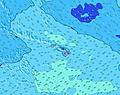 | |||||||||||||||
Wave Height (m) Direction Period (s) | E 6 | S 16 | E 8 | E 8 | E 8 | E 8 | E 8 | E 8 | E 8 | E 8 | E 8 | E 8 | E 8 | E 8 | E 8 | E 8 | E 8 | E 8 | E 8 | E 8 | E 8 | S 18 | S 18 | E 8 |
Wave Graph | ||||||||||||||||||||||||
291 | 334 | 320 | 263 | 235 | 202 | 207 | 246 | 241 | 203 | 202 | 279 | 239 | 167 | 222 | 193 | 164 | 164 | 163 | 163 | 159 | 154 | 154 | 159 | |
Wind (km/h) | ||||||||||||||||||||||||
Wind State on-shore cross-onshore cross-shore cross-offshore off-shore glassy | cross-on | cross-on | cross-on | cross | cross | cross-on | cross-on | cross-on | cross-on | cross | cross | cross | cross | cross | cross-on | cross-on | cross-on | cross-on | cross-on | cross-on | cross-on | cross-on | cross-on | cross-on |
High Tide | 9:42PM0.68m | 11:40AM0.69m | 10:42PM0.62m | 12:33PM0.81m | 11:45PM0.57m | 1:22PM0.92m | ||||||||||||||||||
Low Tide | 4:42AM0.14m | 5:27PM0.39m | 5:24AM0.10m | 6:51PM0.35m | 6:07AM0.06m | |||||||||||||||||||
— | — | — | — | 5:43 | — | — | — | — | — | — | — | 5:43 | — | — | — | — | — | — | — | 5:43 | — | — | — | |
6:58 | — | — | — | — | — | — | — | 6:59 | — | — | — | — | — | — | — | 6:59 | — | — | — | — | — | — | 6:59 | |
mm | — | — | — | — | — | — | — | — | — | — | — | — | — | — | — | — | — | — | — | — | — | — | — | — |
Temp °C | 25 | 25 | 24 | 24 | 24 | 25 | 25 | 26 | 25 | 24 | 24 | 24 | 24 | 24 | 25 | 25 | 24 | 24 | 24 | 24 | 24 | 24 | 25 | 24 |
Feels °C | 22 | 22 | 22 | 22 | 23 | 23 | 22 | 24 | 24 | 23 | 23 | 23 | 23 | 23 | 24 | 24 | 23 | 22 | 22 | 23 | 24 | 24 | 25 | 24 |
Swell 1 Height (m) Direction Period (s) | S 16 | S 16 | S 16 | S 16 | S 16 | S 16 | S 15 | S 15 | S 15 | S 15 | S 15 | E 8 | E 8 | S 14 | S 14 | S 13 | S 13 | S 13 | S 13 | S 13 | S 18 | S 18 | S 18 | S 18 |
267 | 334 | 254 | 254 | 186 | 181 | 161 | 155 | 106 | 106 | 109 | 172 | 172 | 97 | 57 | 56 | 55 | 87 | 85 | 89 | 155 | 154 | 154 | 97 | |
Swell 2 Height (m) Direction Period (s) | S 12 | S 12 | S 12 | S 12 | S 12 | S 11 | S 11 | S 11 | S 11 | S 11 | S 11 | S 15 | S 14 | S 11 | S 10 | S 10 | S 10 | S 10 | S 10 | S 18 | S 13 | S 13 | S 12 | S 12 |
71 | 69 | 69 | 69 | 67 | 63 | 59 | 37 | 58 | 58 | 58 | 104 | 107 | 35 | 34 | 33 | 18 | 18 | 18 | 103 | 54 | 52 | 48 | 47 | |
Swell 3 Height (m) Direction Period (s) | SE 13 | SE 13 | SE 13 | SE 13 | SE 13 | SE 13 | SE 12 | SE 12 | SE 12 | SE 12 | SE 12 | S 11 | S 11 | SE 12 | SE 12 | SE 12 | S 20 | S 20 | S 19 | S 10 | S 10 | S 10 | S 10 | S 10 |
45 | 44 | 44 | 43 | 42 | 41 | 40 | 38 | 37 | 36 | 36 | 36 | 35 | 35 | 22 | 21 | 67 | 67 | 66 | 17 | 17 | 17 | 17 | 17 | |
Wind waves Height (m) Direction Period (s) | E 6 | E 6 | E 8 | E 8 | E 8 | E 8 | E 8 | E 8 | E 8 | E 8 | E 8 | E 8 | E 8 | E 8 | E 8 | E 8 | E 8 | E 8 | E 8 | E 8 | E 8 | E 8 | E 8 | E 8 |
291 | 253 | 320 | 263 | 235 | 202 | 207 | 246 | 241 | 203 | 202 | 279 | 239 | 167 | 222 | 193 | 164 | 164 | 163 | 163 | 159 | 135 | 135 | 159 | |
Nearest Offshore or Glassy | ||||||||||||||||||||||||
Distance (km) | 102 | 102 | 64 | 12 | 12 | 77 | 102 | 102 | 102 | 77 | 12 | 64 | 46 | 99 | 102 | 102 | 102 | 64 | 83 | 83 | 46 | 77 | 12 | 12 |
Best forecast wave conditions in Big Island | ||||||||||||||||||||||||
Best forecast wave conditions in United States | ||||||||||||||||||||||||
Header Global | ||||||||||||||||||||||||
- Map Icons:
 Break
Break Live Wave Height (m)
 Live Wind Speed (km/h)
 Surf Rating (10 Max)
 Ocean Swells (m)
- Wind Speed (km/h)


FREE! Surf-Forecast.com widget for your website
The surf report / weather widget below is available to embed on third party websites free of charge and provides a summary of our The Point_Punaluu surf forecast. Simply grab the html code snippet that we provide and paste it into your own site. You can choose your preferred language and metric/imperial units for the surf forecast feed to suit users of your site. Click here to get the code.
 Nearest