

Surf Forecasts:

How big are the waves at Tafatafa today (09 Jun):
- Morning surf: Morning surf (09 Jun, local time) - 2ft (0.6m), 13s period with SW swell.
- Afternoon surf: Afternoon surf (09 Jun, local time) - 2.5ft (0.7m), 12s period with SW swell.
- Evening surf: Evening surf (09 Jun, local time) - 2.5ft (0.7m), 11s period with SW swell.
The current surf forecast for Tafatafa at 6PM is: 0.7m 12s primary swell from a Southwest direction and 0.5m 4s secondary swell from a South direction (forecast issued at 12:00pm June 09). An open ocean swell of 0.7m 7s is not directed at the surf break. The wind direction is predicted to be onshore.
| Time (+13) & Date | Wave Height | Wave Period |
|---|---|---|
| Morning (09 Jun) | 2ft (0.6m) | 13s |
| Afternoon (09 Jun) | 2.5ft (0.7m) | 12s |
| Evening (09 Jun) | 2.5ft (0.7m) | 11s |
Table - waves today at Tafatafa. (Swell directed towards the surf break)
Updates in hr min s Forecast update imminent
Short Range ForecastLight rain (total 2mm), mostly falling on Wed night. Warm (max 26°C on Tue morning, min 25°C on Wed night). Winds increasing (light winds from the SSW on Tue morning, strong winds from the SSE by Wed night). | ||||||||||||||||||||||||
Tue 9 | Wednesday 10 | Thursday 11 | Fri 12 | |||||||||||||||||||||
10 AM | 1 PM | 4 PM | 7 PM | 10 PM | 1 AM | 4 AM | 7 AM | 10 AM | 1 PM | 4 PM | 7 PM | 10 PM | 1 AM | 4 AM | 7 AM | 10 AM | 1 PM | 4 PM | 7 PM | 10 PM | 1 AM | 4 AM | 7 AM | |
Swell Height Map |  |  | 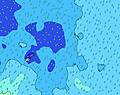 | 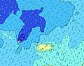 | 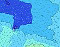 |  | 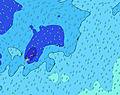 | 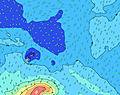 |  | |||||||||||||||
Wave Height (m) Direction Period (s) | SW 13 | SW 12 | SW 12 | SW 12 | SW 11 | SW 21 | SW 21 | SW 20 | SW 20 | SW 19 | SW 19 | SW 18 | SW 18 | SW 18 | SW 17 | SW 17 | S 24 | SSW 23 | SSW 23 | SSW 21 | SSW 21 | SSW 19 | S 19 | S 18 |
Wave Graph | ||||||||||||||||||||||||
103 | 114 | 139 | 134 | 123 | 224 | 222 | 309 | 455 | 450 | 595 | 710 | 808 | 781 | 754 | 918 | 1126 | 1846 | 2772 | 3025 | 3877 | 4088 | 5170 | 6444 | |
Wind (km/h) | ||||||||||||||||||||||||
Wind State on-shore cross-onshore cross-shore cross-offshore off-shore glassy | on | on | on | on | on | on | on | on | on | on | on | cross-on | cross-on | cross-on | cross-on | cross-on | cross-on | cross-on | cross-on | cross-on | cross-on | cross-on | cross-on | cross-on |
High Tide | 1:12PM0.90m | 1:50AM0.95m | 2:07PM0.93m | 2:40AM1.02m | 3:03PM0.96m | 3:32AM1.10m | ||||||||||||||||||
Low Tide | 7:01AM0.32m | 7:25PM0.23m | 7:59AM0.26m | 8:16PM0.20m | 8:56AM0.19m | 9:09PM0.15m | ||||||||||||||||||
6:46 | — | — | — | — | — | 6:46 | — | — | — | — | — | — | — | 6:46 | — | — | — | — | — | — | — | 6:47 | — | |
— | — | 6:05 | — | — | — | — | — | — | — | 6:05 | — | — | — | — | — | — | — | 6:05 | — | — | — | — | 6:05 | |
mm | — | — | — | — | — | — | — | — | — | — | — | — | — | 1 | — | — | — | — | — | — | — | — | — | 1 |
Temp °C | 26 | 26 | 26 | 26 | 26 | 26 | 26 | 26 | 26 | 26 | 26 | 26 | 26 | 26 | 25 | 25 | 25 | 25 | 25 | 25 | 25 | 25 | 26 | 26 |
Feels °C | 28 | 28 | 27 | 27 | 26 | 26 | 26 | 26 | 25 | 25 | 25 | 24 | 23 | 22 | 21 | 21 | 21 | 22 | 21 | 21 | 22 | 22 | 24 | 24 |
Swell 1 Height (m) Direction Period (s) | SE 7 | SE 7 | SE 7 | SW 12 | SW 11 | SW 11 | SW 11 | SW 20 | SW 13 | SW 19 | SW 19 | SW 18 | SW 18 | SW 18 | SW 17 | SW 17 | SW 17 | SSW 23 | SSW 23 | SSW 21 | SSW 21 | SSW 19 | S 19 | S 18 |
65 | 63 | 44 | 134 | 123 | 121 | 72 | 309 | 202 | 450 | 595 | 710 | 808 | 781 | 754 | 918 | 908 | 1846 | 2772 | 3025 | 3877 | 4088 | 5170 | 6444 | |
Swell 2 Height (m) Direction Period (s) | SW 13 | SW 12 | SW 12 | ESE 7 | S 14 | SW 21 | SW 13 | SW 13 | SW 20 | SW 12 | SW 8 | SW 12 | SW 12 | SW 12 | S 26 | SSW 24 | S 24 | SW 16 | SW 16 | SW 16 | SW 16 | SW 16 | SW 17 | SW 17 |
103 | 114 | 139 | 40 | 66 | 224 | 108 | 109 | 455 | 175 | 86 | 90 | 89 | 66 | 337 | 787 | 1126 | 875 | 952 | 834 | 834 | 865 | 918 | 929 | |
Swell 3 Height (m) Direction Period (s) | S 16 | S 16 | S 15 | S 15 | ENE 7 | ENE 7 | SW 21 | SW 11 | ENE 7 | S 13 | SW 12 | S 12 | S 12 | S 12 | SW 11 | S 11 | S 11 | SSE 13 | SSE 14 | SSE 14 | SSE 14 | S 12 | SE 15 | — |
46 | 79 | 72 | 68 | 18 | 18 | 222 | 71 | 16 | 29 | 141 | 46 | 25 | 25 | 46 | 10 | 10 | 18 | 18 | 18 | 20 | 11 | 8 | — | |
Wind waves Height (m) Direction Period (s) | SSW 3 | SSW 4 | SSW 3 | S 4 | SSE 9 | SSE 8 | SE 4 | SE 7 | SE 4 | SE 7 | SE 7 | S 8 | S 7 | SSE 7 | SSE 7 | SSE 8 | SSE 8 | SSE 7 | SSE 7 | SSE 7 | SSE 7 | SE 7 | SE 7 | ESE 7 |
2 | 1 | 4 | 6 | 96 | 72 | 27 | 77 | 26 | 91 | 91 | 248 | 333 | 489 | 579 | 663 | 623 | 588 | 503 | 456 | 428 | 384 | 316 | 229 | |
Nearest Offshore or Glassy | ||||||||||||||||||||||||
Distance (km) | 91 | 91 | 2181 | 118 | 118 | 118 | 2177 | 2177 | 2177 | 872 | 2177 | 2177 | 2177 | 2177 | 1259 | 1259 | 1265 | 1265 | 2177 | 2177 | 2177 | 2177 | 2177 | 1265 |
Best forecast wave conditions in Upolu | ||||||||||||||||||||||||
Best forecast wave conditions in Samoa | ||||||||||||||||||||||||
Header Global | ||||||||||||||||||||||||
- Map Icons:
 Break
Break Live Wave Height (m)
 Live Wind Speed (km/h)
 Surf Rating (10 Max)
 Ocean Swells (m)
- Wind Speed (km/h)


FREE! Surf-Forecast.com widget for your website
The surf report / weather widget below is available to embed on third party websites free of charge and provides a summary of our Tafatafa surf forecast. Simply grab the html code snippet that we provide and paste it into your own site. You can choose your preferred language and metric/imperial units for the surf forecast feed to suit users of your site. Click here to get the code.
 Nearest