
Sunderland Bay Surf Guide
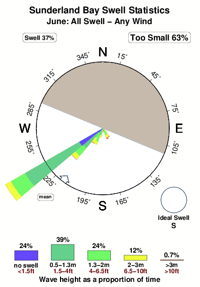
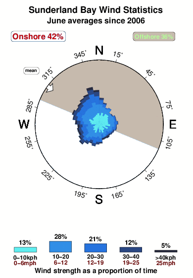
Sunderland Bay in Phillip Island is a reasonably exposed point break that does not work very often. Summer in particular tends to be flat. Offshore winds are from the north northeast. Tends to receive distant groundswells and the best swell direction is from the south.The break here is a left hand point. Best around high tide. When the surf is up, crowds are likely Beware of sharks ,rocks,penguins.
Sunderland Bay Spot Info
| Type: | Rating: | Reliability: | Todays Sea Temp*: |
|---|---|---|---|
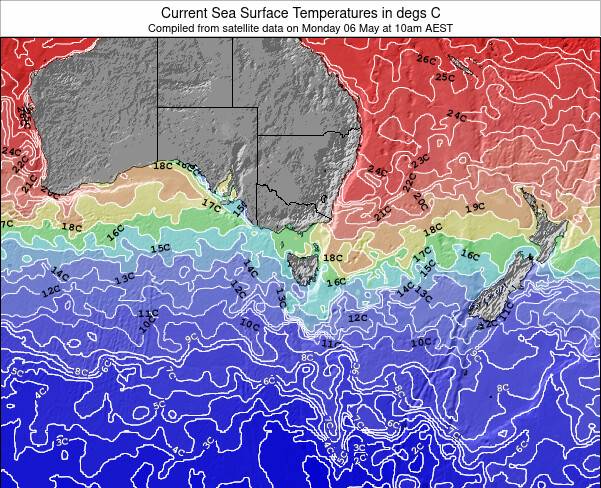
| inconsistent | 15.2°C*ocean temperature recorded from satellite |
Surfing Sunderland Bay:
The best conditions reported for surf at Sunderland Bay occur when a South swell combines with an offshore wind direction from the North-northeast.
What's the best time of year to surf Sunderland Bay (for consistent clean waves)?
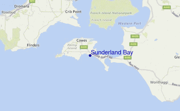
Explore Sunderland Bay Location Map
Interactive Sunderland Bay surf break location map. View information about nearby surf breaks, their wave consistency and rating compared to other spots in the region. Current swell conditions from local buoys are shown along with live wind speed and direction from nearby weather stations. Click icons on the map for more detail. The closest passenger airport to Sunderland Bay is Melbourne Moorabbin Airport (MBW) in Australia, 61 km (38 miles) away (directly). The second nearest airport to Sunderland Bay is Avalon Airport (AVV), also in Australia, 88 km (55 miles) away.
- Map Icons:
 Break
Break Live Wave Height (m)
 Live Wind Speed (km/h)
 Surf Rating (10 Max)
 Ocean Swells (m)
- Wind Speed (km/h)
Tuesday, 9 June 2026, 21:57 Local Time
| Tue | Wed | |||
| 7PM | 10PM | 1AM | 4AM | |
| Wave (m) | ||||
| Period (s) | 14 | 16 | 16 | 16 |
| Wind (km/h) | ||||
| Wind State | off | off | cross- off |
off |
Tides at Sunderland Bay
| NEXT | IS AT (local time) | remaining |
|---|---|---|
| high tide | ||
| low tide |
Swell History at Sunderland Bay
Surf stats for Sunderland Bay, see the swell variation by month or season on the history page here.

Wind History at Sunderland Bay
Wind stats for Sunderland Bay, see the variation in direction and stength by month or season on the history page here.
Sunderland Bay Reviews:
Interactive Porthcawl Point location map. View nearby buoy information, live wind conditions and surrounding roads, paths and locations to help find new breaks. Click the buoys or wind icon to view more information.
- Overall:
 3.0
3.0 - Quality on a good day:3.0
- Consistency of Surf:
 2.0
2.0 - Difficulty Level:3.0
- Crowds:2.0
Other Nearby Breaks Closest To:
Discover surf breaks near Sunderland Bay. Click below to view there surf guides.
- Surfies Point
 Point
Point- 3.0
Reliability: fairly consistent0km away - Express Point
- Point
- 3.0
Reliability: consistent1km away - Surf Beach
 Beach
Beach- 3.0
Reliability: fairly consistent1km away - Smiths Beach
- Beach and point
- 2.0
Reliability: inconsistent2km away - Forrest Caves (Phillip Island)
- Beach and reef
Reliability: fairly consistent3km away
 Nearest