Sceale Bay Surf Guide
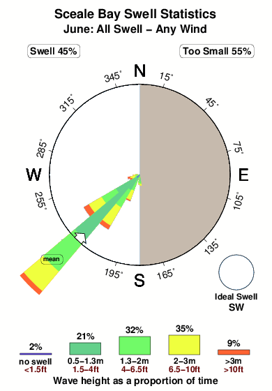
Sceale Bay on the West Coast is a sheltered beach and reef break that usually has waves. Winter is the best time of year for surfing here. Offshore winds blow from the east. Most of the surf here comes from groundswells and the best swell direction is from the southwest. The beach breaks offer lefts and rights and there is a left hand reef break as well.. Best around mid tide. It very rarely gets crowded here. Watch out for rips, sharks and isolation.
Sceale Bay Spot Info
| Type: | Rating: | Reliability: | Todays Sea Temp*: |
|---|---|---|---|
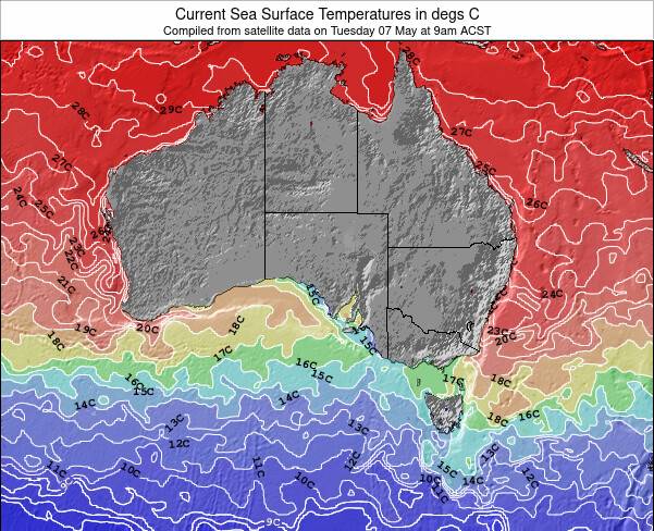
| consistent | 17.2°C*ocean temperature recorded from satellite |
Surfing Sceale Bay:
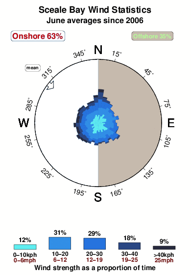
The best conditions reported for surf at Sceale Bay occur when a Southwest swell combines with an offshore wind direction from the East.
What's the best time of year to surf Sceale Bay (for consistent clean waves)?
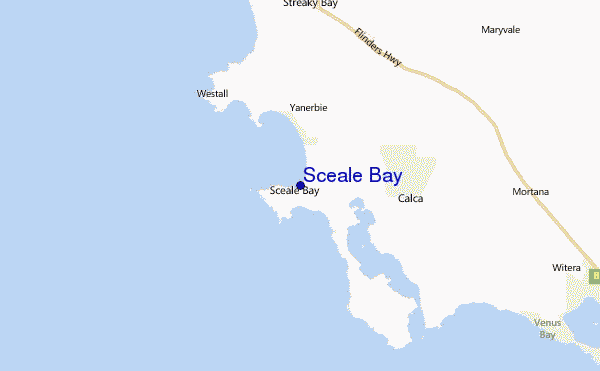
Explore Sceale Bay Location Map
Interactive Sceale Bay surf break location map. View information about nearby surf breaks, their wave consistency and rating compared to other spots in the region. Current swell conditions from local buoys are shown along with live wind speed and direction from nearby weather stations. Click icons on the map for more detail. The nearest passenger airport to Sceale Bay is Woomera Airport (UMR) in Australia, which is 323 km (201 miles) away (directly). The second closest airport to Sceale Bay is Adelaide International Airport (ADL), also in Australia, 454 km (282 miles) away.
- Map Icons:
 Break
Break Live Wave Height (m)
 Live Wind Speed (km/h)
 Surf Rating (10 Max)
 Ocean Swells (m)
- Wind Speed (km/h)
Wednesday, 10 June 2026, 04:42 Local Time
| Wednesday 10 | ||||
| 0:30AM | 3:30AM | 6:30AM | 9:30AM | |
| Wave (m) | ||||
| Period (s) | 15 | 15 | 14 | 14 |
| Wind (km/h) | ||||
| Wind State | cross- on |
on | on | cross- on |
Tides at Sceale Bay
| NEXT | IS AT (local time) | remaining |
|---|---|---|
| high tide | ||
| low tide |
Swell History at Sceale Bay
Surf stats for Sceale Bay, see the swell variation by month or season on the history page here.

Wind History at Sceale Bay
Wind stats for Sceale Bay, see the variation in direction and stength by month or season on the history page here.
Other Nearby Breaks Closest To:
Discover surf breaks near Sceale Bay. Click below to view there surf guides.
 Nearest