

- Forecast
- Maps
- Live
- Weather State
- Spot Information


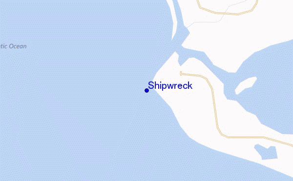
Shipwreck surf Forecast / Liberia / Liberia
- Map Icons:
 Break
Break Live Wave Height (m)
 Live Wind Speed (km/h)
 Surf Rating (10 Max)
 Ocean Swells (m)
- Wind Speed (km/h)
How big are the waves at Shipwreck today?
The current surf forecast for Shipwreck at 12AM is: 0.7m 16s primary swell from a South-southwest direction and 0.7m 10s secondary swell from a South direction, 0.6m 7s secondary swell from a South direction (forecast issued at 05:00pm April 19). The wind direction is predicted to be onshore.
| Time (GMT) & Date | Wave Height | Wave Period |
|---|---|---|
| Morning (20 Apr) | - | - |
| Afternoon (20 Apr) | 1.5ft (0.5m) | 16s |
| Evening (20 Apr) | 2.5ft (0.7m) | 16s |
Table - waves today at Shipwreck. (Swell directed towards the surf break)
Friday 19 | Saturday 20 | Sunday 21 | Monday 22 | Tuesday 23 | Wednesday 24 | Thursday 25 | Friday 26 | Sat 27 | ||||||||||||||||||||||||||||||||||||||||||||||||||||
| 3 PM | 6 PM | 9 PM | 0 AM | 3 AM | 6 AM | 9 AM | 12 PM | 3 PM | 6 PM | 9 PM | 0 AM | 3 AM | 6 AM | 9 AM | 12 PM | 3 PM | 6 PM | 9 PM | 0 AM | 3 AM | 6 AM | 9 AM | 12 PM | 3 PM | 6 PM | 9 PM | 0 AM | 3 AM | 6 AM | 9 AM | 12 PM | 3 PM | 6 PM | 9 PM | 0 AM | 3 AM | 6 AM | 9 AM | 12 PM | 3 PM | 6 PM | 9 PM | 0 AM | 3 AM | 6 AM | 9 AM | 12 PM | 3 PM | 6 PM | 9 PM | 0 AM | 3 AM | 6 AM | 9 AM | 12 PM | 3 PM | 6 PM | 9 PM | 0 AM | |
Rating (10 max) | ||||||||||||||||||||||||||||||||||||||||||||||||||||||||||||
Swell Height Map | 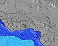 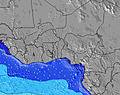 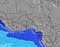 | 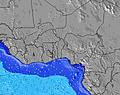 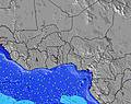 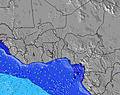 | 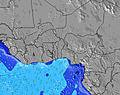 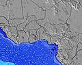 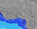 | 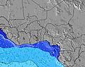 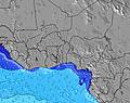 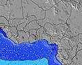 | 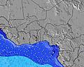 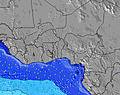 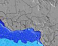 | 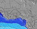 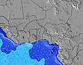  | 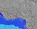 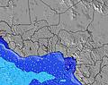 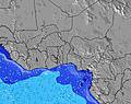 | 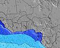 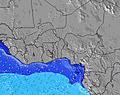 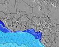 | 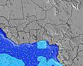 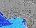 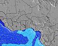 | |||||||||||||||||||||||||||||||||||||||||||||||||||
| Wave Height (m) & direction (?) | ||||||||||||||||||||||||||||||||||||||||||||||||||||||||||||
| Period(s) (?) | 16 | 16 | 16 | 16 | 16 | 15 | 15 | 15 | 14 | 14 | 14 | 14 | 14 | 13 | 13 | 13 | 13 | 13 | 13 | 13 | 13 | 13 | 13 | 13 | 13 | 13 | 13 | 13 | 13 | 13 | 13 | 13 | 13 | 13 | 13 | 12 | 12 | 12 | 12 | 12 | 12 | 12 | 12 | 15 | 15 | 15 | 14 | 14 | 14 | 14 | 12 | 13 | 13 | 11 | 11 | 11 | 13 | 10 | 10 | 10 |
Wave (?)Graph | ||||||||||||||||||||||||||||||||||||||||||||||||||||||||||||
| Energy (?) | 155 | 203 | 229 | 226 | 280 | 249 | 309 | 485 | 478 | 508 | 459 | 433 | 415 | 408 | 427 | 427 | 421 | 491 | 491 | 499 | 499 | 499 | 461 | 461 | 499 | 437 | 454 | 418 | 440 | 522 | 424 | 418 | 418 | 411 | 405 | 398 | 392 | 323 | 313 | 308 | 303 | 232 | 289 | 236 | 223 | 272 | 264 | 264 | 261 | 253 | 276 | 282 | 431 | 184 | 184 | 178 | 151 | 146 | 116 | 116 |
Wind (km/h) | ||||||||||||||||||||||||||||||||||||||||||||||||||||||||||||
| Wind State (?) onshore cross-onshore cross-shore cross-offshore offshore glassy | cross- on | cross- on | cross- on | on | on | cross- on | cross- on | on | on | cross- on | cross- on | cross- on | cross- on | cross | cross | cross- on | cross- on | cross- on | cross- on | cross- on | cross- on | cross- on | cross- on | cross- on | cross- on | cross- on | on | cross- on | cross- on | cross | cross- off | cross- on | cross- on | on | cross- on | cross- on | cross- on | cross | cross- off | cross | cross- on | cross- on | on | on | cross- on | cross | cross- off | cross- on | cross- on | cross- on | on | on | on | cross | cross- off | cross- on | cross- on | cross- on | cross- on | cross- on |
High Tide / height (m) | 4:32PM 1.15 | 4:59AM 1.03 | 5:05PM 1.20 | 5:33AM 1.10 | 5:36PM 1.23 | 6:04AM 1.16 | 6:05PM 1.24 | 6:35AM 1.20 | 6:34PM 1.23 | 7:06AM 1.22 | 7:04PM 1.20 | 7:37AM 1.21 | 7:33PM 1.15 | 8:09AM 1.19 | 8:04PM 1.10 | |||||||||||||||||||||||||||||||||||||||||||||
Low Tide / height (m) | 10:55PM 0.32 | 10:46AM 0.36 | 11:23PM 0.26 | 11:21AM 0.32 | 11:50PM 0.20 | 11:54AM 0.28 | 12:17AM 0.15 | 12:27PM 0.26 | 12:45AM 0.12 | 1:00PM 0.25 | 1:14AM 0.10 | 1:33PM 0.25 | 1:44AM 0.11 | 2:08PM 0.28 | ||||||||||||||||||||||||||||||||||||||||||||||
Friday 19 | Saturday 20 | Sunday 21 | Monday 22 | Tuesday 23 | Wednesday 24 | Thursday 25 | Friday 26 | Sat 27 | ||||||||||||||||||||||||||||||||||||||||||||||||||||
| Sunrise | - | - | - | - | - | - | 6:35 | - | - | - | - | - | - | - | 6:33 | - | - | - | - | - | - | - | 6:33 | - | - | - | - | - | - | - | 6:33 | - | - | - | - | - | - | - | 6:33 | - | - | - | - | - | - | - | 6:33 | - | - | - | - | - | - | - | 6:33 | - | - | - | - | - |
| Sunset | - | 6:52 | - | - | - | - | - | - | - | 6:52 | - | - | - | - | - | - | - | 6:52 | - | - | - | - | - | - | - | 6:52 | - | - | - | - | - | - | - | 6:52 | - | - | - | - | - | - | - | 6:52 | - | - | - | - | - | - | - | 6:52 | - | - | - | - | - | - | - | 6:52 | - | - |
Rain (mm) | 1 | 1 | - | - | 1 | - | - | 1 | - | 1 | 2 | 1 | 1 | 2 | 1 | - | - | - | - | - | 2 | - | - | - | 1 | - | 1 | 3 | - | - | - | - | - | - | - | - | - | - | 2 | 4 | - | 1 | - | - | - | 1 | 1 | 1 | 1 | - | - | - | - | 1 | 1 | - | 1 | - | - | - |
| Temp. °C | 30 | 30 | 29 | 29 | 28 | 28 | 29 | 29 | 29 | 29 | 28 | 28 | 28 | 27 | 27 | 28 | 29 | 28 | 28 | 28 | 27 | 27 | 28 | 28 | 28 | 28 | 28 | 28 | 27 | 27 | 26 | 28 | 28 | 28 | 28 | 28 | 27 | 27 | 26 | 26 | 27 | 28 | 28 | 28 | 28 | 27 | 27 | 28 | 28 | 28 | 28 | 28 | 27 | 27 | 26 | 28 | 27 | 27 | 27 | 27 |
| Feels °C (?) | 35 | 33 | 32 | 33 | 32 | 32 | 33 | 33 | 32 | 32 | 31 | 31 | 31 | 30 | 31 | 31 | 32 | 30 | 31 | 32 | 30 | 30 | 32 | 31 | 31 | 31 | 31 | 32 | 30 | 31 | 29 | 31 | 30 | 30 | 31 | 31 | 30 | 30 | 28 | 29 | 28 | 29 | 31 | 31 | 31 | 29 | 29 | 31 | 29 | 29 | 30 | 30 | 30 | 30 | 28 | 31 | 28 | 28 | 29 | 29 |
FREE! Surf-Forecast.com widget for your website
The surf report / weather widget below is available to embed on third party websites free of charge and provides a summary of our Shipwreck surf forecast. Simply grab the html code snippet that we provide and paste it into your own site. You can choose your preferred language and metric/imperial units for the surf forecast feed to suit users of your site. Click here to get the code.


 Nearest