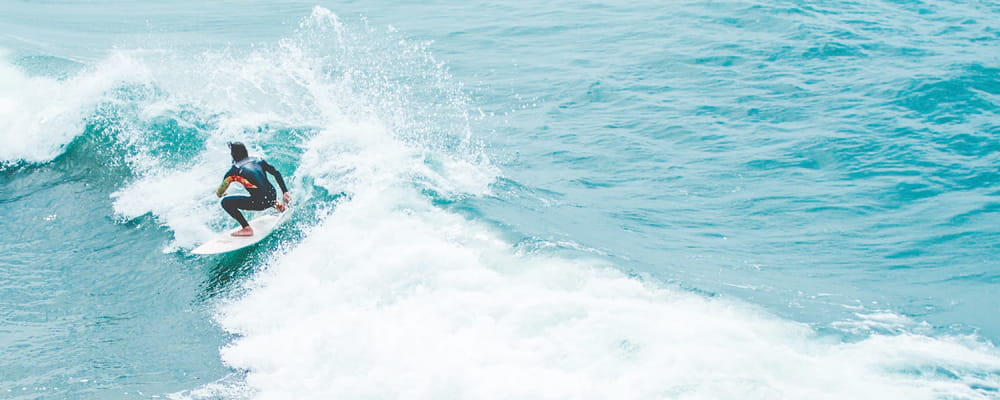

Surf Forecasts:

How big are the waves at Punihos today (09 Jun):
- Morning surf: Morning surf (09 Jun, local time) - 8ft (2.5m), 16s period with WSW swell.
- Afternoon surf: Afternoon surf (09 Jun, local time) - 7.5ft (2.3m), 16s period with WSW swell.
- Evening surf: Evening surf (09 Jun, local time) - 7ft (2.2m), 16s period with WSW swell.
The current surf forecast for Punihos at 6PM is: 2.2m 16s primary swell from a West-southwest direction and 2.5m 12s secondary swell from a West-southwest direction (forecast issued at 11:00am June 09). The wind direction is predicted to be offshore and the swell rating is 5.
| Time (NZST) & Date | Wave Height | Wave Period |
|---|---|---|
| Morning (09 Jun) | 8ft (2.5m) | 16s |
| Afternoon (09 Jun) | 7.5ft (2.3m) | 16s |
| Evening (09 Jun) | 7ft (2.2m) | 16s |
Table - waves today at Punihos. (Swell directed towards the surf break)
Updates in hr min s Forecast update imminent
Short Range ForecastMostly dry. Very mild (max 14°C on Tue morning, min 9°C on Tue night). Wind will be generally light. | ||||||||||||||||||||||||
Tue 9 | Wednesday 10 | Thursday 11 | Fri 12 | |||||||||||||||||||||
9 AM | 12 PM | 3 PM | 6 PM | 9 PM | 12 AM | 3 AM | 6 AM | 9 AM | 12 PM | 3 PM | 6 PM | 9 PM | 12 AM | 3 AM | 6 AM | 9 AM | 12 PM | 3 PM | 6 PM | 9 PM | 12 AM | 3 AM | 6 AM | |
Swell Height Map |  |  |  |  |  |  |  |  |  | |||||||||||||||
Wave Height (m) Direction Period (s) | WSW 16 | WSW 16 | WSW 16 | WSW 16 | WSW 16 | WSW 16 | WSW 16 | WSW 15 | WSW 15 | WSW 15 | WSW 15 | WSW 14 | WSW 14 | WSW 14 | WSW 14 | WSW 14 | WSW 14 | WSW 14 | WSW 13 | WSW 16 | WSW 16 | WSW 15 | WSW 15 | WSW 14 |
Wave Graph | ||||||||||||||||||||||||
3222 | 8132 | 2750 | 2414 | 2414 | 2354 | 2266 | 3438 | 3034 | 2754 | 2261 | 2033 | 1772 | 1601 | 1265 | 1247 | 915 | 902 | 756 | 1586 | 1728 | 1344 | 1145 | 996 | |
Wind (km/h) | ||||||||||||||||||||||||
Wind State on-shore cross-onshore cross-shore cross-offshore off-shore glassy | cross-off | cross-off | cross-off | off | off | off | off | off | off | glassy | cross-off | cross-off | off | cross-off | off | glassy | glassy | glassy | cross-on | cross | cross-off | cross | cross | cross |
High Tide | 4:17PM2.50m | 4:38AM2.66m | 5:19PM2.59m | 5:39AM2.73m | 6:20PM2.73m | |||||||||||||||||||
Low Tide | 10:07AM0.66m | 10:28PM0.76m | 11:05AM0.58m | 11:29PM0.69m | 12:03PM0.47m | 00:30AM0.57m | ||||||||||||||||||
7:39 | — | — | — | — | — | — | 7:39 | — | — | — | — | — | — | — | 7:39 | — | — | — | — | — | — | — | 7:39 | |
— | — | 5:07 | — | — | — | — | — | — | — | 5:07 | — | — | — | — | — | — | — | 5:07 | — | — | — | — | 5:07 | |
mm | — | — | — | — | — | — | — | — | — | — | — | — | — | — | — | — | — | — | — | — | — | — | — | — |
Temp °C | 12 | 14 | 14 | 11 | 10 | 10 | 10 | 9 | 10 | 12 | 12 | 11 | 10 | 10 | 10 | 10 | 10 | 12 | 12 | 11 | 10 | 11 | 12 | 12 |
Feels °C | 10 | 11 | 11 | 8 | 7 | 7 | 8 | 7 | 8 | 11 | 10 | 9 | 8 | 8 | 8 | 9 | 9 | 12 | 11 | 9 | 7 | 8 | 8 | 8 |
Swell 1 Height (m) Direction Period (s) | WSW 11 | WSW 16 | WSW 12 | WSW 12 | WSW 12 | WSW 16 | WSW 16 | WSW 15 | WSW 15 | WSW 15 | WSW 15 | WSW 14 | WSW 14 | WSW 14 | WSW 14 | WSW 14 | WSW 14 | WSW 14 | WSW 13 | WSW 16 | WSW 16 | WSW 15 | WSW 15 | WSW 14 |
2547 | 8132 | 2441 | 1966 | 1596 | 2354 | 2266 | 3438 | 3034 | 2754 | 2261 | 2033 | 1772 | 1601 | 1265 | 1247 | 915 | 902 | 756 | 1586 | 1728 | 1344 | 1145 | 996 | |
Swell 2 Height (m) Direction Period (s) | WSW 16 | S 14 | WSW 16 | WSW 16 | WSW 16 | WSW 11 | WSW 11 | SSE 14 | S 13 | SSE 5 | SSE 12 | SSE 12 | S 11 | S 11 | WSW 19 | S 10 | WSW 18 | WSW 18 | WSW 17 | S 10 | S 12 | WSW 20 | S 12 | WSW 18 |
3222 | 62 | 2750 | 2414 | 2414 | 1011 | 778 | 207 | 87 | 6 | 27 | 26 | 9 | 9 | 73 | 8 | 352 | 582 | 634 | 7 | 12 | 75 | 11 | 124 | |
Swell 3 Height (m) Direction Period (s) | S 22 | SSE 15 | S 17 | S 17 | S 21 | SSE 19 | SSE 14 | — | — | S 12 | — | — | — | — | S 10 | — | S 10 | S 10 | S 10 | S 13 | S 10 | S 12 | — | S 12 |
36 | 225 | 142 | 211 | 424 | 492 | 276 | — | — | 27 | — | — | — | — | 9 | — | 8 | 8 | 8 | 13 | 7 | 11 | — | 11 | |
Wind waves Height (m) Direction Period (s) | — | SSE 6 | — | — | SSE 21 | SSE 14 | SSE 7 | — | SSE 13 | — | — | — | — | — | — | — | — | — | — | — | — | WSW 6 | SW 6 | SW 7 |
— | 11 | — | — | 1050 | 530 | 83 | — | 192 | — | — | — | — | — | — | — | — | — | — | — | — | 68 | 162 | 220 | |
Nearest Offshore or Glassy | ||||||||||||||||||||||||
Distance (km) | 0 | 0 | 0 | 0 | 0 | 0 | 0 | 0 | 0 | 0 | 0 | 0 | 0 | 0 | 0 | 0 | 0 | 0 | 16 | 3 | 0 | 3 | 22 | 20 |
Best forecast wave conditions in Taranaki | ||||||||||||||||||||||||
Best forecast wave conditions in New Zealand | ||||||||||||||||||||||||
Header Global | ||||||||||||||||||||||||
- Map Icons:
 Break
Break Live Wave Height (m)
 Live Wind Speed (km/h)
 Surf Rating (10 Max)
 Ocean Swells (m)
- Wind Speed (km/h)


FREE! Surf-Forecast.com widget for your website
The surf report / weather widget below is available to embed on third party websites free of charge and provides a summary of our Punihos surf forecast. Simply grab the html code snippet that we provide and paste it into your own site. You can choose your preferred language and metric/imperial units for the surf forecast feed to suit users of your site. Click here to get the code.
 Nearest