

Oswald State Park/Short Sands Surf Guide
Oswald State Park/Short Sands in Oregon_North is an exposed beach break that has reasonably consistent surf and can work at any time of the year. The best wind direction is from the east with some shelter here from north winds. Most of the surf here comes from groundswells and the best swell direction is from the southwest. The beach break offers both left and right hand waves. A fairly popluar wave that can sometimes get crowded Watch out for dangerous rips.
Oswald State Park/Short Sands Spot Info
| Type: | Rating: | Reliability: | Todays Sea Temp*: |
|---|---|---|---|
| fairly consistent | 13.2°C*ocean temperature recorded from satellite |
Surfing Oswald State Park/Short Sands:
The best conditions reported for surf at Oswald State Park/Short Sands occur when a Southwest swell combines with an offshore wind direction from the East.
What's the best time of year to surf Oswald State Park/Short Sands (for consistent clean waves)?
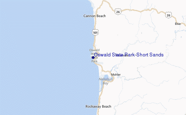
Explore Oswald State Park/Short Sands Location Map
Interactive Oswald State Park/Short Sands surf break location map. View information about nearby surf breaks, their wave consistency and rating compared to other spots in the region. Current swell conditions from local buoys are shown along with live wind speed and direction from nearby weather stations. Click icons on the map for more detail. The closest passenger airport to Oswald State Park/Short Sands is Scappoose Industrial Airpark (San Luis) Airport (SPB) in USA, 86 km (53 miles) away (directly). The second nearest airport to Oswald State Park/Short Sands is Mc Minnville Muni (Mackminnville) Airport (MMV), also in USA, 91 km (57 miles) away.
- Map Icons:
 Break
Break Live Wave Height (m)
 Live Wind Speed (km/h)
 Surf Rating (10 Max)
 Ocean Swells (m)
- Wind Speed (km/h)
Tuesday, 9 June 2026, 05:18 Local Time
| Tuesday 09 | ||||
| 2AM | 5AM | 8AM | 11AM | |
| Wave (m) | ||||
| Period (s) | 9 | 9 | 9 | 9 |
| Wind (km/h) | ||||
| Wind State | on | on | on | on |
Tides at Oswald State Park/Short Sands
| NEXT | IS AT (local time) | remaining |
|---|---|---|
| high tide | ||
| low tide |
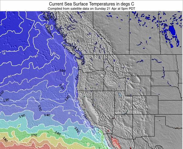
Oswald State Park/Short Sands Sea Temperature
The Oswald State Park/Short Sands water temperature is rather cool (13.2 °C) and the air temperature will feel about the same. A good quality spring wetsuit with optional neoprene boots should suffice. No need for wetsuit gloves.
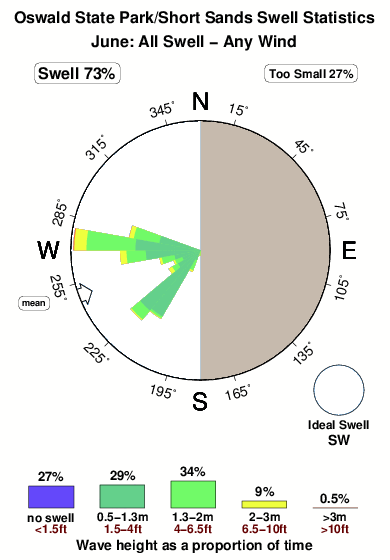
Swell History at Oswald State Park/Short Sands
Surf stats for Oswald State Park/Short Sands, see the swell variation by month or season on the history page here.

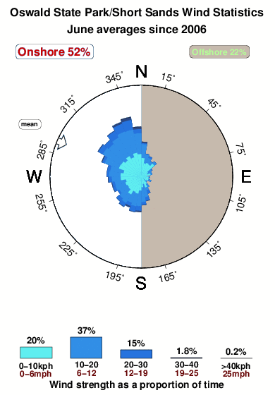
Wind History at Oswald State Park/Short Sands
Wind stats for Oswald State Park/Short Sands, see the variation in direction and stength by month or season on the history page here.
Oswald State Park/Short Sands Reviews:
Interactive Porthcawl Point location map. View nearby buoy information, live wind conditions and surrounding roads, paths and locations to help find new breaks. Click the buoys or wind icon to view more information.
- Overall:
 1.0
1.0 - Quality on a good day:
 3.2
3.2 - Consistency of Surf:
 3.5
3.5 - Difficulty Level:
 2.4
2.4 - Wind and Kite Surfing:1.2
- Crowds:3.0
In the fleeting Oregon summer or any time the weather is 1/2-way decent (which is more often than the common misconception,) the place is an absolute zoo starting around 9:00 or 10:00 a.m. The small parking lots are full as droves of softtop-schlepping hipsters from Portland file down the old growth forest trail to the beach with coolers full of Pabst, selfie sticks, frisbees and guitars. The place is a Portlandia episode waiting to be filmed.
That said, even during the warmer months/days, if you're a trooper and can manage dawn patrol, you can usually catch the place almost entirely deserted for an hour or two in the early morning. (The parking lot is 'open' at 6:00, but I've never been ticketed for pulling in at 5:00-5:30).
Summer months are generally weak for Oregon surf anyways, so the small waves and friendly 'scene' at Shorties makes it look like some sort of Hipster Beach Blanket Bingo.
Come Fall and Winter though, this place takes on an entirely different vibe. The best months for quality are October and November. The sandbars from the multiple creek outflows are groomed and have yet to be pummeled by the heavy-duty NW winter swells, and Shorties is capable of spitting barrels and long uninterrupted lines when those conditions line up just right.
Typically, the worst thing about Shorties isn't the droves of kooks. When the waves are good they tend to flounder about in the whitewash, well out of the way of any firing lines. The Seaside crews that dominate The Point typically don't surf here, or if they do, the a$$hole meter is dialed back considerably.
No, the worst thing about Shorties are the blow-in California surfers that roll up with their bros and 20 chippy-thrusters strapped to the roof. It doesn't take long to spot them: most of them riding something by ...Lost or Al Merrick and sporting Hurley wetsuits with any color other than black. You can hear the forced California-drawls and observe the spastic shredding better left to Mission Beach or Blacks or Steamer Lane. The only real conflicts I've ever seen in the water at Shorties had some Cal bros involved.
Fortunately the bros don't typically know when to catch Shorties going off so the local and semi-local (Portland) surfers usually get the lion's share of quality surf there. With multiple, shifting peaks there's almost always enough waves to go around when its good.”
Other Nearby Breaks Closest To:
Discover surf breaks near Oswald State Park/Short Sands. Click below to view there surf guides.
 Nearest