

Surf Forecasts:

How big are the waves at Ontonagon today (09 Jun):
- Morning surf: Morning surf (09 Jun, local time) - 0.5ft (0.2m), 5s period with E swell.
- Afternoon surf: Afternoon surf (09 Jun, local time) - 0.5ft (0.2m), 5s period with E swell.
- Evening surf: Evening surf (09 Jun, local time) - 1ft (0.3m), 2s period with ENE swell.
The current surf forecast for Ontonagon at 4AM is: 0.2m 5s primary swell from a East direction (forecast issued at 07:00pm June 08). The wind direction is predicted to be cross-offshore.
| Time (EDT) & Date | Wave Height | Wave Period |
|---|---|---|
| Morning (09 Jun) | 0.5ft (0.2m) | 5s |
| Afternoon (09 Jun) | 0.5ft (0.2m) | 5s |
| Evening (09 Jun) | 1ft (0.3m) | 2s |
Table - waves today at Ontonagon. (Swell directed towards the surf break)
Updates in hr min s Forecast update imminent
Short Range ForecastHeavy rain (total 26mm), heaviest during Wed night. Warm (max 27°C on Wed afternoon, min 16°C on Tue night). Wind will be generally light. | ||||||||||||||||||||||||
Mon 8 | Tuesday 9 | Wednesday 10 | Thu 11 | |||||||||||||||||||||
5 PM | 8 PM | 11 PM | 2 AM | 5 AM | 8 AM | 11 AM | 2 PM | 5 PM | 8 PM | 11 PM | 2 AM | 5 AM | 8 AM | 11 AM | 2 PM | 5 PM | 8 PM | 11 PM | 2 AM | 5 AM | 8 AM | 11 AM | 2 PM | |
Swell Height Map | 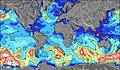 | 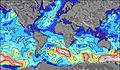 | 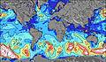 | 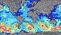 |  |  |  |  |  | |||||||||||||||
Wave Height (m) Direction Period (s) | — | E 3 | E 3 | ESE 4 | E 5 | E 5 | E 5 | E 5 | E 5 | E 5 | ENE 3 | E 3 | E 3 | ESE 3 | E 4 | E 4 | E 4 | ESE 5 | E 5 | E 6 | E 6 | E 5 | E 5 | SW 6 |
Wave Graph | ||||||||||||||||||||||||
0 | 1 | 2 | 2 | 2 | 2 | 2 | 2 | 1 | 2 | 2 | 2 | 1 | 0 | 0 | 0 | 0 | 0 | 20 | 10 | 5 | 2 | 1 | 0 | |
Wind (km/h) | ||||||||||||||||||||||||
Wind State on-shore cross-onshore cross-shore cross-offshore off-shore glassy | off | cross-off | cross-off | cross-off | cross-off | cross-off | cross-on | cross-on | cross-on | cross-on | cross-off | cross-off | cross-off | cross-off | cross-off | off | off | off | cross-off | cross-off | cross-off | cross-off | cross | cross-off |
High Tide | ||||||||||||||||||||||||
Low Tide | ||||||||||||||||||||||||
— | — | — | — | 6:03 | — | — | — | — | — | — | — | 6:01 | — | — | — | — | — | — | — | 6:01 | — | — | — | |
— | 9:49 | — | — | — | — | — | — | — | 9:50 | — | — | — | — | — | — | — | 9:50 | — | — | — | — | — | 9:51 | |
mm | 1 | 2 | 3 | 4 | 1 | — | — | — | — | — | — | — | — | — | 1 | 1 | 1 | 5 | 3 | 3 | — | — | — | 1 |
Temp °C | 23 | 19 | 19 | 18 | 18 | 18 | 18 | 19 | 18 | 18 | 16 | 16 | 17 | 18 | 20 | 23 | 27 | 23 | 22 | 17 | 16 | 16 | 19 | 16 |
Feels °C | 23 | 19 | 20 | 18 | 20 | 19 | 18 | 18 | 16 | 17 | 16 | 16 | 17 | 18 | 19 | 24 | 29 | 24 | 23 | 15 | 15 | 14 | 18 | 15 |
Swell 1 Height (m) Direction Period (s) | — | — | E 3 | ESE 4 | E 5 | E 5 | E 5 | E 5 | E 5 | E 5 | — | — | — | — | — | — | — | — | E 5 | E 6 | E 6 | E 5 | E 5 | — |
— | — | 2 | 2 | 2 | 2 | 2 | 2 | 1 | 2 | — | — | — | — | — | — | — | — | 20 | 10 | 5 | 2 | 1 | — | |
Swell 2 Height (m) Direction Period (s) | — | — | — | — | — | — | — | — | — | — | — | — | — | — | — | — | — | — | — | — | — | — | — | W 7 |
— | — | — | — | — | — | — | — | — | — | — | — | — | — | — | — | — | — | — | — | — | — | — | 1 | |
Swell 3 Height (m) Direction Period (s) | — | — | — | — | E 5 | — | E 5 | — | — | — | — | — | — | — | — | — | — | — | — | — | — | — | — | — |
— | — | — | — | 1 | — | 1 | — | — | — | — | — | — | — | — | — | — | — | — | — | — | — | — | — | |
Wind waves Height (m) Direction Period (s) | — | E 3 | — | — | — | — | — | — | — | E 3 | ENE 3 | E 3 | E 3 | ESE 3 | E 4 | E 4 | E 4 | ESE 5 | SE 5 | SSW 5 | SW 6 | SW 6 | SW 6 | SW 6 |
— | 1 | — | — | — | — | — | — | — | 1 | 2 | 2 | 1 | 3 | 7 | 15 | 25 | 40 | 37 | 61 | 119 | 165 | 196 | 193 | |
Nearest Offshore or Glassy | ||||||||||||||||||||||||
Distance (km) | 1569 | 1622 | 1937 | 1717 | 1455 | 1486 | 1486 | 2803 | 2803 | 2014 | 1520 | 1518 | 1520 | 1520 | 1721 | 2624 | 2839 | 2855 | 552 | 1520 | 1462 | 1428 | 1423 | 1451 |
Best forecast wave conditions in Lake Superior | ||||||||||||||||||||||||
Best forecast wave conditions in United States | ||||||||||||||||||||||||
Header Global | ||||||||||||||||||||||||
- Map Icons:
 Break
Break Live Wave Height (m)
 Live Wind Speed (km/h)
 Surf Rating (10 Max)
 Ocean Swells (m)
- Wind Speed (km/h)


FREE! Surf-Forecast.com widget for your website
The surf report / weather widget below is available to embed on third party websites free of charge and provides a summary of our Ontonagon surf forecast. Simply grab the html code snippet that we provide and paste it into your own site. You can choose your preferred language and metric/imperial units for the surf forecast feed to suit users of your site. Click here to get the code.
 Nearest