

- Forecast
- Maps
- Live
- Weather State
- Spot Information

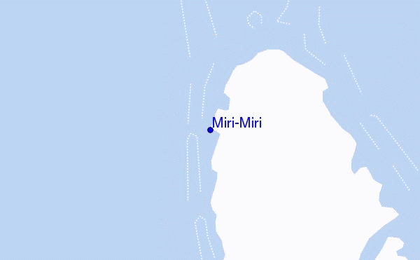
Miri-Miri surf Forecast / Raiatea / French Polynesia
- Map Icons:
 Break
Break Live Wave Height (m)
 Live Wind Speed (km/h)
 Surf Rating (10 Max)
 Ocean Swells (m)
- Wind Speed (km/h)
How big are the waves at Miri-Miri today?
The current surf forecast for Miri-Miri at 8PM is: 1.3m 14s primary swell from a South-southwest direction (forecast issued at 07:00pm April 19). An open ocean swell of 0.4m 14s is not directed at the surf break, a second open ocean swell of 1.0m 8s is not directed at the surf break. The wind direction is predicted to be offshore and the swell rating is 4.
| Time (-10) & Date | Wave Height | Wave Period |
|---|---|---|
| Morning (19 Apr) | - | - |
| Afternoon (19 Apr) | 4.5ft (1.3m) | 14s |
| Evening (19 Apr) | 4.5ft (1.3m) | 14s |
Table - waves today at Miri-Miri. (Swell directed towards the surf break)
Friday 19 | Saturday 20 | Sunday 21 | Monday 22 | Tuesday 23 | Wednesday 24 | Thursday 25 | Friday 26 | Sat 27 | ||||||||||||||||||||||||||||||||||||||||||||||||||||
| 5 PM | 8 PM | 11 PM | 2 AM | 5 AM | 8 AM | 11 AM | 2 PM | 5 PM | 8 PM | 11 PM | 2 AM | 5 AM | 8 AM | 11 AM | 2 PM | 5 PM | 8 PM | 11 PM | 2 AM | 5 AM | 8 AM | 11 AM | 2 PM | 5 PM | 8 PM | 11 PM | 2 AM | 5 AM | 8 AM | 11 AM | 2 PM | 5 PM | 8 PM | 11 PM | 2 AM | 5 AM | 8 AM | 11 AM | 2 PM | 5 PM | 8 PM | 11 PM | 2 AM | 5 AM | 8 AM | 11 AM | 2 PM | 5 PM | 8 PM | 11 PM | 2 AM | 5 AM | 8 AM | 11 AM | 2 PM | 5 PM | 8 PM | 11 PM | 2 AM | |
Rating (10 max) | ||||||||||||||||||||||||||||||||||||||||||||||||||||||||||||
Swell Height Map |    |    |  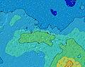  |  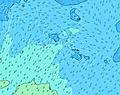 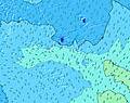 |  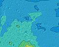 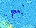 | 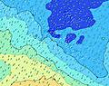 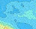 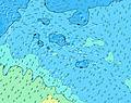 | 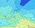 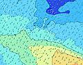 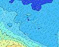 | 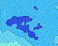   |    | |||||||||||||||||||||||||||||||||||||||||||||||||||
| Wave Height (m) & direction (?) | ||||||||||||||||||||||||||||||||||||||||||||||||||||||||||||
| Period(s) (?) | 14 | 14 | 14 | 15 | 19 | 16 | 19 | 18 | 18 | 15 | 16 | 16 | 16 | 16 | 16 | 15 | 15 | 15 | 15 | 14 | 14 | 14 | 14 | 14 | 14 | 14 | 14 | 14 | 14 | 14 | 13 | 13 | 13 | 13 | 13 | 13 | 13 | 12 | 13 | 13 | 13 | 15 | 15 | 15 | 14 | 14 | 14 | 14 | 14 | 14 | 14 | 17 | 16 | 15 | 15 | 15 | 14 | 14 | 14 | 13 |
Wave (?)Graph | ||||||||||||||||||||||||||||||||||||||||||||||||||||||||||||
| Energy (?) | 638 | 638 | 553 | 568 | 1543 | 749 | 1495 | 1561 | 768 | 750 | 1469 | 1451 | 1451 | 1415 | 1361 | 1344 | 1162 | 1052 | 911 | 886 | 886 | 874 | 874 | 774 | 785 | 722 | 722 | 621 | 612 | 578 | 553 | 472 | 465 | 427 | 427 | 421 | 335 | 325 | 257 | 261 | 265 | 468 | 537 | 522 | 561 | 508 | 469 | 463 | 530 | 774 | 487 | 580 | 1040 | 1081 | 1067 | 1038 | 1010 | 982 | 814 | 722 |
Wind (km/h) | ||||||||||||||||||||||||||||||||||||||||||||||||||||||||||||
| Wind State (?) onshore cross-onshore cross-shore cross-offshore offshore glassy | off | off | off | off | off | off | off | off | off | off | off | off | off | off | cross- off | cross- off | cross- off | off | off | off | off | cross- off | cross- off | off | off | off | off | off | off | off | cross- off | cross- off | cross- off | off | cross- off | cross- off | cross- off | cross- off | cross- off | cross | glass | glass | cross- off | cross- off | off | cross- off | off | cross- off | cross- off | cross- off | cross- off | cross- off | cross- off | off | off | cross- off | cross- off | cross- off | cross- off | cross- off |
High Tide / height (m) | 11:13PM 0.22 | 11:20AM 0.20 | 11:28PM 0.23 | 11:30AM 0.21 | 11:44PM 0.24 | 11:42AM 0.22 | 12:01AM 0.24 | 11:54AM 0.23 | 12:16AM 0.23 | 12:07PM 0.23 | 12:32AM 0.22 | 12:20PM 0.23 | 12:46AM 0.20 | 12:34PM 0.22 | 12:59AM 0.18 | |||||||||||||||||||||||||||||||||||||||||||||
Low Tide / height (m) | 5:15PM 0.05 | 5:37AM 0.04 | 5:22PM 0.04 | 5:43AM 0.04 | 5:33PM 0.02 | 5:52AM 0.04 | 5:48PM 0.01 | 6:02AM 0.03 | 6:05PM 0.00 | 6:15AM 0.03 | 6:24PM -0.00 | 6:27AM 0.03 | 6:43PM -0.00 | 6:38AM 0.04 | 7:02PM 0.01 | |||||||||||||||||||||||||||||||||||||||||||||
Friday 19 | Saturday 20 | Sunday 21 | Monday 22 | Tuesday 23 | Wednesday 24 | Thursday 25 | Friday 26 | Sat 27 | ||||||||||||||||||||||||||||||||||||||||||||||||||||
| Sunrise | - | - | - | - | - | 6:15 | - | - | - | - | - | - | - | 6:15 | - | - | - | - | - | - | - | 6:16 | - | - | - | - | - | - | - | 6:16 | - | - | - | - | - | - | - | 6:16 | - | - | - | - | - | - | - | 6:16 | - | - | - | - | - | - | - | 6:16 | - | - | - | - | - | - |
| Sunset | 5:53 | - | - | - | - | - | - | - | 5:52 | - | - | - | - | - | - | - | 5:52 | - | - | - | - | - | - | - | 5:52 | - | - | - | - | - | - | - | 5:51 | - | - | - | - | - | - | - | 5:51 | - | - | - | - | - | - | - | 5:50 | - | - | - | - | - | - | - | 5:50 | - | - | - |
Rain (mm) | 1 | 2 | 2 | 2 | - | - | - | - | - | - | - | 1 | 2 | 4 | 6 | 6 | 1 | 1 | - | 1 | - | - | 1 | 1 | 1 | 1 | 2 | - | 1 | 1 | 2 | 1 | 1 | - | 1 | 2 | 1 | 2 | 2 | 1 | 1 | 2 | 2 | - | - | 2 | 1 | 1 | - | 1 | - | - | 1 | 1 | - | - | - | 1 | 1 | 1 |
| Temp. °C | 28 | 28 | 28 | 28 | 28 | 28 | 28 | 28 | 28 | 28 | 28 | 28 | 28 | 28 | 28 | 28 | 28 | 28 | 28 | 28 | 28 | 28 | 28 | 28 | 27 | 28 | 27 | 28 | 27 | 27 | 27 | 28 | 28 | 28 | 27 | 27 | 28 | 28 | 28 | 28 | 28 | 27 | 27 | 27 | 27 | 27 | 27 | 28 | 28 | 28 | 28 | 27 | 27 | 27 | 27 | 28 | 27 | 27 | 27 | 27 |
| Feels °C (?) | 30 | 29 | 28 | 28 | 28 | 28 | 28 | 29 | 29 | 28 | 29 | 29 | 28 | 28 | 29 | 30 | 31 | 29 | 29 | 29 | 29 | 29 | 29 | 30 | 28 | 30 | 28 | 29 | 28 | 28 | 28 | 30 | 30 | 30 | 29 | 29 | 31 | 30 | 31 | 32 | 32 | 32 | 30 | 30 | 30 | 30 | 29 | 30 | 30 | 29 | 29 | 27 | 28 | 28 | 28 | 29 | 27 | 27 | 27 | 27 |
FREE! Surf-Forecast.com widget for your website
The surf report / weather widget below is available to embed on third party websites free of charge and provides a summary of our Miri-Miri surf forecast. Simply grab the html code snippet that we provide and paste it into your own site. You can choose your preferred language and metric/imperial units for the surf forecast feed to suit users of your site. Click here to get the code.


 Nearest