

Surf Forecasts:

How big are the waves at Matelot today (09 Jun):
- Morning surf: Morning surf (09 Jun, local time) - 4.5ft (1.4m), 8s period with ENE swell.
- Afternoon surf: Afternoon surf (09 Jun, local time) - 4.5ft (1.3m), 8s period with ENE swell.
- Evening surf: Evening surf (09 Jun, local time) - 4.5ft (1.4m), 8s period with ENE swell.
The current surf forecast for Matelot at 3AM is: 1.5m 8s primary swell from a East-northeast direction and 0.2m 9s secondary swell from a North-northeast direction (forecast issued at 07:00pm June 08). The wind direction is predicted to be cross-onshore.
| Time (AST) & Date | Wave Height | Wave Period |
|---|---|---|
| Morning (09 Jun) | 4.5ft (1.4m) | 8s |
| Afternoon (09 Jun) | 4.5ft (1.3m) | 8s |
| Evening (09 Jun) | 4.5ft (1.4m) | 8s |
Table - waves today at Matelot. (Swell directed towards the surf break)
Updates in hr min s Forecast update imminent
Short Range ForecastModerate rain (total 14mm), heaviest on Tue night. Warm (max 28°C on Tue morning, min 24°C on Tue night). Wind will be generally light. | ||||||||||||||||||||||||
Mon 8 | Tuesday 9 | Wednesday 10 | Thu 11 | |||||||||||||||||||||
5 PM | 8 PM | 11 PM | 2 AM | 5 AM | 8 AM | 11 AM | 2 PM | 5 PM | 8 PM | 11 PM | 2 AM | 5 AM | 8 AM | 11 AM | 2 PM | 5 PM | 8 PM | 11 PM | 2 AM | 5 AM | 8 AM | 11 AM | 2 PM | |
Swell Height Map |  |  | 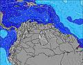 | 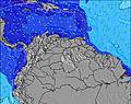 |  | 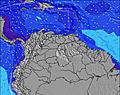 | 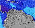 | 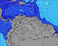 | 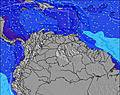 | |||||||||||||||
Wave Height (m) Direction Period (s) | ENE 8 | ENE 8 | ENE 8 | ENE 8 | ENE 8 | ENE 8 | ENE 8 | ENE 8 | ENE 8 | ENE 8 | ENE 8 | ENE 8 | ENE 8 | ENE 8 | ENE 8 | ENE 8 | ENE 8 | ENE 8 | ENE 8 | ENE 8 | ENE 8 | ENE 8 | ENE 8 | E 8 |
Wave Graph | ||||||||||||||||||||||||
266 | 266 | 277 | 266 | 259 | 226 | 226 | 212 | 183 | 221 | 215 | 215 | 181 | 178 | 173 | 202 | 207 | 245 | 295 | 333 | 341 | 341 | 333 | 374 | |
Wind (km/h) | ||||||||||||||||||||||||
Wind State on-shore cross-onshore cross-shore cross-offshore off-shore glassy | cross-on | cross-on | cross-on | cross-on | cross-on | cross-on | cross-on | cross-on | cross-on | cross-on | cross-on | cross-on | cross-on | cross | cross | cross | cross-on | cross-on | cross-on | cross | cross-on | cross-on | cross | cross-on |
High Tide | 9:40PM0.69m | 9:46AM0.61m | 10:27PM0.73m | 11:09AM0.59m | 11:16PM0.77m | 12:27PM0.60m | ||||||||||||||||||
Low Tide | 3:07PM0.30m | 4:16AM0.36m | 4:00PM0.32m | 5:22AM0.28m | 4:56PM0.33m | 6:20AM0.19m | ||||||||||||||||||
— | — | — | — | 5:41 | — | — | — | — | — | — | — | 5:41 | — | — | — | — | — | — | — | 5:41 | — | — | — | |
6:24 | — | — | — | — | — | — | — | 6:24 | — | — | — | — | — | — | — | 6:25 | — | — | — | — | — | — | 6:25 | |
mm | — | — | — | — | — | — | — | — | — | — | — | 1 | 2 | 1 | 1 | 1 | 1 | 1 | 1 | 1 | — | 1 | 1 | 1 |
Temp °C | 28 | 26 | 26 | 25 | 25 | 27 | 28 | 28 | 27 | 25 | 25 | 25 | 24 | 26 | 26 | 27 | 26 | 25 | 25 | 25 | 25 | 26 | 27 | 27 |
Feels °C | 30 | 28 | 29 | 27 | 28 | 29 | 29 | 29 | 29 | 27 | 27 | 28 | 26 | 28 | 28 | 29 | 28 | 27 | 27 | 27 | 27 | 28 | 28 | 28 |
Swell 1 Height (m) Direction Period (s) | NNE 10 | NNE 10 | NNE 9 | NNE 9 | NNE 9 | NNE 9 | N 9 | N 9 | N 9 | NNE 9 | NNE 9 | NNE 9 | NNE 9 | ENE 8 | NNE 9 | NNE 9 | NNE 9 | NNE 9 | NNE 9 | N 9 | N 9 | N 8 | NE 8 | N 8 |
9 | 9 | 9 | 9 | 9 | 9 | 7 | 7 | 6 | 8 | 8 | 8 | 8 | 178 | 8 | 8 | 8 | 8 | 8 | 2 | 2 | 1 | 3 | 1 | |
Swell 2 Height (m) Direction Period (s) | — | — | — | — | — | — | — | NNE 9 | — | — | — | — | — | NNE 9 | — | — | — | — | — | — | — | — | — | — |
— | — | — | — | — | — | — | 8 | — | — | — | — | — | 8 | — | — | — | — | — | — | — | — | — | — | |
Swell 3 Height (m) Direction Period (s) | — | — | — | — | — | — | — | — | — | — | — | — | — | — | — | — | — | — | — | — | — | — | — | — |
— | — | — | — | — | — | — | — | — | — | — | — | — | — | — | — | — | — | — | — | — | — | — | — | |
Wind waves Height (m) Direction Period (s) | ENE 8 | ENE 8 | ENE 8 | ENE 8 | ENE 8 | ENE 8 | ENE 8 | ENE 8 | ENE 8 | ENE 8 | ENE 8 | ENE 8 | ENE 8 | — | ENE 8 | ENE 8 | ENE 8 | ENE 8 | ENE 8 | ENE 8 | ENE 8 | ENE 8 | ENE 8 | E 8 |
266 | 266 | 277 | 266 | 259 | 226 | 226 | 212 | 183 | 221 | 215 | 215 | 181 | — | 173 | 202 | 207 | 245 | 295 | 333 | 341 | 341 | 333 | 374 | |
Nearest Offshore or Glassy | ||||||||||||||||||||||||
Distance (km) | 154 | 154 | 154 | 154 | 232 | 154 | 154 | 302 | 154 | 154 | 154 | 154 | 154 | 447 | 447 | 810 | 154 | 154 | 551 | 551 | 154 | 154 | 673 | 154 |
Best forecast wave conditions in Tobago | ||||||||||||||||||||||||
Best forecast wave conditions in Trinidad and Tobago | ||||||||||||||||||||||||
Header Global | ||||||||||||||||||||||||
- Map Icons:
 Break
Break Live Wave Height (m)
 Live Wind Speed (km/h)
 Surf Rating (10 Max)
 Ocean Swells (m)
- Wind Speed (km/h)


FREE! Surf-Forecast.com widget for your website
The surf report / weather widget below is available to embed on third party websites free of charge and provides a summary of our Matelot surf forecast. Simply grab the html code snippet that we provide and paste it into your own site. You can choose your preferred language and metric/imperial units for the surf forecast feed to suit users of your site. Click here to get the code.
 Nearest