
Masa Chapa Surf Guide
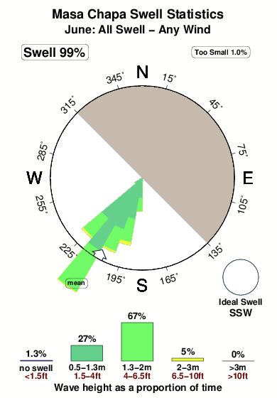
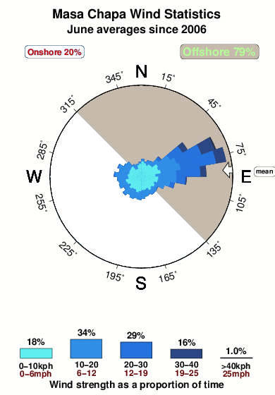
Masa Chapa in Leon Province is an exposed reef break that only works once in a while Offshore winds are from the northeast. Easily blown out by an onshore breeze Groundswells more frequent than windswells and the ideal swell direction is from the south southwest. A right hand reef break. Best around low tide. Unlikely to be too crowded, even when the surf is up. Hazards include rips and rocks.
Masa Chapa Spot Info
| Type: | Rating: | Reliability: | Todays Sea Temp*: |
|---|---|---|---|
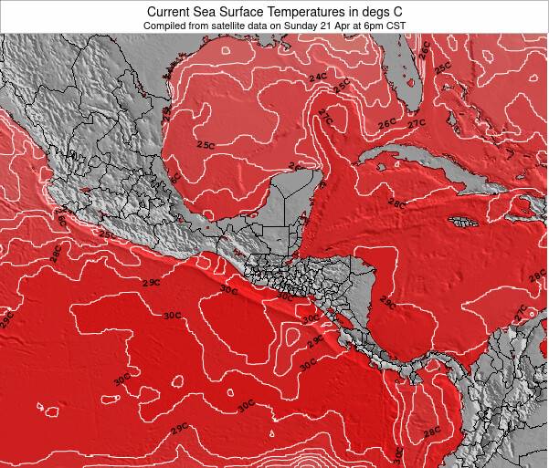
| inconsistent | 29.8°C*ocean temperature recorded from satellite |
Surfing Masa Chapa:
The best conditions reported for surf at Masa Chapa occur when a South-southwest swell combines with an offshore wind direction from the Northeast.
What's the best time of year to surf Masa Chapa (for consistent clean waves)?
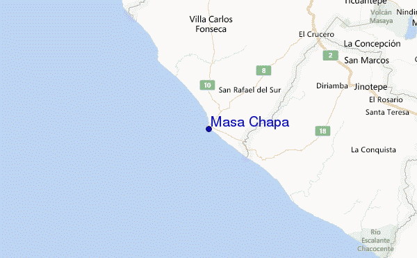
Explore Masa Chapa Location Map
Interactive Masa Chapa surf break location map. View information about nearby surf breaks, their wave consistency and rating compared to other spots in the region. Current swell conditions from local buoys are shown along with live wind speed and direction from nearby weather stations. Click icons on the map for more detail. The nearest passenger airport to Masa Chapa is Managua International Airport (MGA) in Nicaragua, which is 56 km (35 miles) away (directly). The second closest airport to Masa Chapa is Daniel Oduber Quiros International (Liberia) Airport (LIR) in Costa Rica, 169 km (105 miles) away.
- Map Icons:
 Break
Break Live Wave Height (m)
 Live Wind Speed (km/h)
 Surf Rating (10 Max)
 Ocean Swells (m)
- Wind Speed (km/h)
Tuesday, 9 June 2026, 02:24 Local Time
| Tuesday 09 | ||||
| 3AM | 6AM | 9AM | 12PM | |
| Wave (m) | ||||
| Period (s) | 18 | 17 | 17 | 17 |
| Wind (km/h) | ||||
| Wind State | cross | cross | cross | cross |
Tides at Masa Chapa
| NEXT | IS AT (local time) | remaining |
|---|---|---|
| high tide | ||
| low tide |
Swell History at Masa Chapa
Surf stats for Masa Chapa, see the swell variation by month or season on the history page here.

Wind History at Masa Chapa
Wind stats for Masa Chapa, see the variation in direction and stength by month or season on the history page here.
Other Nearby Breaks Closest To:
Discover surf breaks near Masa Chapa. Click below to view there surf guides.
- Melon and Pochomil
 Beach
Beach 3.0
3.0
Reliability: fairly consistent1km away - Montelimar
 Point
Point- 3.0
Reliability: fairly consistent1km away - Pochomil Viejo
 Reef
Reef- 3.0
Reliability: inconsistent3km away - Casares
- Beach
- 3.0
Reliability: fairly consistent10km away - Punta San Diego
- Beach and point
- 3.0
Reliability: fairly consistent15km away
 Nearest