Main Beach Surf Guide
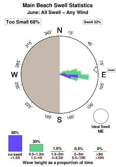
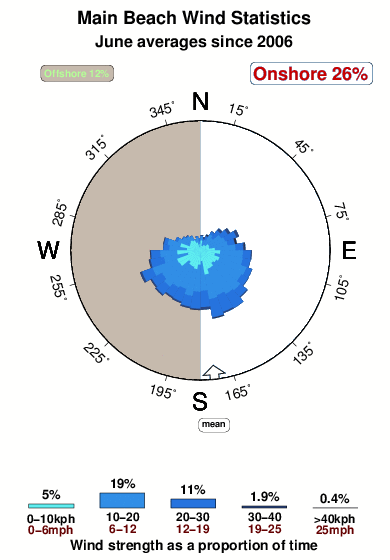
Main Beach in North Florida is an exposed beach break that has pretty consitent surf and can work at any time of the year. Offshore winds blow from the west. Windswells and groundswells in equal measure and the best swell direction is from the northeast. The beach breaks favour lefts. Best around high tide when the tide is rising. Often Crowded. Hazards include sharks and jellyfish.
Main Beach Spot Info
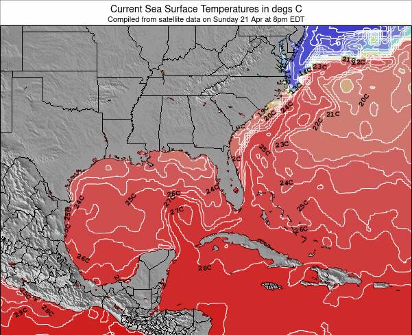
| Type: | Rating: | Reliability: | Todays Sea Temp*: |
|---|---|---|---|
| fairly consistent | 26.6°C*ocean temperature recorded from satellite |
Surfing Main Beach:
The best conditions reported for surf at Main Beach occur when a Northeast swell combines with an offshore wind direction from the West.
What's the best time of year to surf Main Beach (for consistent clean waves)?
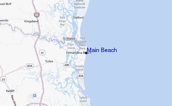
Explore Main Beach Location Map
Interactive Main Beach surf break location map. View information about nearby surf breaks, their wave consistency and rating compared to other spots in the region. Current swell conditions from local buoys are shown along with live wind speed and direction from nearby weather stations. Click icons on the map for more detail. The closest passenger airport to Main Beach is Jacksonville International Airport (JAX) in USA, 31 km (19 miles) away (directly). The second nearest airport to Main Beach is Jacksonville Nas Airport (NIP), also in USA, 54 km (34 miles) away.
- Map Icons:
 Break
Break Live Wave Height (m)
 Live Wind Speed (km/h)
 Surf Rating (10 Max)
 Ocean Swells (m)
- Wind Speed (km/h)
Tuesday, 9 June 2026, 05:35 Local Time
| Tuesday 09 | ||||
| 5AM | 8AM | 11AM | 2PM | |
| Wave (m) | ||||
| Period (s) | 8 | 8 | 8 | 8 |
| Wind (km/h) | ||||
| Wind State | on | on | on | on |
Tides at Main Beach
| NEXT | IS AT (local time) | remaining |
|---|---|---|
| high tide | ||
| low tide |
Swell History at Main Beach
Surf stats for Main Beach, see the swell variation by month or season on the history page here.

Wind History at Main Beach
Wind stats for Main Beach, see the variation in direction and stength by month or season on the history page here.
Other Nearby Breaks Closest To:
Discover surf breaks near Main Beach. Click below to view there surf guides.
- Fernandina Beach Pier
 Beach/pier
 1.0
1.0
Reliability: fairly consistent1km away - Fernandina Pier
- Beach
- 1.0
Reliability: fairly consistent1km away - Hooks
- Beach
- 1.0
Reliability: fairly consistent2km away - St Marys Rivermouth
 River
River- 1.0
Reliability: inconsistent3km away - Little Talbot Island
- Beach/pier
- 1.0
Reliability: fairly consistent24km away
 Nearest