
Mackinac Island Surf Guide
Mackinac Island in Lake Huron is an exposed beach break that has unreliable waves Works best in offshore winds from the west southwest. Short period wind swells are the rule and the best wave direction is from the northeast. Waves at the beach are both lefts and rights. A fairly popluar wave that can sometimes get crowded Take care to avoid the rocks.
Mackinac Island Spot Info
| Type: | Rating: | Reliability: | Todays Sea Temp*: |
|---|---|---|---|
| inconsistent | 9.6°C*ocean temperature recorded from satellite |
Surfing Mackinac Island:
The best conditions reported for surf at Mackinac Island occur when a Northeast swell combines with an offshore wind direction from the West-southwest.
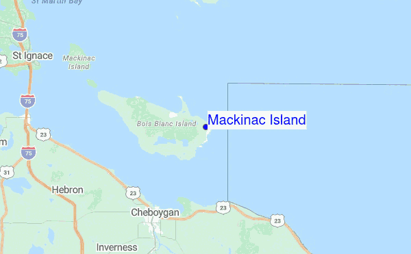
Explore Mackinac Island Location Map
Interactive Mackinac Island surf break location map. View information about nearby surf breaks, their wave consistency and rating compared to other spots in the region. Current swell conditions from local buoys are shown along with live wind speed and direction from nearby weather stations. Click icons on the map for more detail. The closest passenger airport to Mackinac Island is Sault Ste Marie Airport (YAM) in Canada, which is 80 km (50 miles) away (directly). The second nearest airport to Mackinac Island is Gore Bay Manitoulin Airport (YZE), also in Canada, 141 km (88 miles) away.
- Map Icons:
 Break
Break Live Wave Height (m)
 Live Wind Speed (km/h)
 Surf Rating (10 Max)
 Ocean Swells (m)
- Wind Speed (km/h)
Tuesday, 9 June 2026, 12:15 Local Time
| Tuesday 09 | ||||
| 11AM | 2PM | 5PM | 8PM | |
| Wave (m) | ||||
| Period (s) | - | - | - | - |
| Wind (km/h) | ||||
| Wind State | cross- on |
cross- on |
on | on |
Swell History at Mackinac Island
Surf stats for Mackinac Island, see the swell variation by month or season on the history page here.


Wind History at Mackinac Island
Wind stats for Mackinac Island, see the variation in direction and stength by month or season on the history page here.

Other Nearby Breaks Closest To:
Discover surf breaks near Mackinac Island. Click below to view there surf guides.
 Nearest