

Surf Forecasts:

How big are the waves at Lautaunuu today (09 Jun):
- Morning surf: Morning surf (09 Jun, local time) - 2ft (0.6m), 7s period with E swell.
- Afternoon surf: Afternoon surf (09 Jun, local time) - 1.5ft (0.5m), 7s period with E swell.
- Evening surf: Evening surf (09 Jun, local time) - 1.5ft (0.5m), 7s period with E swell.
The current surf forecast for Lautaunuu at 7PM is: 0.5m 7s primary swell from a East direction (forecast issued at 12:00pm June 09). An open ocean swell of 0.3m 12s is not directed at the surf break, a second open ocean swell of 0.4m 3s is not directed at the surf break. The wind direction is predicted to be cross-offshore.
| Time (+13) & Date | Wave Height | Wave Period |
|---|---|---|
| Morning (09 Jun) | 2ft (0.6m) | 7s |
| Afternoon (09 Jun) | 1.5ft (0.5m) | 7s |
| Evening (09 Jun) | 1.5ft (0.5m) | 7s |
Table - waves today at Lautaunuu. (Swell directed towards the surf break)
Updates in hr min s Forecast update imminent
Short Range ForecastMostly dry. Warm (max 27°C on Tue morning, min 25°C on Wed night). Winds increasing (light winds from the S on Tue morning, strong winds from the SSE by Wed night). | ||||||||||||||||||||||||
Tue 9 | Wednesday 10 | Thursday 11 | Fri 12 | |||||||||||||||||||||
10 AM | 1 PM | 4 PM | 7 PM | 10 PM | 1 AM | 4 AM | 7 AM | 10 AM | 1 PM | 4 PM | 7 PM | 10 PM | 1 AM | 4 AM | 7 AM | 10 AM | 1 PM | 4 PM | 7 PM | 10 PM | 1 AM | 4 AM | 7 AM | |
Swell Height Map |  |  | 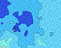 | 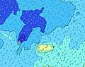 | 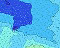 |  | 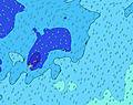 | 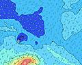 |  | |||||||||||||||
Wave Height (m) Direction Period (s) | E 7 | E 7 | E 7 | E 7 | E 7 | E 7 | E 7 | E 7 | E 7 | NNE 13 | E 7 | NE 9 | N 12 | N 12 | N 12 | N 12 | N 12 | NE 8 | N 12 | N 11 | NE 8 | NE 8 | NE 10 | NE 10 |
Wave Graph | ||||||||||||||||||||||||
31 | 31 | 21 | 21 | 23 | 38 | 38 | 37 | 37 | 57 | 35 | 23 | 26 | 25 | 25 | 25 | 25 | 24 | 24 | 23 | 10 | 10 | 25 | 24 | |
Wind (km/h) | ||||||||||||||||||||||||
Wind State on-shore cross-onshore cross-shore cross-offshore off-shore glassy | off | off | cross-off | cross-off | cross-off | cross-off | cross-off | cross-off | cross-off | cross-off | cross-off | cross-off | cross-off | cross-off | cross-off | cross-off | cross-off | cross-off | cross-off | cross-off | cross-off | cross-off | cross-off | cross-off |
High Tide | 1:01PM0.77m | 1:37AM0.82m | 2:00PM0.78m | 2:32AM0.88m | 2:57PM0.81m | 3:25AM0.94m | ||||||||||||||||||
Low Tide | 7:09AM0.17m | 7:32PM0.11m | 8:09AM0.12m | 8:24PM0.08m | 9:07AM0.06m | 9:17PM0.04m | ||||||||||||||||||
6:46 | — | — | — | — | — | 6:46 | — | — | — | — | — | — | — | 6:46 | — | — | — | — | — | — | — | 6:46 | — | |
— | — | 6:05 | — | — | — | — | — | — | — | 6:05 | — | — | — | — | — | — | — | 6:06 | — | — | — | — | 6:06 | |
mm | — | — | — | — | — | — | — | — | — | — | — | — | — | — | — | — | — | — | — | — | — | — | — | — |
Temp °C | 27 | 27 | 27 | 27 | 27 | 26 | 26 | 26 | 27 | 27 | 27 | 27 | 27 | 26 | 25 | 25 | 25 | 25 | 25 | 25 | 25 | 26 | 26 | 26 |
Feels °C | 30 | 29 | 28 | 28 | 27 | 26 | 26 | 26 | 27 | 26 | 26 | 25 | 24 | 22 | 20 | 20 | 21 | 21 | 21 | 21 | 21 | 23 | 23 | 24 |
Swell 1 Height (m) Direction Period (s) | E 7 | E 7 | E 7 | E 7 | E 7 | E 7 | E 7 | E 7 | E 7 | E 7 | E 7 | E 7 | SW 18 | SW 18 | SW 17 | SW 17 | SW 17 | SW 17 | SW 16 | SW 16 | SW 16 | SW 16 | SW 17 | SW 17 |
31 | 31 | 21 | 21 | 23 | 38 | 38 | 37 | 37 | 34 | 35 | 23 | 81 | 79 | 76 | 102 | 101 | 98 | 95 | 91 | 91 | 94 | 102 | 143 | |
Swell 2 Height (m) Direction Period (s) | NE 8 | NE 8 | NE 8 | SW 12 | SW 11 | NNE 10 | NNE 9 | NNE 14 | NNE 13 | NNE 13 | NE 9 | NE 9 | SW 8 | SW 8 | SW 8 | SW 8 | SW 9 | NE 8 | NE 8 | NE 8 | SSW 21 | SSW 20 | SSW 19 | SSW 18 |
10 | 10 | 10 | 21 | 19 | 9 | 17 | 36 | 34 | 57 | 22 | 20 | 16 | 16 | 16 | 18 | 19 | 24 | 24 | 23 | 86 | 79 | 119 | 110 | |
Swell 3 Height (m) Direction Period (s) | SW 13 | SW 12 | SW 12 | ENE 8 | N 14 | SW 11 | N 14 | NNE 9 | SW 13 | SW 12 | SW 12 | SW 18 | N 12 | N 12 | N 12 | N 12 | N 12 | SW 8 | N 12 | N 11 | NE 8 | NE 8 | NE 10 | NE 10 |
26 | 21 | 21 | 6 | 16 | 19 | 16 | 8 | 27 | 24 | 23 | 84 | 26 | 25 | 25 | 25 | 25 | 18 | 23 | 21 | 10 | 10 | 25 | 24 | |
Wind waves Height (m) Direction Period (s) | — | — | S 2 | SSE 3 | SSE 3 | SSE 3 | SE 3 | SSE 4 | SE 4 | SE 4 | SE 4 | SE 4 | SE 4 | SE 5 | SE 6 | SE 6 | SE 6 | SE 6 | SE 6 | SE 6 | ESE 6 | ESE 6 | ESE 7 | ESE 7 |
— | — | 1 | 3 | 6 | 7 | 6 | 8 | 10 | 10 | 12 | 14 | 35 | 67 | 133 | 161 | 164 | 175 | 172 | 172 | 175 | 170 | 175 | 166 | |
Nearest Offshore or Glassy | ||||||||||||||||||||||||
Distance (km) | 105 | 105 | 2190 | 130 | 130 | 130 | 2186 | 2186 | 2186 | 888 | 2186 | 2186 | 2186 | 2186 | 1261 | 1261 | 1268 | 1268 | 2186 | 2186 | 2186 | 2186 | 2186 | 1268 |
Best forecast wave conditions in Upolu | ||||||||||||||||||||||||
Best forecast wave conditions in Samoa | ||||||||||||||||||||||||
Header Global | ||||||||||||||||||||||||
- Map Icons:
 Break
Break Live Wave Height (m)
 Live Wind Speed (km/h)
 Surf Rating (10 Max)
 Ocean Swells (m)
- Wind Speed (km/h)


FREE! Surf-Forecast.com widget for your website
The surf report / weather widget below is available to embed on third party websites free of charge and provides a summary of our Lautaunuu surf forecast. Simply grab the html code snippet that we provide and paste it into your own site. You can choose your preferred language and metric/imperial units for the surf forecast feed to suit users of your site. Click here to get the code.
 Nearest