

Surf Forecasts:

How big are the waves at Kenting today (09 Jun):
- Morning surf: Morning surf (09 Jun, local time) - 10ft (3.0m), 8s period with SW swell.
- Afternoon surf: Afternoon surf (09 Jun, local time) - 10ft (3.0m), 8s period with SW swell.
- Evening surf: Evening surf (09 Jun, local time) - 10ft (3.0m), 9s period with SW swell.
The current surf forecast for Kenting at 1PM is: 3.0m 8s primary swell from a Southwest direction and 0.2m 10s secondary swell from a East direction, 0.1m 12s secondary swell from a Northeast direction (forecast issued at 07:00am June 09). The wind direction is predicted to be cross-shore.
| Time (CST) & Date | Wave Height | Wave Period |
|---|---|---|
| Morning (09 Jun) | 10ft (3.0m) | 8s |
| Afternoon (09 Jun) | 10ft (3.0m) | 8s |
| Evening (09 Jun) | 10ft (3.0m) | 9s |
Table - waves today at Kenting. (Swell directed towards the surf break)
Updates in hr min s Forecast update imminent
Short Range ForecastHeavy rain (total 107mm), heaviest during Wed afternoon. Warm (max 28°C on Tue morning, min 24°C on Wed afternoon). Winds decreasing (strong winds from the WSW on Tue afternoon, calm by Thu afternoon). | ||||||||||||||||||||||||
Tuesday 9 | Wednesday 10 | Thursday 11 | Fri 12 | |||||||||||||||||||||
5 AM | 8 AM | 11 AM | 2 PM | 5 PM | 8 PM | 11 PM | 2 AM | 5 AM | 8 AM | 11 AM | 2 PM | 5 PM | 8 PM | 11 PM | 2 AM | 5 AM | 8 AM | 11 AM | 2 PM | 5 PM | 8 PM | 11 PM | 2 AM | |
Swell Height Map | 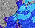 | 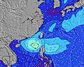 | 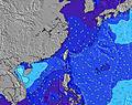 | 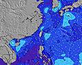 | 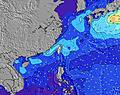 | 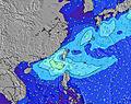 | 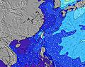 | 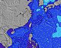 | 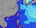 | 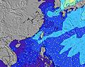 | ||||||||||||||
Wave Height (m) Direction Period (s) | SW 9 | SW 8 | SW 8 | SW 8 | SW 8 | SW 9 | SW 8 | SW 8 | SW 8 | SW 8 | SW 8 | SW 8 | SW 8 | SW 8 | SW 8 | SW 8 | SW 8 | SW 8 | SW 8 | SW 8 | SW 8 | SW 8 | NE 6 | NE 6 |
Wave Graph | ||||||||||||||||||||||||
1469 | 1081 | 1055 | 1055 | 1220 | 1440 | 1197 | 953 | 702 | 574 | 481 | 579 | 507 | 448 | 392 | 338 | 306 | 273 | 504 | 364 | 299 | 210 | 131 | 244 | |
Wind (km/h) | ||||||||||||||||||||||||
Wind State on-shore cross-onshore cross-shore cross-offshore off-shore glassy | cross | cross | cross | cross | cross-off | cross-off | cross-off | cross-off | cross-off | cross-off | glassy | cross-on | cross-on | cross | cross | cross | cross | cross-on | cross-on | cross-on | glassy | glassy | cross-on | cross-on |
High Tide | 2:01AM0.68m | 12:57PM0.83m | 2:37AM0.79m | 2:23PM0.75m | 3:14AM0.92m | 3:48PM0.70m | ||||||||||||||||||
Low Tide | 6:48AM0.53m | 7:55PM0.31m | 8:35AM0.45m | 8:32PM0.34m | 9:57AM0.32m | 9:09PM0.38m | ||||||||||||||||||
5:11 | — | — | — | — | — | — | — | 5:11 | — | — | — | — | — | — | — | 5:13 | — | — | — | — | — | — | 5:13 | |
— | — | — | — | 6:38 | — | — | — | — | — | — | — | 6:38 | — | — | — | — | — | — | — | 6:39 | — | — | 6:39 | |
mm | 3 | 5 | 4 | 5 | 2 | 4 | 3 | 4 | 5 | 5 | 8 | 22 | 21 | 4 | 2 | 1 | — | 1 | 1 | 2 | 5 | — | 2 | — |
Temp °C | 28 | 28 | 28 | 28 | 28 | 27 | 27 | 27 | 26 | 26 | 26 | 25 | 24 | 25 | 25 | 24 | 25 | 25 | 27 | 26 | 26 | 26 | 26 | 26 |
Feels °C | 28 | 27 | 27 | 27 | 27 | 26 | 26 | 27 | 26 | 29 | 31 | 29 | 26 | 26 | 25 | 23 | 25 | 26 | 29 | 30 | 32 | 31 | 30 | 29 |
Swell 1 Height (m) Direction Period (s) | E 10 | SE 7 | E 10 | E 10 | NE 12 | NE 12 | NE 12 | NE 12 | SE 7 | SW 8 | SW 8 | SW 8 | SW 8 | SW 8 | SW 8 | SW 8 | SW 8 | SW 8 | SW 8 | SW 8 | SW 8 | SW 8 | SW 8 | SW 8 |
7 | 12 | 8 | 8 | 6 | 6 | 6 | 6 | 23 | 574 | 481 | 481 | 507 | 448 | 392 | 338 | 306 | 273 | 349 | 364 | 299 | 210 | 128 | 94 | |
Swell 2 Height (m) Direction Period (s) | NE 12 | E 10 | NE 12 | NE 12 | E 10 | E 10 | E 10 | E 10 | NE 12 | SE 7 | NE 9 | NE 9 | NE 9 | NE 9 | SE 6 | SE 6 | SE 6 | NE 9 | NE 9 | NE 8 | SE 6 | SE 6 | SE 6 | SE 6 |
6 | 8 | 6 | 6 | 8 | 8 | 8 | 2 | 6 | 23 | 40 | 64 | 97 | 97 | 10 | 6 | 10 | 50 | 91 | 44 | 14 | 14 | 14 | 6 | |
Swell 3 Height (m) Direction Period (s) | E 10 | NE 12 | — | — | — | — | E 10 | NNE 8 | NE 10 | NNE 10 | SE 7 | SE 7 | SE 7 | SE 7 | E 9 | E 9 | SE 6 | SE 6 | SE 7 | SE 7 | NE 11 | NE 11 | SE 8 | ESE 7 |
7 | 6 | — | — | — | — | 7 | 7 | 4 | 9 | 16 | 16 | 16 | 15 | 2 | 2 | 14 | 15 | 16 | 15 | 5 | 5 | 3 | 5 | |
Wind waves Height (m) Direction Period (s) | SW 9 | SW 8 | SW 8 | SW 8 | SW 8 | SW 9 | SW 8 | SW 8 | SW 8 | — | — | SW 8 | — | — | NE 9 | NE 5 | NE 5 | ENE 5 | SW 8 | NE 8 | NE 8 | NE 5 | NE 6 | NE 6 |
1469 | 1081 | 1055 | 1055 | 1220 | 1440 | 1197 | 953 | 702 | — | — | 579 | — | — | 159 | 106 | 84 | 31 | 504 | 112 | 98 | 41 | 131 | 244 | |
Nearest Offshore or Glassy | ||||||||||||||||||||||||
Distance (km) | 318 | 318 | 533 | 440 | 440 | 440 | 510 | 510 | 510 | 0 | 0 | 16 | 350 | 331 | 331 | 331 | 318 | 81 | 862 | 44 | 0 | 0 | 331 | 318 |
Best forecast wave conditions in South Taiwan | ||||||||||||||||||||||||
Best forecast wave conditions in Taiwan | ||||||||||||||||||||||||
Header Global | ||||||||||||||||||||||||
- Map Icons:
 Break
Break Live Wave Height (m)
 Live Wind Speed (km/h)
 Surf Rating (10 Max)
 Ocean Swells (m)
- Wind Speed (km/h)


FREE! Surf-Forecast.com widget for your website
The surf report / weather widget below is available to embed on third party websites free of charge and provides a summary of our Kenting surf forecast. Simply grab the html code snippet that we provide and paste it into your own site. You can choose your preferred language and metric/imperial units for the surf forecast feed to suit users of your site. Click here to get the code.
 Nearest