
In Betweens Surf Guide
In Betweens in Oahu is an exposed reef break that has pretty consitent surf. Summer offers the optimum conditions for surfing. The best wind direction is from the north. Waves just as likely from local windswells as from distant groundswells and the best swell direction is from the south southeast. The reef provides both left and right breaks. Good surf at all stages of the tide. When the surf is up, it can get quite busy in the water. Hazards include Nice spot when all else is small because it has enough waves to go around. Not crowded so you share waves and there is no localism. The reef is the only hazards(i broke and scratched my skeg a couple times.) Nice waves for longboarders, shortboarders should go right to rockpiles..
In Betweens Spot Info
| Type: | Rating: | Reliability: | Todays Sea Temp*: |
|---|---|---|---|
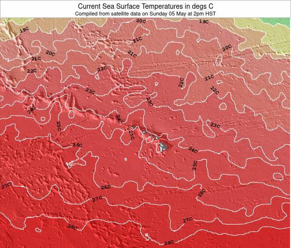
| fairly consistent | 25.7°C*ocean temperature recorded from satellite |
Surfing In Betweens:
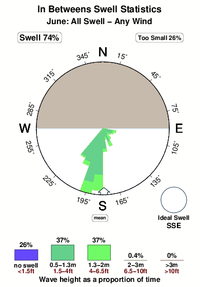
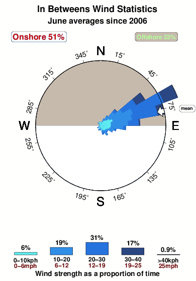
The best conditions reported for surf at In Betweens occur when a South-southeast swell combines with an offshore wind direction from the North.
What's the best time of year to surf In Betweens (for consistent clean waves)?
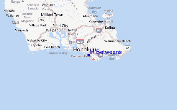
Explore In Betweens Location Map
Interactive In Betweens surf break location map. View information about nearby surf breaks, their wave consistency and rating compared to other spots in the region. Current swell conditions from local buoys are shown along with live wind speed and direction from nearby weather stations. Click icons on the map for more detail. The closest passenger airport to In Betweens is Honolulu International Airport (HNL) in Usa Oahu Isl., 10 km (6 miles) away (directly). The second nearest airport to In Betweens is Kaneohe Bay Mcaf Airport (NGF), also in Usa Oahu Isl., 20 km (12 miles) away.
- Map Icons:
 Break
Break Live Wave Height (m)
 Live Wind Speed (km/h)
 Surf Rating (10 Max)
 Ocean Swells (m)
- Wind Speed (km/h)
Monday, 8 June 2026, 18:15 Local Time
| Monday 08 | Tue | |||
| 5PM | 8PM | 11PM | 2AM | |
| Wave (m) | ||||
| Period (s) | 18 | 7 | 7 | 7 |
| Wind (km/h) | ||||
| Wind State | cross- off |
cross- off |
cross- off |
cross- off |
Tides at In Betweens
| NEXT | IS AT (local time) | remaining |
|---|---|---|
| high tide | ||
| low tide |
Swell History at In Betweens
Surf stats for In Betweens, see the swell variation by month or season on the history page here.

Wind History at In Betweens
Wind stats for In Betweens, see the variation in direction and stength by month or season on the history page here.
Other Nearby Breaks Closest To:
Discover surf breaks near In Betweens. Click below to view there surf guides.
 Nearest