

- Forecast
- Maps
- Live
- Weather State
- Spot Information

Surf Forecasts
Reef
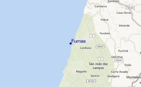
Furnas surf Forecast / Ericeira / Portugal
48hr Weather and Surf, issued 12 pm Thursday 18 Apr 2024 WEST
Forecast update in hr min s Update imminent
Furnas surf forecast is for near shore open water. Breaking waves will often be smaller at less exposed spots.
Today's Furnas sea temperature is 16.2°C (Statistics for 18 Apr 1981-2005 - mean: 15.8 °C max: 17.5 °C min: 14.3 °C)
- Map Icons:
 Break
Break Live Wave Height (m)
 Live Wind Speed (km/h)
 Surf Rating (10 Max)
 Ocean Swells (m)
- Wind Speed (km/h)
Furnas surf forecast is for near shore open water. Breaking waves will often be smaller at less exposed spots.
Today's Furnas sea temperature is 16.2°C (Statistics for 18 Apr 1981-2005 - mean: 15.8 °C max: 17.5 °C min: 14.3 °C)
How big are the waves at Furnas today?
The current surf forecast for Furnas at 4PM is: 1.8m 10s primary swell from a North-northwest direction and 0.4m 13s secondary swell from a West-northwest direction (forecast issued at 12:00pm April 18). The wind direction is predicted to be cross-onshore and the swell rating is 2.
| Time (WEST) & Date | Wave Height | Wave Period |
|---|---|---|
| Morning (18 Apr) | 7ft (2.1m) | 10s |
| Afternoon (18 Apr) | 6ft (1.9m) | 10s |
| Evening (18 Apr) | 5.5ft (1.7m) | 10s |
Table - waves today at Furnas. (Swell directed towards the surf break)
Updates in hr min s Update imminent
Thursday 18 | Friday 19 | Saturday 20 | Sunday 21 | Monday 22 | Tuesday 23 | Wednesday 24 | Thursday 25 | |||||||||||||||||||||||||||||||||||||||||||||||||||||
| 10 AM | 1 PM | 4 PM | 7 PM | 10 PM | 1 AM | 4 AM | 7 AM | 10 AM | 1 PM | 4 PM | 7 PM | 10 PM | 1 AM | 4 AM | 7 AM | 10 AM | 1 PM | 4 PM | 7 PM | 10 PM | 1 AM | 4 AM | 7 AM | 10 AM | 1 PM | 4 PM | 7 PM | 10 PM | 1 AM | 4 AM | 7 AM | 10 AM | 1 PM | 4 PM | 7 PM | 10 PM | 1 AM | 4 AM | 7 AM | 10 AM | 1 PM | 4 PM | 7 PM | 10 PM | 1 AM | 4 AM | 7 AM | 10 AM | 1 PM | 4 PM | 7 PM | 10 PM | 1 AM | 4 AM | 7 AM | 10 AM | 1 PM | 4 PM | 7 PM | |
Rating (10 max) | ||||||||||||||||||||||||||||||||||||||||||||||||||||||||||||
Swell Height Map |    |    |    |    |  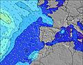 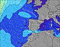 | 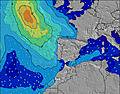 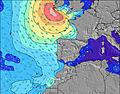 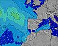 | 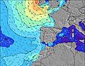 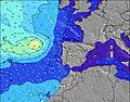 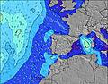 | 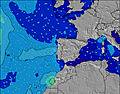   | ||||||||||||||||||||||||||||||||||||||||||||||||||||
| Wave Height (m) & direction (?) | ||||||||||||||||||||||||||||||||||||||||||||||||||||||||||||
| Period(s) (?) | 10 | 10 | 10 | 10 | 10 | 10 | 9 | 9 | 9 | 9 | 9 | 9 | 8 | 8 | 8 | 8 | 8 | 8 | 8 | 8 | 8 | 8 | 8 | 8 | 9 | 9 | 10 | 7 | 10 | 10 | 10 | 9 | 9 | 10 | 10 | 10 | 10 | 11 | 10 | 10 | 10 | 10 | 10 | 9 | 7 | 8 | 9 | 9 | 9 | 8 | 8 | 7 | 6 | 6 | 6 | 6 | 7 | 7 | 7 | 7 |
Wave (?)Graph | ||||||||||||||||||||||||||||||||||||||||||||||||||||||||||||
| Energy (?) | 800 | 688 | 611 | 528 | 442 | 391 | 360 | 300 | 238 | 166 | 129 | 101 | 73 | 54 | 53 | 51 | 51 | 51 | 33 | 67 | 21 | 21 | 21 | 22 | 62 | 65 | 19 | 28 | 19 | 18 | 18 | 17 | 17 | 19 | 18 | 20 | 35 | 37 | 35 | 56 | 204 | 328 | 423 | 380 | 255 | 507 | 1119 | 885 | 613 | 316 | 233 | 171 | 108 | 108 | 115 | 108 | 164 | 136 | 136 | 140 |
Wind (km/h) | ||||||||||||||||||||||||||||||||||||||||||||||||||||||||||||
| Wind State (?) onshore cross-onshore cross-shore cross-offshore offshore glassy | cross- off | cross- on | cross- on | glass | glass | cross | cross | cross- off | cross- off | cross | cross- on | cross- on | on | cross- off | cross- off | cross- on | cross | cross- on | cross | cross | cross | cross- off | cross | cross- off | cross- off | cross- on | cross- on | on | cross- on | cross | cross | cross | cross | cross | cross- on | cross | cross | cross- off | off | off | off | cross- off | cross | cross | cross | cross- off | cross | cross | cross- off | cross | cross | cross | cross- off | cross- off | cross | cross | cross | cross | cross | cross |
High Tide / height (m) | 12:35PM 2.08 | 12:45AM 2.33 | 1:17PM 2.24 | 1:25AM 2.48 | 1:51PM 2.40 | 1:59AM 2.60 | 2:21PM 2.54 | 2:31AM 2.69 | 2:51PM 2.66 | 3:02AM 2.75 | 3:20PM 2.73 | 3:33AM 2.76 | 3:49PM 2.77 | 4:04AM 2.72 | 4:19PM 2.76 | |||||||||||||||||||||||||||||||||||||||||||||
Low Tide / height (m) | 6:34PM 0.91 | 7:09AM 0.67 | 7:15PM 0.75 | 7:42AM 0.53 | 7:49PM 0.59 | 8:12AM 0.40 | 8:21PM 0.46 | 8:40AM 0.31 | 8:52PM 0.35 | 9:09AM 0.26 | 9:23PM 0.29 | 9:37AM 0.25 | 9:54PM 0.27 | 10:07AM 0.29 | ||||||||||||||||||||||||||||||||||||||||||||||
Thursday 18 | Friday 19 | Saturday 20 | Sunday 21 | Monday 22 | Tuesday 23 | Wednesday 24 | Thursday 25 | |||||||||||||||||||||||||||||||||||||||||||||||||||||
| Sunrise | - | - | - | - | - | - | - | 6:54 | - | - | - | - | - | - | - | 6:52 | - | - | - | - | - | - | - | 6:52 | - | - | - | - | - | - | - | 6:50 | - | - | - | - | - | - | - | 6:48 | - | - | - | - | - | - | - | 6:48 | - | - | - | - | - | - | - | 6:47 | - | - | - | - |
| Sunset | - | - | - | 8:17 | - | - | - | - | - | - | - | 8:19 | - | - | - | - | - | - | - | 8:20 | - | - | - | - | - | - | - | 8:21 | - | - | - | - | - | - | - | 8:21 | - | - | - | - | - | - | - | 8:22 | - | - | - | - | - | - | - | 8:22 | - | - | - | - | - | - | - | 8:23 |
Rain (mm) | - | - | - | - | - | - | - | - | - | - | - | - | - | - | - | 1 | 1 | 1 | 2 | 1 | - | - | - | - | - | - | - | - | - | - | - | - | - | - | - | - | - | - | - | - | - | - | - | - | - | - | - | - | - | - | - | - | - | - | - | - | - | - | - | - |
| Temp. °C | 19 | 20 | 19 | 18 | 18 | 17 | 16 | 16 | 17 | 18 | 18 | 17 | 16 | 15 | 15 | 15 | 16 | 17 | 18 | 16 | 16 | 16 | 15 | 15 | 17 | 19 | 18 | 17 | 17 | 16 | 16 | 15 | 17 | 18 | 18 | 17 | 16 | 16 | 15 | 13 | 14 | 18 | 17 | 15 | 14 | 14 | 13 | 12 | 14 | 16 | 16 | 15 | 14 | 13 | 13 | 13 | 14 | 14 | 14 | 14 |
| Feels °C (?) | 18 | 20 | 18 | 19 | 19 | 17 | 16 | 16 | 16 | 15 | 16 | 17 | 16 | 14 | 15 | 14 | 15 | 15 | 15 | 13 | 14 | 15 | 14 | 14 | 16 | 18 | 17 | 16 | 16 | 15 | 14 | 13 | 15 | 15 | 14 | 14 | 13 | 13 | 10 | 6 | 6 | 14 | 11 | 8 | 9 | 9 | 7 | 6 | 8 | 9 | 9 | 8 | 9 | 9 | 9 | 9 | 10 | 9 | 8 | 8 |
FREE! Surf-Forecast.com widget for your website
The surf report / weather widget below is available to embed on third party websites free of charge and provides a summary of our Furnas surf forecast. Simply grab the html code snippet that we provide and paste it into your own site. You can choose your preferred language and metric/imperial units for the surf forecast feed to suit users of your site. Click here to get the code.


 Nearest