
Freeport Pier Surf Guide
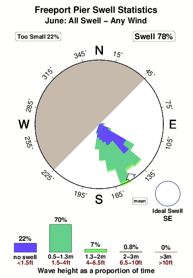
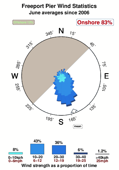
Freeport Pier in Texas is an exposed beach/Pier break that has quite reliable surf. The best conditions for surfing are during the hurricane season. Offshore winds are from the northwest. Windswells are much more typical than groudswells and the best wave direction is from the southeast. The beach break provides left and right handers. Good surf at all stages of the tide. Sometimes crowded. Beware of rips, sharks and jellyfish.
Freeport Pier Spot Info
| Type: | Rating: | Reliability: | Todays Sea Temp*: |
|---|---|---|---|
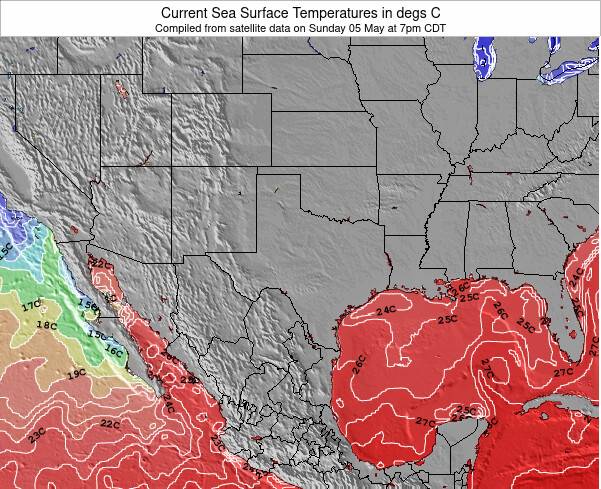
| fairly consistent | 28.2°C*ocean temperature recorded from satellite |
Surfing Freeport Pier:
The best conditions reported for surf at Freeport Pier occur when a Southeast swell combines with an offshore wind direction from the Northwest.
What's the best time of year to surf Freeport Pier (for consistent clean waves)?
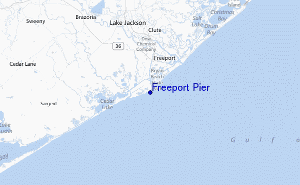
Explore Freeport Pier Location Map
Interactive Freeport Pier surf break location map. View information about nearby surf breaks, their wave consistency and rating compared to other spots in the region. Current swell conditions from local buoys are shown along with live wind speed and direction from nearby weather stations. Click icons on the map for more detail. The closest passenger airport to Freeport Pier is Scholes International At Galveston Airport (GLS) in USA, 68 km (42 miles) away (directly). The second nearest airport to Freeport Pier is Ellington Fld (Houston) Airport (EFD), also in USA, 85 km (53 miles) away.
- Map Icons:
 Break
Break Live Wave Height (m)
 Live Wind Speed (km/h)
 Surf Rating (10 Max)
 Ocean Swells (m)
- Wind Speed (km/h)
Tuesday, 9 June 2026, 10:40 Local Time
| Tuesday 09 | ||||
| 10AM | 1PM | 4PM | 7PM | |
| Wave (m) | ||||
| Period (s) | 6 | 6 | 6 | 6 |
| Wind (km/h) | ||||
| Wind State | on | on | on | on |
Tides at Freeport Pier
| NEXT | IS AT (local time) | remaining |
|---|---|---|
| high tide | ||
| low tide |
Swell History at Freeport Pier
Surf stats for Freeport Pier, see the swell variation by month or season on the history page here.

Wind History at Freeport Pier
Wind stats for Freeport Pier, see the variation in direction and stength by month or season on the history page here.
Other Nearby Breaks Closest To:
Discover surf breaks near Freeport Pier. Click below to view there surf guides.
 Nearest