

Freeport Channel Surf Guide
Freeport Channel in Texas is a sheltered beach/Pier break that has inconsistent surf. Spring and Summer provide the best conditions. The best wind direction is from the north. Windswells are much more typical than groudswells and the best wave direction is from the east. Waves at the beach are both lefts and rights. Good surf at all stages of the tide. A fairly popluar wave that can sometimes get crowded Take care of rips, sharks and jellyfish.
Freeport Channel Spot Info
| Type: | Rating: | Reliability: | Todays Sea Temp*: |
|---|---|---|---|
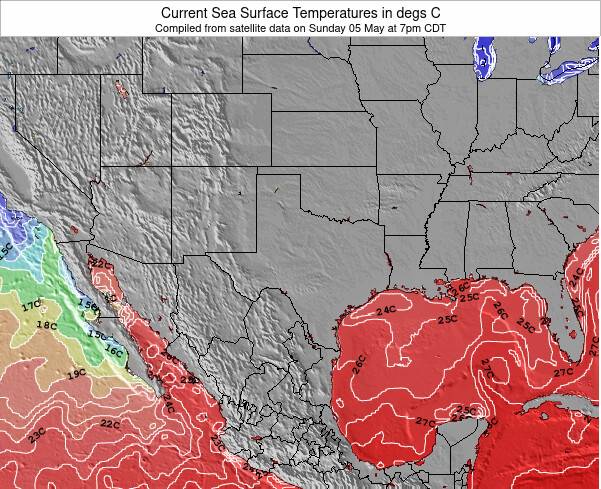
| inconsistent | 28.2°C*ocean temperature recorded from satellite |
Surfing Freeport Channel:
The best conditions reported for surf at Freeport Channel occur when a East swell combines with an offshore wind direction from the North.
What's the best time of year to surf Freeport Channel (for consistent clean waves)?
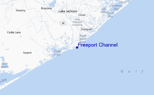
Explore Freeport Channel Location Map
Interactive Freeport Channel surf break location map. View information about nearby surf breaks, their wave consistency and rating compared to other spots in the region. Current swell conditions from local buoys are shown along with live wind speed and direction from nearby weather stations. Click icons on the map for more detail. The closest passenger airport to Freeport Channel is Scholes International At Galveston Airport (GLS) in USA, 69 km (43 miles) away (directly). The second nearest airport to Freeport Channel is Palacios Muni Airport (PSX), also in USA, 84 km (52 miles) away.
- Map Icons:
 Break
Break Live Wave Height (m)
 Live Wind Speed (km/h)
 Surf Rating (10 Max)
 Ocean Swells (m)
- Wind Speed (km/h)
Tuesday, 9 June 2026, 19:20 Local Time
| Tuesday 09 | Wed | |||
| 4PM | 7PM | 10PM | 1AM | |
| Wave (m) | ||||
| Period (s) | 6 | 6 | 6 | 6 |
| Wind (km/h) | ||||
| Wind State | cross- on |
cross- on |
cross- on |
cross- on |
Tides at Freeport Channel
| NEXT | IS AT (local time) | remaining |
|---|---|---|
| high tide | ||
| low tide |
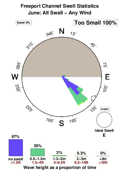
Swell History at Freeport Channel
Surf stats for Freeport Channel, see the swell variation by month or season on the history page here.

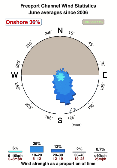
Wind History at Freeport Channel
Wind stats for Freeport Channel, see the variation in direction and stength by month or season on the history page here.
Freeport Channel Reviews:
Interactive Porthcawl Point location map. View nearby buoy information, live wind conditions and surrounding roads, paths and locations to help find new breaks. Click the buoys or wind icon to view more information.
- Overall:
 3.0
3.0 - Quality on a good day:3.0
- Consistency of Surf:
 2.0
2.0 - Difficulty Level:
 4.0
4.0 - Crowds:3.0
We all had long boards, with guys like Bingo, George Glass, Don Green, Jeff Hutton, Randy Tamlyn, Jake DeBoe, mark Wheeler, Steve Smith logging weekend miles to enjoy the salt, sand, and suds.
We paddled across this freeport channel to surf the south side, mush to the consternation of the dutiful Coast Guard.
Now, the jetty is concrete topped and you walk out past the breaks and jump off. The addition of restrooms, parking and shower has cleaned up the area.
For short boarders it is ok. Long boards can be rented at Bingo's shop. He has a chapel with the walls covered in old boards.
It's clean, relaxing and close. Come visit!”
Other Nearby Breaks Closest To:
Discover surf breaks near Freeport Channel. Click below to view there surf guides.
- Freeport Pier
 Beach/pier
- 3.0
Reliability: fairly consistent1km away - Surfside Beach Octagone
 Sandbar
- 3.0
Reliability: fairly consistent13km away - Surfside
- Sandbar
- 2.0
Reliability:13km away - Quintana Jetty
- Sandbar
- 2.0
Reliability: fairly consistent26km away - Surfside Jetty
- Beach/jetty
- 2.0
Reliability: inconsistent35km away
 Nearest