

- Forecast
- Maps
- Live
- Weather State
- Spot Information

Surf Forecasts
Reef
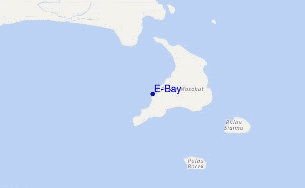
E-Bay surf Forecast / Mentawi Islands / Indonesia
48hr Weather and Surf, issued 6 pm Tuesday 16 Apr 2024 WIB
Forecast update in hr min s Update imminent
E-Bay surf forecast is for near shore open water. Breaking waves will often be smaller at less exposed spots.
Today's E-Bay sea temperature is 30.3°C (Statistics for 16 Apr 1981-2005 - mean: 29.6 °C max: 30.4 °C min: 28.6 °C)
- Map Icons:
 Break
Break Live Wave Height (m)
 Live Wind Speed (km/h)
 Surf Rating (10 Max)
 Ocean Swells (m)
- Wind Speed (km/h)
E-Bay surf forecast is for near shore open water. Breaking waves will often be smaller at less exposed spots.
Today's E-Bay sea temperature is 30.3°C (Statistics for 16 Apr 1981-2005 - mean: 29.6 °C max: 30.4 °C min: 28.6 °C)
How big are the waves at E-Bay today?
The current surf forecast for E-Bay at 2AM is: 0.5m 14s primary swell from a South-southwest direction (forecast issued at 06:00pm April 16). An open ocean swell of 0.7m 8s is not directed at the surf break. The wind direction is predicted to be cross-offshore and the swell rating is 2.
| Time (WIB) & Date | Wave Height | Wave Period |
|---|---|---|
| Morning (17 Apr) | 1.5ft (0.5m) | 14s |
| Afternoon (17 Apr) | 1.5ft (0.4m) | 19s |
| Evening (17 Apr) | - | - |
Table - waves today at E-Bay. (Swell directed towards the surf break)
Updates in hr min s Update imminent
Tuesday 16 | Wednesday 17 | Thursday 18 | Friday 19 | Saturday 20 | Sunday 21 | Monday 22 | Tuesday 23 | Wed 24 | ||||||||||||||||||||||||||||||||||||||||||||||||||||
| 4 PM | 7 PM | 10 PM | 1 AM | 4 AM | 7 AM | 10 AM | 1 PM | 4 PM | 7 PM | 10 PM | 1 AM | 4 AM | 7 AM | 10 AM | 1 PM | 4 PM | 7 PM | 10 PM | 1 AM | 4 AM | 7 AM | 10 AM | 1 PM | 4 PM | 7 PM | 10 PM | 1 AM | 4 AM | 7 AM | 10 AM | 1 PM | 4 PM | 7 PM | 10 PM | 1 AM | 4 AM | 7 AM | 10 AM | 1 PM | 4 PM | 7 PM | 10 PM | 1 AM | 4 AM | 7 AM | 10 AM | 1 PM | 4 PM | 7 PM | 10 PM | 1 AM | 4 AM | 7 AM | 10 AM | 1 PM | 4 PM | 7 PM | 10 PM | 1 AM | |
Rating (10 max) | ||||||||||||||||||||||||||||||||||||||||||||||||||||||||||||
Swell Height Map |    |    |    |    |    |   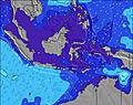 |  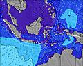 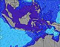 |  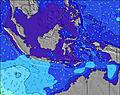 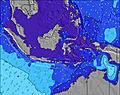 | 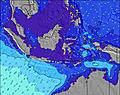 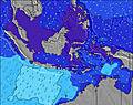 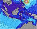 | |||||||||||||||||||||||||||||||||||||||||||||||||||
| Wave Height (m) & direction (?) | ||||||||||||||||||||||||||||||||||||||||||||||||||||||||||||
| Period(s) (?) | 13 | 13 | 13 | 14 | 14 | 14 | 14 | 14 | 19 | 19 | 18 | 18 | 18 | 18 | 17 | 16 | 16 | 16 | 16 | 16 | 16 | 16 | 16 | 16 | 16 | 15 | 15 | 15 | 15 | 14 | 14 | 14 | 14 | 14 | 13 | 13 | 13 | 13 | 13 | 13 | 13 | 15 | 15 | 15 | 14 | 14 | 14 | 14 | 14 | 16 | 16 | 16 | 15 | 15 | 14 | 14 | 14 | 14 | 14 | 14 |
Wave (?)Graph | ||||||||||||||||||||||||||||||||||||||||||||||||||||||||||||
| Energy (?) | 98 | 99 | 101 | 104 | 113 | 68 | 106 | 69 | 146 | 175 | 161 | 211 | 276 | 312 | 302 | 274 | 268 | 330 | 407 | 493 | 402 | 318 | 314 | 382 | 377 | 353 | 275 | 272 | 272 | 268 | 264 | 211 | 175 | 161 | 156 | 154 | 154 | 154 | 154 | 135 | 127 | 121 | 225 | 309 | 215 | 269 | 331 | 331 | 243 | 527 | 527 | 520 | 487 | 376 | 350 | 423 | 366 | 341 | 346 | 341 |
Wind (km/h) | ||||||||||||||||||||||||||||||||||||||||||||||||||||||||||||
| Wind State (?) onshore cross-onshore cross-shore cross-offshore offshore glassy | cross- on | cross- on | cross- on | cross- off | cross- off | cross- off | cross- off | cross- off | cross- off | off | cross- off | cross- off | cross- off | cross- off | glass | glass | glass | cross- on | glass | glass | on | glass | glass | glass | glass | cross- off | glass | glass | glass | off | off | cross- off | cross- off | cross- off | cross- off | cross- off | cross- off | cross- off | glass | glass | glass | cross- off | cross- off | cross- off | off | off | off | cross- off | off | off | off | off | cross- off | cross- off | off | glass | cross- off | cross- off | cross- off | off |
High Tide / height (m) | 1:39AM 0.54 | 1:45PM 0.82 | 3:10AM 0.62 | 3:02PM 0.83 | 4:04AM 0.72 | 3:58PM 0.87 | 4:42AM 0.83 | 4:42PM 0.90 | 5:14AM 0.94 | 5:18PM 0.92 | 5:43AM 1.03 | 5:52PM 0.92 | 6:11AM 1.10 | 6:23PM 0.91 | ||||||||||||||||||||||||||||||||||||||||||||||
Low Tide / height (m) | 7:04PM 0.37 | 5:32AM 0.42 | 9:26PM 0.35 | 7:40AM 0.47 | 10:07PM 0.31 | 9:38AM 0.43 | 10:29PM 0.27 | 10:31AM 0.36 | 10:49PM 0.23 | 11:09AM 0.28 | 11:10PM 0.18 | 11:42AM 0.21 | 11:34PM 0.14 | 12:14PM 0.14 | 12:00AM 0.10 | |||||||||||||||||||||||||||||||||||||||||||||
Tuesday 16 | Wednesday 17 | Thursday 18 | Friday 19 | Saturday 20 | Sunday 21 | Monday 22 | Tuesday 23 | Wed 24 | ||||||||||||||||||||||||||||||||||||||||||||||||||||
| Sunrise | - | - | - | - | - | 6:20 | - | - | - | - | - | - | - | 6:20 | - | - | - | - | - | - | - | 6:20 | - | - | - | - | - | - | - | 6:18 | - | - | - | - | - | - | - | 6:18 | - | - | - | - | - | - | - | 6:18 | - | - | - | - | - | - | - | 6:18 | - | - | - | - | - | - |
| Sunset | 6:23 | - | - | - | - | - | - | - | 6:23 | - | - | - | - | - | - | - | 6:23 | - | - | - | - | - | - | - | 6:22 | - | - | - | - | - | - | - | 6:22 | - | - | - | - | - | - | - | 6:22 | - | - | - | - | - | - | - | 6:22 | - | - | - | - | - | - | - | 6:22 | - | - | - |
Rain (mm) | - | 1 | 4 | 4 | 1 | 2 | 1 | - | - | - | - | - | - | - | - | 2 | 1 | - | - | - | - | - | - | - | 1 | 1 | - | 1 | 1 | 1 | - | - | - | - | - | 2 | 1 | 1 | 1 | 2 | 1 | 3 | 1 | 1 | 4 | 2 | 1 | 2 | - | - | - | - | - | - | - | 1 | 4 | 1 | 1 | 1 |
| Temp. °C | 30 | 29 | 29 | 28 | 27 | 26 | 27 | 28 | 28 | 28 | 28 | 28 | 27 | 27 | 28 | 29 | 29 | 29 | 28 | 28 | 28 | 28 | 29 | 29 | 29 | 28 | 28 | 27 | 27 | 27 | 28 | 29 | 29 | 29 | 28 | 27 | 27 | 27 | 28 | 29 | 29 | 28 | 28 | 27 | 26 | 25 | 25 | 26 | 26 | 27 | 27 | 27 | 26 | 26 | 28 | 29 | 29 | 28 | 28 | 27 |
| Feels °C (?) | 34 | 33 | 34 | 32 | 29 | 28 | 29 | 30 | 30 | 29 | 29 | 30 | 30 | 31 | 33 | 34 | 33 | 33 | 32 | 32 | 32 | 32 | 33 | 34 | 34 | 32 | 33 | 32 | 32 | 31 | 31 | 33 | 33 | 33 | 31 | 30 | 31 | 32 | 33 | 34 | 34 | 32 | 32 | 30 | 29 | 28 | 27 | 28 | 28 | 30 | 29 | 30 | 29 | 30 | 32 | 34 | 33 | 32 | 32 | 31 |
FREE! Surf-Forecast.com widget for your website
The surf report / weather widget below is available to embed on third party websites free of charge and provides a summary of our E-Bay surf forecast. Simply grab the html code snippet that we provide and paste it into your own site. You can choose your preferred language and metric/imperial units for the surf forecast feed to suit users of your site. Click here to get the code.


 Nearest