Dirk Hartog Island Surf Guide
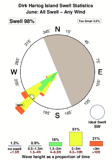
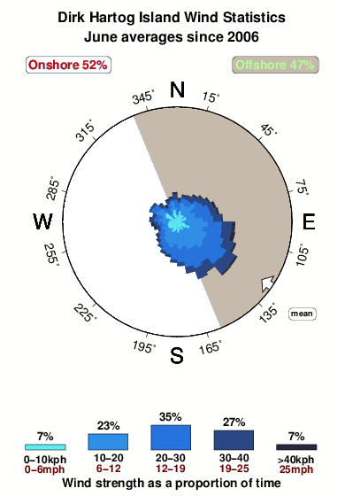
Dirk Hartog Island in North West is a fairly exposed reef break that has consistent surf, although summer tends to be mostly flat. Offshore winds blow from the east northeast. Clean groundswells prevail and the best swell direction is from the southwest. A reef breaks right. Surfable at all stages of the tide. It very rarely gets crowded here. Beware of urchins, rips, rocks, sharks, sharks and isolation.
Dirk Hartog Island Spot Info
| Type: | Rating: | Reliability: | Todays Sea Temp*: |
|---|---|---|---|
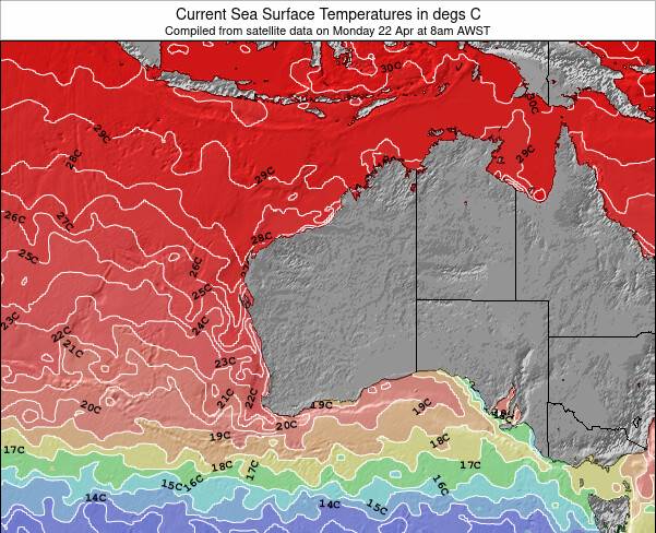
| consistent | 24.1°C*ocean temperature recorded from satellite |
Surfing Dirk Hartog Island:
The best conditions reported for surf at Dirk Hartog Island occur when a Southwest swell combines with an offshore wind direction from the East-northeast.
What's the best time of year to surf Dirk Hartog Island (for consistent clean waves)?
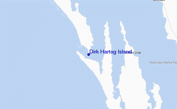
Explore Dirk Hartog Island Location Map
Interactive Dirk Hartog Island surf break location map. View information about nearby surf breaks, their wave consistency and rating compared to other spots in the region. Current swell conditions from local buoys are shown along with live wind speed and direction from nearby weather stations. Click icons on the map for more detail. The nearest passenger airport to Dirk Hartog Island is Learmonth Airport (LEA) in Australia, which is 445 km (276 miles) away (directly). The second closest airport to Dirk Hartog Island is Perth International Airport (PER), also in Australia, 697 km (433 miles) away.
- Map Icons:
 Break
Break Live Wave Height (m)
 Live Wind Speed (km/h)
 Surf Rating (10 Max)
 Ocean Swells (m)
- Wind Speed (km/h)
Tuesday, 9 June 2026, 16:19 Local Time
| Tuesday 09 | ||||
| 11AM | 2PM | 5PM | 8PM | |
| Wave (m) | ||||
| Period (s) | 15 | 15 | 16 | 16 |
| Wind (km/h) | ||||
| Wind State | cross- on |
cross- on |
cross- on |
cross- on |
Tides at Dirk Hartog Island
| NEXT | IS AT (local time) | remaining |
|---|---|---|
| high tide | ||
| low tide |
Swell History at Dirk Hartog Island
Surf stats for Dirk Hartog Island, see the swell variation by month or season on the history page here.

Wind History at Dirk Hartog Island
Wind stats for Dirk Hartog Island, see the variation in direction and stength by month or season on the history page here.
Other Nearby Breaks Closest To:
Discover surf breaks near Dirk Hartog Island. Click below to view there surf guides.
 Nearest