
Surf Forecasts:

How big are the waves at Chengkung today (09 Jun):
- Morning surf: Morning surf (09 Jun, local time) - 0.5ft (0.2m), 10s period with E swell.
- Afternoon surf: Afternoon surf (09 Jun, local time) - 0.5ft (0.2m), 10s period with E swell.
- Evening surf: Evening surf (09 Jun, local time) - 1.5ft (0.4m), 8s period with NE swell.
The current surf forecast for Chengkung at 2PM is: 0.2m 10s primary swell from a East direction and 0.2m 8s secondary swell from a North-northeast direction (forecast issued at 07:00am June 09). An open ocean swell of 1.3m 8s is not directed at the surf break. The wind direction is predicted to be glassy.
| Time (CST) & Date | Wave Height | Wave Period |
|---|---|---|
| Morning (09 Jun) | 0.5ft (0.2m) | 10s |
| Afternoon (09 Jun) | 0.5ft (0.2m) | 10s |
| Evening (09 Jun) | 1.5ft (0.4m) | 8s |
Table - waves today at Chengkung. (Swell directed towards the surf break)
Updates in hr min s Forecast update imminent
Short Range ForecastHeavy rain (total 148mm), heaviest during Tue night. Warm (max 27°C on Tue morning, min 23°C on Wed night). Wind will be generally light. | ||||||||||||||||||||||||
Tuesday 9 | Wednesday 10 | Thursday 11 | Fri 12 | |||||||||||||||||||||
5 AM | 8 AM | 11 AM | 2 PM | 5 PM | 8 PM | 11 PM | 2 AM | 5 AM | 8 AM | 11 AM | 2 PM | 5 PM | 8 PM | 11 PM | 2 AM | 5 AM | 8 AM | 11 AM | 2 PM | 5 PM | 8 PM | 11 PM | 2 AM | |
Swell Height Map |  |  |  | 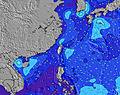 | 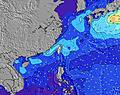 | 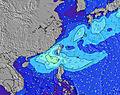 | 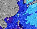 | 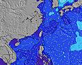 | 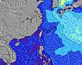 | 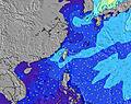 | ||||||||||||||
Wave Height (m) Direction Period (s) | E 10 | E 10 | E 10 | E 10 | NE 8 | NE 8 | NE 8 | NNE 8 | NE 8 | NE 9 | NE 9 | NE 9 | NE 9 | NE 9 | NE 9 | NE 9 | NE 9 | NE 8 | NE 8 | NE 8 | NE 8 | NE 5 | NE 7 | NE 7 |
Wave Graph | ||||||||||||||||||||||||
8 | 8 | 8 | 8 | 32 | 18 | 102 | 219 | 304 | 370 | 412 | 343 | 287 | 225 | 408 | 220 | 190 | 82 | 112 | 109 | 123 | 134 | 184 | 156 | |
Wind (km/h) | ||||||||||||||||||||||||
Wind State on-shore cross-onshore cross-shore cross-offshore off-shore glassy | off | off | glassy | glassy | cross-on | cross-on | cross-on | cross-on | cross-on | cross-on | cross-on | cross-on | cross-on | cross | cross-on | cross | cross | cross | cross-on | cross-on | cross-on | cross-on | cross-on | cross-on |
High Tide | 12:19PM1.24m | 1:18AM1.37m | 1:48PM1.23m | 2:06AM1.46m | 3:06PM1.27m | |||||||||||||||||||
Low Tide | 6:25AM0.74m | 6:39PM0.57m | 7:42AM0.61m | 7:38PM0.63m | 8:47AM0.44m | 8:36PM0.67m | ||||||||||||||||||
5:07 | — | — | — | — | — | — | — | 5:07 | — | — | — | — | — | — | — | 5:07 | — | — | — | — | — | — | 5:07 | |
— | — | — | — | 6:38 | — | — | — | — | — | — | — | 6:38 | — | — | — | — | — | — | — | 6:38 | — | — | 6:39 | |
mm | 10 | 5 | 4 | 2 | 4 | 6 | 16 | 13 | 11 | 13 | 10 | 1 | 3 | 14 | 14 | 8 | 8 | 7 | — | 7 | 1 | 1 | — | — |
Temp °C | 26 | 27 | 27 | 27 | 27 | 26 | 25 | 25 | 25 | 25 | 25 | 25 | 25 | 24 | 23 | 23 | 23 | 24 | 25 | 24 | 25 | 25 | 24 | 24 |
Feels °C | 31 | 32 | 34 | 34 | 32 | 29 | 29 | 28 | 27 | 26 | 26 | 26 | 27 | 26 | 25 | 26 | 27 | 28 | 29 | 28 | 29 | 28 | 25 | 25 |
Swell 1 Height (m) Direction Period (s) | S 8 | S 8 | S 8 | S 8 | S 7 | S 7 | S 7 | S 8 | S 8 | S 8 | SE 7 | SSE 7 | SSE 7 | SSE 7 | NE 9 | NE 9 | NE 9 | NE 8 | SE 6 | SSE 7 | SE 7 | SSE 7 | SE 7 | SE 6 |
275 | 275 | 275 | 193 | 124 | 124 | 131 | 144 | 95 | 29 | 25 | 19 | 19 | 18 | 199 | 149 | 126 | 82 | 11 | 18 | 23 | 18 | 11 | 10 | |
Swell 2 Height (m) Direction Period (s) | E 10 | E 10 | E 10 | NNE 8 | E 10 | NE 8 | E 10 | E 10 | E 10 | SSE 7 | SSW 7 | SSW 7 | SSW 7 | SSW 7 | SSE 7 | SE 7 | SE 7 | SE 6 | SSW 8 | SSW 8 | SSW 7 | SSW 7 | SSW 7 | SSW 7 |
8 | 8 | 8 | 6 | 8 | 18 | 7 | 2 | 2 | 36 | 18 | 10 | 11 | 11 | 18 | 11 | 11 | 11 | 6 | 6 | 5 | 5 | 5 | 5 | |
Swell 3 Height (m) Direction Period (s) | NE 12 | NE 12 | NE 12 | E 10 | NE 12 | E 10 | SE 9 | — | E 10 | E 10 | E 9 | E 9 | E 9 | E 9 | SSW 8 | SSW 8 | SSW 8 | SSW 8 | E 9 | E 9 | E 9 | E 9 | SE 9 | ESE 8 |
6 | 6 | 6 | 8 | 6 | 7 | 3 | — | 2 | 2 | 2 | 2 | 2 | 2 | 11 | 11 | 11 | 11 | 2 | 1 | 1 | 2 | 3 | 7 | |
Wind waves Height (m) Direction Period (s) | S 8 | SSW 8 | SSW 8 | — | NE 8 | NE 4 | NE 8 | NNE 8 | NE 8 | NE 9 | NE 9 | NE 9 | NE 9 | NE 9 | NE 9 | NE 9 | NE 9 | NNE 3 | NE 8 | NE 8 | NE 8 | NE 5 | NE 7 | NE 7 |
559 | 585 | 1141 | — | 32 | 11 | 102 | 219 | 304 | 370 | 412 | 343 | 287 | 225 | 408 | 220 | 190 | 3 | 112 | 109 | 123 | 134 | 184 | 156 | |
Nearest Offshore or Glassy | ||||||||||||||||||||||||
Distance (km) | 169 | 169 | 588 | 481 | 481 | 481 | 588 | 588 | 588 | 137 | 148 | 127 | 202 | 183 | 183 | 183 | 169 | 127 | 732 | 107 | 107 | 127 | 183 | 169 |
Best forecast wave conditions in South Taiwan | ||||||||||||||||||||||||
Best forecast wave conditions in Taiwan | ||||||||||||||||||||||||
Header Global | ||||||||||||||||||||||||
- Map Icons:
 Break
Break Live Wave Height (m)
 Live Wind Speed (km/h)
 Surf Rating (10 Max)
 Ocean Swells (m)
- Wind Speed (km/h)


FREE! Surf-Forecast.com widget for your website
The surf report / weather widget below is available to embed on third party websites free of charge and provides a summary of our Chengkung surf forecast. Simply grab the html code snippet that we provide and paste it into your own site. You can choose your preferred language and metric/imperial units for the surf forecast feed to suit users of your site. Click here to get the code.
 Nearest