
Bonnet Point Surf Guide
Bonnet Point in Rhode Island is a reasonably exposed point break that has inconsistent surf with no particular seasonal pattern. Offshore winds are from the north with some shelter here from northeast winds. Most of the surf here comes from groundswells and the ideal swell direction is from the southeast.There is a left breaking point here. Good surf at all stages of the tide. Sometimes crowded. Watch out for rips and rocks.
Bonnet Point Spot Info
| Type: | Rating: | Reliability: | Todays Sea Temp*: |
|---|---|---|---|
| inconsistent | 16.2°C*ocean temperature recorded from satellite |
Surfing Bonnet Point:
The best conditions reported for surf at Bonnet Point occur when a Southeast swell combines with an offshore wind direction from the North.
What's the best time of year to surf Bonnet Point (for consistent clean waves)?
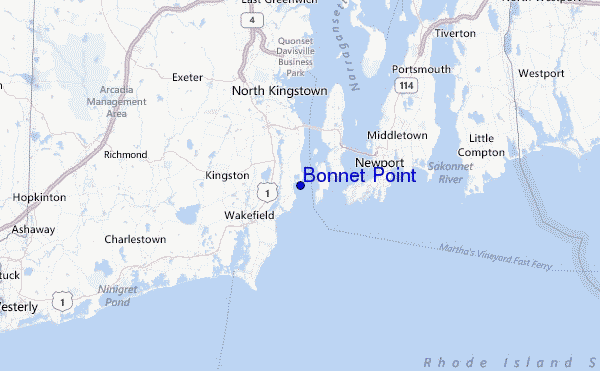
Explore Bonnet Point Location Map
Interactive Bonnet Point surf break location map. View information about nearby surf breaks, their wave consistency and rating compared to other spots in the region. Current swell conditions from local buoys are shown along with live wind speed and direction from nearby weather stations. Click icons on the map for more detail. The closest passenger airport to Bonnet Point is Theodore Francis Green State (Providence) Airport (PVD) in USA, 28 km (17 miles) away (directly). The second nearest airport to Bonnet Point is North Central State (Smithfield) Airport (SFZ), also in USA, 51 km (32 miles) away.
- Map Icons:
 Break
Break Live Wave Height (m)
 Live Wind Speed (km/h)
 Surf Rating (10 Max)
 Ocean Swells (m)
- Wind Speed (km/h)
Tuesday, 9 June 2026, 06:36 Local Time
| Tuesday 09 | ||||
| 5AM | 8AM | 11AM | 2PM | |
| Wave (m) | ||||
| Period (s) | 7 | 4 | 4 | 4 |
| Wind (km/h) | ||||
| Wind State | cross | cross | cross- on |
cross- on |
Tides at Bonnet Point
| NEXT | IS AT (local time) | remaining |
|---|---|---|
| high tide | ||
| low tide |
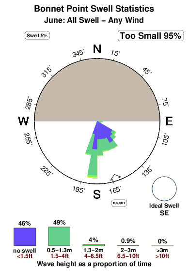
Swell History at Bonnet Point
Surf stats for Bonnet Point, see the swell variation by month or season on the history page here.

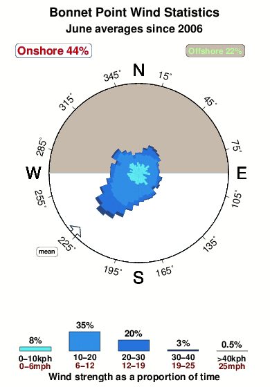
Wind History at Bonnet Point
Wind stats for Bonnet Point, see the variation in direction and stength by month or season on the history page here.
Other Nearby Breaks Closest To:
Discover surf breaks near Bonnet Point. Click below to view there surf guides.
- Bonnet Shores Point
 Point
Point 3.0
3.0
Reliability: rarely breaks1km away - Narragansett Town Beach
 Beach
Beach 2.0
2.0
Reliability: fairly consistent4km away - North Pier (Narragansett)
- Beach
- 2.0
Reliability: fairly consistent5km away - Monahans Dock
 Reef
Reef- 2.0
Reliability: fairly consistent6km away - Baileys Beach
- Beach
- 2.0
Reliability: inconsistent9km away
 Nearest