
Bahia de las Aguilas Surf Guide
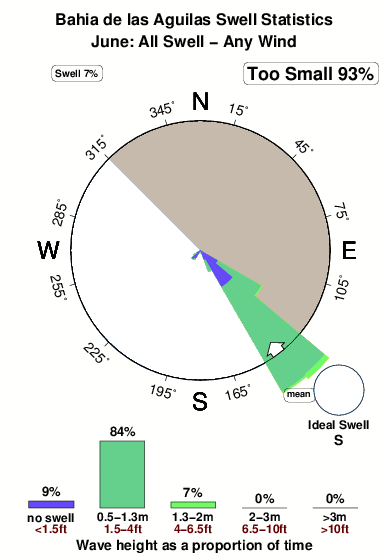
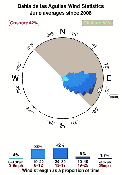
Bahia de las Aguilas on the South Coast is a quite exposed beach break that has fairly consistent surf The best wind direction is from the northeast. Waves just as likely from local windswells as from distant groundswells and the ideal swell direction is from the south. The beach breaks offer lefts and rights. Best around low tide when the tide is rising. Rarely crowded here.
Bahia de las Aguilas Spot Info
| Type: | Rating: | Reliability: | Todays Sea Temp*: |
|---|---|---|---|
| fairly consistent | 28.4°C*ocean temperature recorded from satellite |
Surfing Bahia de las Aguilas:
The best conditions reported for surf at Bahia de las Aguilas occur when a South swell combines with an offshore wind direction from the Northeast.
What's the best time of year to surf Bahia de las Aguilas (for consistent clean waves)?
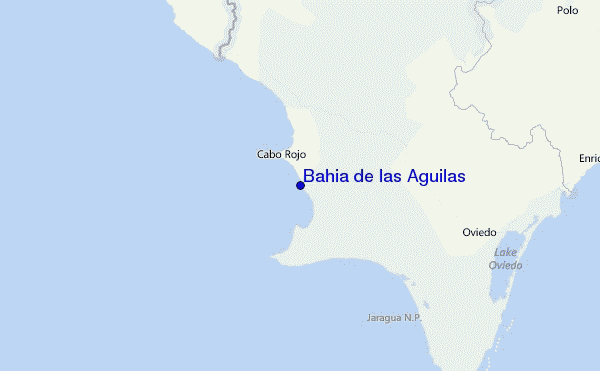
Explore Bahia de las Aguilas Location Map
Interactive Bahia de las Aguilas surf break location map. View information about nearby surf breaks, their wave consistency and rating compared to other spots in the region. Current swell conditions from local buoys are shown along with live wind speed and direction from nearby weather stations. Click icons on the map for more detail. The closest passenger airport to Bahia de las Aguilas is Maria Montez International (Barahona) Airport (BRX) in Dominican Republic, which is 71 km (44 miles) away (directly). The second nearest airport to Bahia de las Aguilas is Port Au Prince International (Port-au-prince) Airport (PAP) in Haiti, 105 km (65 miles) away.
- Map Icons:
 Break
Break Live Wave Height (m)
 Live Wind Speed (km/h)
 Surf Rating (10 Max)
 Ocean Swells (m)
- Wind Speed (km/h)
Tuesday, 9 June 2026, 10:35 Local Time
| Tuesday 09 | ||||
| 11AM | 2PM | 5PM | 8PM | |
| Wave (m) | ||||
| Period (s) | 8 | 5 | 5 | 8 |
| Wind (km/h) | ||||
| Wind State | cross | cross | cross | cross- off |
Tides at Bahia de las Aguilas
| NEXT | IS AT (local time) | remaining |
|---|---|---|
| high tide | ||
| low tide |
Swell History at Bahia de las Aguilas
Surf stats for Bahia de las Aguilas, see the swell variation by month or season on the history page here.

Wind History at Bahia de las Aguilas
Wind stats for Bahia de las Aguilas, see the variation in direction and stength by month or season on the history page here.
Other Nearby Breaks Closest To:
Discover surf breaks near Bahia de las Aguilas. Click below to view there surf guides.
 Nearest