

Surf Forecasts:

How big are the waves at Alao today (08 Jun):
- Afternoon surf: Afternoon surf (08 Jun, local time) - 1.5ft (0.5m), 6s period with E swell.
- Evening surf: Evening surf (08 Jun, local time) - 2ft (0.6m), 7s period with ENE swell.
The current surf forecast for Alao at 8PM is: 0.5m 7s primary swell from a East direction (forecast issued at 12:00pm June 08). An open ocean swell of 0.6m 7s is not directed at the surf break, a second open ocean swell of 0.6m 12s is not directed at the surf break. The wind direction is predicted to be cross-onshore.
| Time (SST) & Date | Wave Height | Wave Period |
|---|---|---|
| Morning (08 Jun) | - | - |
| Afternoon (08 Jun) | 1.5ft (0.5m) | 6s |
| Evening (08 Jun) | 2ft (0.6m) | 7s |
Table - waves today at Alao. (Swell directed towards the surf break)
Updates in hr min s Forecast update imminent
Short Range ForecastMostly dry. Warm (max 27°C on Mon morning, min 25°C on Tue night). Winds increasing (calm on Mon morning, strong winds from the SSE by Tue night). | ||||||||||||||||||||||||
Mon 8 | Tuesday 9 | Wednesday 10 | Thu 11 | |||||||||||||||||||||
10 AM | 1 PM | 4 PM | 7 PM | 10 PM | 1 AM | 4 AM | 7 AM | 10 AM | 1 PM | 4 PM | 7 PM | 10 PM | 1 AM | 4 AM | 7 AM | 10 AM | 1 PM | 4 PM | 7 PM | 10 PM | 1 AM | 4 AM | 7 AM | |
Swell Height Map |  |  | 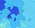 | 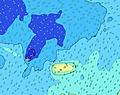 | 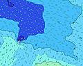 |  | 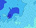 | 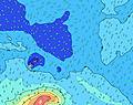 |  | |||||||||||||||
Wave Height (m) Direction Period (s) | S 16 | E 6 | E 6 | E 7 | ENE 7 | ENE 7 | ENE 7 | E 7 | E 7 | E 7 | E 7 | E 7 | SSE 5 | N 12 | N 12 | N 12 | N 12 | N 12 | N 12 | N 11 | N 11 | N 11 | N 11 | N 11 |
Wave Graph | ||||||||||||||||||||||||
0 | 20 | 20 | 22 | 41 | 40 | 41 | 35 | 59 | 44 | 44 | 43 | 44 | 46 | 45 | 72 | 44 | 71 | 67 | 61 | 59 | 58 | 58 | 37 | |
Wind (km/h) | ||||||||||||||||||||||||
Wind State on-shore cross-onshore cross-shore cross-offshore off-shore glassy | cross-on | glassy | cross-on | cross-on | cross-on | on | on | on | on | cross-on | cross-on | cross-on | on | on | cross-on | on | on | on | on | on | on | on | on | on |
High Tide | 1:08PM0.88m | 1:44AM0.92m | 2:03PM0.90m | 2:35AM0.99m | 2:59PM0.93m | 3:27AM1.06m | ||||||||||||||||||
Low Tide | 7:20PM0.23m | 7:53AM0.25m | 8:12PM0.19m | 8:51AM0.18m | 9:05PM0.15m | |||||||||||||||||||
6:41 | — | — | — | — | — | 6:41 | — | — | — | — | — | — | — | 6:41 | — | — | — | — | — | — | — | 6:43 | — | |
— | — | 6:00 | — | — | — | — | — | — | — | 6:00 | — | — | — | — | — | — | — | 6:00 | — | — | — | — | 6:00 | |
mm | — | — | — | — | — | — | — | — | — | — | — | — | — | — | — | — | — | — | — | — | — | — | — | — |
Temp °C | 27 | 27 | 27 | 27 | 27 | 26 | 26 | 26 | 26 | 26 | 26 | 26 | 26 | 26 | 25 | 25 | 25 | 25 | 25 | 25 | 25 | 25 | 26 | 26 |
Feels °C | 29 | 30 | 29 | 29 | 29 | 27 | 27 | 26 | 26 | 25 | 24 | 24 | 23 | 22 | 21 | 21 | 20 | 21 | 21 | 21 | 21 | 21 | 23 | 24 |
Swell 1 Height (m) Direction Period (s) | ESE 6 | SE 9 | SE 7 | SE 7 | ENE 7 | ENE 7 | ENE 7 | E 7 | E 7 | E 7 | E 7 | SW 18 | SW 8 | SW 18 | SW 17 | SW 17 | SSW 24 | SSW 23 | SSW 23 | SSW 21 | SSW 21 | SSW 20 | S 19 | SSW 18 |
66 | 76 | 42 | 42 | 41 | 40 | 41 | 35 | 59 | 44 | 44 | 396 | 101 | 442 | 505 | 482 | 1190 | 1830 | 2772 | 3053 | 3536 | 3795 | 7575 | 5094 | |
Swell 2 Height (m) Direction Period (s) | SW 13 | SW 11 | SW 12 | SW 12 | SE 8 | SW 11 | SW 11 | SW 13 | SW 20 | SW 13 | SW 12 | E 7 | SW 18 | SW 12 | SSW 26 | SSW 24 | SW 17 | SW 16 | SW 16 | SW 16 | SW 16 | SW 16 | SW 16 | SW 17 |
57 | 82 | 84 | 84 | 35 | 76 | 75 | 87 | 239 | 138 | 118 | 43 | 379 | 69 | 220 | 800 | 465 | 454 | 443 | 432 | 432 | 432 | 443 | 476 | |
Swell 3 Height (m) Direction Period (s) | S 16 | E 6 | E 6 | E 7 | SW 11 | SE 7 | SE 7 | SE 7 | SW 13 | SW 19 | SW 19 | S 12 | E 6 | N 12 | N 12 | N 12 | N 12 | N 12 | N 12 | N 11 | N 11 | N 11 | N 11 | N 11 |
82 | 20 | 20 | 22 | 79 | 33 | 30 | 23 | 85 | 303 | 299 | 46 | 30 | 46 | 45 | 72 | 44 | 71 | 67 | 61 | 59 | 58 | 58 | 37 | |
Wind waves Height (m) Direction Period (s) | — | — | — | — | — | — | SSW 4 | SE 3 | SSW 4 | S 4 | SSE 4 | SSW 12 | SSE 5 | SSE 7 | S 7 | SSE 7 | SSE 7 | SSE 7 | SSE 7 | SSE 7 | SE 7 | SE 7 | SE 7 | SE 7 |
— | — | — | — | — | — | 1 | 1 | 5 | 8 | 24 | 452 | 44 | 308 | 508 | 607 | 621 | 573 | 531 | 480 | 437 | 397 | 335 | 416 | |
Nearest Offshore or Glassy | ||||||||||||||||||||||||
Distance (km) | 2 | 2 | 2064 | 2 | 2 | 2 | 2059 | 2059 | 2059 | 906 | 2059 | 2059 | 2059 | 2059 | 1358 | 1358 | 1365 | 1365 | 2059 | 2059 | 2059 | 2059 | 2059 | 1365 |
Best forecast wave conditions in American-Samoa - Tutuila | ||||||||||||||||||||||||
Best forecast wave conditions in American Samoa | ||||||||||||||||||||||||
Header Global | ||||||||||||||||||||||||
- Map Icons:
 Break
Break Live Wave Height (m)
 Live Wind Speed (km/h)
 Surf Rating (10 Max)
 Ocean Swells (m)
- Wind Speed (km/h)


FREE! Surf-Forecast.com widget for your website
The surf report / weather widget below is available to embed on third party websites free of charge and provides a summary of our Alao surf forecast. Simply grab the html code snippet that we provide and paste it into your own site. You can choose your preferred language and metric/imperial units for the surf forecast feed to suit users of your site. Click here to get the code.
 Nearest